Lost Valley Reservoir Boat Ramp
- May–Sep
- best months
Is Lost Valley Reservoir Boat Ramp open right now?
Alert in the area
The Forest Service lists 5 alerts for Payette National Forest.
Over Snow Vehicle Closure (Forestwide)
Agency alert covering Payette National Forest · Order 0412-638 · USFS · Payette National Forest
Over Snow Vehicle Closure (Brundage Mountain Resort Snowcat Routes)
Agency alert covering Payette National Forest · Order 0412-637 · USFS · Payette National Forest
Lost Valley Log Hauling
Agency alert covering Payette National Forest · USFS · Payette National Forest
Over Snow Vehicle Closure (Granite Mountain)
Agency alert covering Payette National Forest · Order 0412-635 · USFS · Payette National Forest
Gordon Titus Upper Elevation Parking Lot Winter Restrictions
Agency alert covering Payette National Forest · Order 0412-543 · USFS · Payette National Forest
As of · Source: USFS · Payette National Forest. Agencies don't list every closure — check before you go.
Lost Valley Reservoir Boat Ramp is a boat launch in Idaho's Payette National Forest, within the New Meadows Ranger District. The nearest town is New Meadows, about 9 miles away. The site has vault toilets, and no fees are required to use it. Summer is the most comfortable time to visit. Typical averages from a nearby weather station in New Meadows show July and August highs around 85°F with lows in the low 40s, while winter highs stay near freezing. Cold Spring campground sits about a mile away, and Evergreen Campground is roughly 6 miles off. Paddlers can also look to the Weiser River, about 4 miles away, and the West Fork Weiser River, about 5 miles away.
- Launch type
- Boat ramp
- Fee
- No fee
- Restrooms
- Yes
- Cold SpringCamping1.2 mi
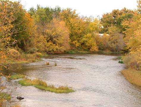 Weiser RiverCanoeingPhoto: Decumanus, CC BY-SA 3.0 (via Wikimedia Commons)3.9 mi
- West Fork Weiser RiverCanoeing5 mi
 Evergreen CampgroundCampingPhoto: Recreation.gov (RIDB) / public domain5.7 mi
- West River Recreational TrailHiking5.8 mi
- Lost CreekHiking8.8 mi
- Upper Lick CreekHiking9 mi
- LaffertyCamping9.6 mi
Source: Roamze catalog (indexable pages within 10 miles, PostGIS distance)
- Weiser RiverCanoeing · ~7 min drivePhoto: Decumanus, CC BY-SA 3.0 (via Wikimedia Commons)
- Copper Creek Boat LaunchBoat launch · ~31 min drive
- Island Bar Recreation SiteFloat trip · ~57 min drive
 Little Salmon RiverCanoeing · ~17 min drivePhoto: NOAA, Public domain (via Wikimedia Commons)
- Copperfield Boat RampBoat launch · ~34 min drive
 North Fork Payette RiverCanoeing · ~37 min drivePhoto: Mll1013, Public domain (via Wikimedia Commons)
- Hells Canyon Creek Boat LaunchBoat launch · ~40 min drive
 Imnaha RiverCanoeing · ~48 min drivePhoto: Sam Beebe, CC BY 2.0 (via Wikimedia Commons)
- Rainbow PointBoat launch · ~41 min drive
- West Fork Weiser RiverCanoeing · ~8 min drive
Best time to visit Lost Valley Reservoir Boat Ramp
Best months: May–September. Best months have typical highs of 55–85 °F, lows of 30 °F or warmer (32 °F where the station doesn't record snow), at most one snowy day and no more than 12 wet days.
Jan
30° / 9°
Feb
36° / 12°
Mar
45° / 21°
Apr
55° / 27°
May
64° / 33°
Jun
72° / 39°
Jul
85° / 43°
Aug
85° / 41°
Sep
75° / 33°
Oct
59° / 25°
Nov
42° / 19°
Dec
31° / 13°
Typical high / low (°F) and days with rain or snow, 1991–2020. Measured at New Meadows Rs, ID, 8.2 mi away at 3,862 ft. We don't have this place's elevation, so higher spots nearby can run cooler. This station doesn't record snowfall. Source: NOAA NCEI U.S. Climate Normals 1991–2020.
Closures we've recorded since August 2026
Over Snow Vehicle Closure (Forestwide)
Payette National Forest · Order dated November 2, 2026; seen Nov 10, 2026, no lift recorded · Forest Service
