Weiser River Trail
- 3.8 mi
- distance
- 129 ft
- climb
- Gravel
- surface
- May–Sep
- best months
Clear today
Weather is good · OpenWeather · checked 10 h ago
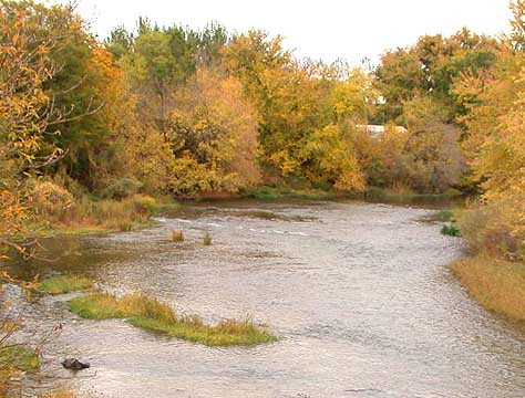
Weiser River Trail is a 3.78-mile gravel trail in the Tamarack trail system near Tamarack, Idaho. The trail gains 507 feet of elevation over its distance.
Local outfitters
- Black Bear RV Park15 mi away
Not on Roamze yet. Their page has how to reach them.
- Nearby · Lower Drain Trail · Ditch Witch Trail · Westy
Best time to go · May–Sep
Best time to visit Weiser River Trail
Best months: May–September. Best months have typical highs of 55–85 °F, lows of 30 °F or warmer (32 °F where the station doesn't record snow), at most one snowy day and no more than 12 wet days.
Jan
30° / 9°
Feb
36° / 12°
Mar
45° / 21°
Apr
55° / 27°
May
64° / 33°
Jun
72° / 39°
Jul
85° / 43°
Aug
85° / 41°
Sep
75° / 33°
Oct
59° / 25°
Nov
42° / 19°
Dec
31° / 13°
Typical high / low (°F) and days with rain or snow, 1991–2020. Measured at New Meadows Rs, ID, 4.8 mi away at 3,862 ft. This station doesn't record snowfall. Source: NOAA NCEI U.S. Climate Normals 1991–2020.
Keep exploring — more rides worth the drive
RIDE
Lower Drain Trail
~18 min drive
0.45-mile hard singletrack in Idaho with 401 ft gain, rated black diamond.
RIDE
Ditch Witch Trail
~18 min drive
1.00-mile out-and-back singletrack in Idaho with 355 ft elevation gain.
RIDE
Westy
~18 min drive
2.01-mile trail at Payette Rim Trailhead with 340 ft elevation gain
RIDE
Short Cut
~19 min drive
0.19-mile easy singletrack out-and-back in Idaho with 7 ft elevation gain.
RIDE
Grand Traverse Trail
~18 min drive
1.63-mile out-and-back singletrack in Idaho with 688 ft elevation gain.
RIDE
Grand Traverse
~19 min drive
1.64-mile trail in Idaho's Meadows Summit system with 401 ft elevation gain.
RIDE
Baby Bear Trail
~19 min drive
0.63-mile easy singletrack out-and-back in Idaho with 142 ft of elevation gain.
RIDE
Upper Drain Trail
~18 min drive
0.64-mile moderate singletrack out-and-back in Idaho with 214 ft elevation gain.
RIDE
Upper Drain Trail
~19 min drive
0.64-mile dirt trail at Payette Rim Trailhead with 214 ft elevation gain
RIDE
Sleepy Hollow Trail
~19 min drive
0.56-mile easy singletrack out-and-back in Idaho with 97 ft gain.
Map and trail data © OpenStreetMap contributors
