Lower Salmon River
- 23.1 mi
- round trip
- 34 ft
- climb
- 3,032 ft
- high point
- Out and back
- route
- Apr–Jun, Sep–Oct
- best months
Is Lower Salmon River open right now?
Alert in the area
The Forest Service lists an alert for Salmon-Challis National Forest.
Stoddard Bridge Construction Closure
Agency alert covering Salmon-Challis National Forest · Order 0413-07-17 · USFS · Salmon-Challis National Forest
As of · Source: USFS · Salmon-Challis National Forest. Agencies don't list every closure — check before you go.
The Lower Salmon River is an easy, out-and-back hike in Idaho's Salmon-Challis National Forest, within the North Fork Ranger District. The trail is about 23 miles long, with a low point of 2,789 feet and a high of 3,032 feet. It is managed by the Forest Service and is open year-round. The route is rated easy, with a total elevation gain of about 34 feet. The trail surface is natural, and horses are allowed. Bikes are not. For comfortable weather, aim for late spring or early fall. Typical averages from a nearby weather station in Shoup, Idaho, run to highs around 71°F in May and 77°F in September, while July and August average highs near 90°F. Corn Creek Campground Complex sits just 0.1 mile away, and the Butts Point hike is about 0.4 mile off. Cottonwood Butte and Horse Creek Trail are both within about 3 miles.
Best time to go · Apr–Jun, Sep–Oct
Best time to visit Lower Salmon River
Best months: April–June and September–October. Best months have typical highs of 55–85 °F, lows of 30 °F or warmer (32 °F where the station doesn't record snow), at most one snowy day and no more than 12 wet days.
Jan
31° / 17°
Feb
37° / 20°
Mar
52° / 30°
Apr
61° / 36°
May
71° / 42°
Jun
79° / 48°
Jul
90° / 54°
Aug
89° / 52°
Sep
77° / 45°
Oct
60° / 35°
Nov
42° / 27°
Dec
31° / 19°
Typical high / low (°F) and days with rain or snow, 1991–2020. Measured at Shoup, ID, 20 mi away at 3,400 ft. This station doesn't record snowfall. Source: NOAA NCEI U.S. Climate Normals 1991–2020.
Keep exploring — more trails worth the drive
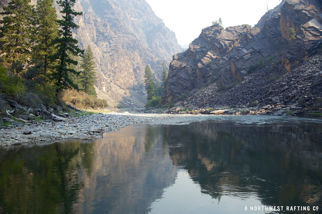 Photo: Northwest Rafting Company, CC BY 2.0 (via Flickr)
Stoddard
~11 min drive
25.40-mile point-to-point trail in Idaho with 8,278 ft elevation gain.
HIKE
Horse Creek Trail
~6 min drive
28.66-mile out-and-back trail in Idaho with 4,466 ft elevation gain.
HIKE
Stoddard Access
~11 min drive
1.24-mile out-and-back trail in Idaho with 65 ft of elevation gain.
HIKE
Stripe Creek-Divide
~18 min drive
5.69-mile out-and-back trail in Idaho with 1,322 ft elevation gain.
HIKE
Butts Point
Next door
14.54-mile out-and-back trail in Idaho with 4,882 ft elevation gain.
HIKE
Cramer Basin
~8 min drive
Cramer Basin is an 11.46-mile out-and-back trail in Idaho with 3,748 ft of elevation gain.
HIKE
Waugh Mtn-West Horse Trail
~15 min drive
2.86-mile out-and-back trail in Idaho with 955 ft gain and 8,359 ft max elevation.
HIKE
Cottonwood Butte
~5 min drive
25.86-mile point-to-point trail in Idaho with 5,958 ft elevation gain.
HIKE
HORSE CREEK
~19 min drive
28.82-mile out-and-back trail in Idaho with 4,651 ft elevation gain
HIKE
Elkhorn Mountain
~19 min drive
4.20-mile out-and-back trail to Elkhorn Mountain in Idaho with 123 ft elevation gain.
