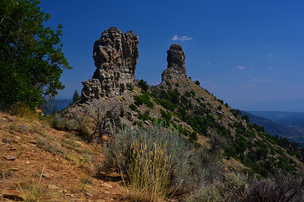
Mule Mountain
- 8,929 ft
- summit
- 2
- ways up
- May–Jun, Sep–Oct
- best months
Is Mule Mountain open right now?
Closure in the area
There's a closure order in San Juan National Forest. It doesn't name Mule Mountain, so check the source for the area it covers (3 listed).
Travel is not advised to the San Juan NF
Agency closure covering San Juan National Forest · USFS · San Juan National Forest
Closures and dangerous conditions on roads, bridges, and trails from flooding
Agency closure covering San Juan National Forest · USFS · San Juan National Forest
Multiple roads and trails damaged by flooding on SJNF
Agency closure covering San Juan National Forest · USFS · San Juan National Forest
Bear Activity High Across San Juan National Forest
Agency alert covering San Juan National Forest · USFS · San Juan National Forest
West Fork Road and Bridge Closure Order
Agency alert covering Pagosa Ranger District · Order 02-13-06-25-19 · USFS · Pagosa Ranger District
As of · Source: USFS · San Juan National Forest. Agencies don't list every closure — check before you go.
Mule Mountain is a summit of 8,929 feet in the Pagosa Ranger District of the San Juan National Forest in Colorado, about 15 miles from the town of Piedra. Summer is the most comfortable time to go. Typical averages from the nearby Lemon Dam weather station, which sits a few hundred feet lower, show July highs around 79°F with lows near 49°F, while September cools to highs around 70°F. Several trails start close by. The Mule Mtn. Spur 2 Trail is just 0.2 miles away, and the Mule Mountain Trail is about 1.4 miles off. For an overnight base, Lower Piedra Campground is about 2 miles away, and Devil Creek offers canoeing roughly 4 miles out.
Conditions and forecast
Daily highs and lows, wind and the chance of precipitation at the summit and route start for the next 7 days, from the Open-Meteo model.
- Summit elevation
- 8,929 ft
Elevation from USGS 3D Elevation Program terrain data (about 10 m resolution).
- Mule Mtn. Spur 2 TrailEasyabout 460 ft of climbing2.8 mi round trip
- MULE MOUNTAINHardabout 2,288 ft of climbing11.2 mi round trip
Compare the routes Mule Mtn. Spur 2 Trail MULE MOUNTAIN Climbing About 460 ft About 2,288 ft Round trip 2.8 mi 11.2 mi Difficulty Easy Hard Terrain Hike Hike Map © Mapbox © OpenStreetMap contributors Questions about Mule Mountain
How tall is Mule Mountain?
8,929 ft (2,722 m).
How many routes go to the summit of Mule Mountain?
2: Mule Mtn. Spur 2 Trail and MULE MOUNTAIN.
What is the shortest route up Mule Mountain?
Mule Mtn. Spur 2 Trail, about 2.8 mi round trip.
- Devil Mountain9,925 ft · Colorado2 routes2.5 mi away
- Horse Mountain9,946 ft · Colorado1 route3.5 mi away
- Slide Mountain11,109 ft · Colorado1 route13 mi away
- Pecho de la Doncella6,843 ft · New Mexico1 route23 mi away
- Palomino Mountain12,236 ft · Colorado1 route25 mi away
 Irving Peak13,210 ft · Colorado1 route25 mi awayPhoto: Jeremiah LaRocco, CC BY-SA 2.0 (via Wikimedia Commons)
- Mule Mtn. Spur 2 TrailHiking0.2 mi
- Mule Mountain Spur 1 TrailHiking1.1 mi
- Mule Mountain TrailHiking1.4 mi
 Lower Piedra CampgroundCampingPhoto: Dicklyon, CC BY-SA 4.0 (via Wikimedia Commons)2 mi
- Piedra Camp 1Camping3.1 mi
- Piedra Camp 3Camping3.2 mi
- Devil CreekCanoeing3.7 mi
 Stollsteimer CreekCanoeingPhoto: Dicklyon, CC BY-SA 4.0 (via Wikimedia Commons)5.9 mi
Source: Roamze catalog (indexable pages within 10 miles, PostGIS distance)
 Pagosa PeakSummit · ~32 min drivePhoto: Jeffrey Beall, CC BY 4.0 (via Wikimedia Commons)
 Cimarrona PeakSummit · ~38 min drivePhoto: Jeffrey Beall, CC BY 4.0 (via Wikimedia Commons)
 Organ MountainSummit · ~43 min drivePhoto: Jeremiah LaRocco, CC BY-SA 2.0 (via Wikimedia Commons)
 Amherst MountainSummit · ~43 min drivePhoto: Jeremiah LaRocco, CC BY-SA 2.0 (via Wikimedia Commons)
- Irving PeakSummit · ~44 min drivePhoto: Jeremiah LaRocco, CC BY-SA 2.0 (via Wikimedia Commons)
 Thunder MountainSummit · ~47 min drivePhoto: Jeremiah LaRocco, CC BY-SA 2.0 (via Wikimedia Commons)
 Aztec MountainSummit · ~49 min drivePhoto: Jeremiah LaRocco, CC BY-SA 2.0 (via Wikimedia Commons)
 Jupiter MountainSummit · ~49 min drivePhoto: Jeremiah LaRocco, CC BY-SA 2.0 (via Wikimedia Commons)
 Rio Grande PyramidSummit · ~50 min drivePhoto: U.S. Forest Service Staff, Public domain (via Wikimedia Commons)
 Windom PeakSummit · ~50 min drivePhoto: Jeremiah LaRocco, CC BY-SA 2.0 (via Wikimedia Commons)
Best time to visit Mule Mountain
Best months: May–June and September–October. Best months have typical highs of 55–85 °F, lows of 30 °F or warmer (32 °F where the station doesn't record snow), at most one snowy day and no more than 12 wet days.
Jan
37° / 9°
9 wet
Feb
40° / 11°
8 wet
Mar
47° / 19°
8 wet
Apr
54° / 26°
7 wet
May
63° / 35°
8 wet
Jun
75° / 43°
7 wet
Jul
79° / 49°
14 wet
Aug
76° / 48°
16 wet
Sep
70° / 41°
11 wet
Oct
59° / 32°
8 wet
Nov
46° / 22°
7 wet
Dec
37° / 13°
8 wet
Typical high / low (°F) and days with rain or snow, 1991–2020. Measured at Lemon Dam, CO, 20.8 mi away at 8,110 ft. The station sits about 800 ft lower than this place, so expect it a little cooler here. This station doesn't record snowfall. Source: NOAA NCEI U.S. Climate Normals 1991–2020.