Organ Mountain
 Photo: Jeremiah LaRocco, CC BY-SA 2.0 (via Wikimedia Commons)
- 13,018 ft
- summit
- Forest Service
- managed by
Is Organ Mountain open right now?
Closure in the area
There's a closure order in Columbine Ranger District. It doesn't name Organ Mountain, so check the source for the area it covers (5 listed).
Pagosa Ranger District Road Closure
Agency closure covering Columbine Ranger District · Order 02-13-08-26-17 · USFS · Columbine Ranger District
COLUMBINE RANGER DISTRICT Road Closure
Agency closure covering Columbine Ranger District · Order 02-13-08-26-18 · USFS · Columbine Ranger District
Travel is not advised to the San Juan NF
Agency closure covering San Juan National Forest · USFS · San Juan National Forest
Closures and dangerous conditions on roads, bridges, and trails from flooding
Agency closure covering San Juan National Forest · USFS · San Juan National Forest
Multiple roads and trails damaged by flooding on SJNF
Agency closure covering San Juan National Forest · USFS · San Juan National Forest
As of · Source: USFS · Columbine Ranger District. Agencies don't list every closure — check before you go.
Organ Mountain is a summit of about 13,018 feet in La Plata County, Colorado, inside the Weminuche Wilderness. The peak lies within the Columbine Ranger District of the San Juan National Forest, which the Forest Service manages, and the nearest town is Silverton, about 18 miles away. Vallecito Creek, a canoeing spot, is about a mile away, and the Johnson Creek hike is about 1.7 miles off. The Old Endlich Mesa Trail and Vallecito Campground are both within about 6 miles.
Conditions and forecast
Daily highs and lows, wind and the chance of precipitation at the summit for the next 7 days, from the Open-Meteo model.
- Summit elevation
- 13,018 ft
- Land manager
- Forest Service
Elevation from USGS 3D Elevation Program terrain data (about 10 m resolution).
We don't know of a mapped trail or route to the summit of Organ Mountain. Plan the approach with local maps, a guidebook or a local guide, and check conditions before you go.
Questions about Organ Mountain
How tall is Organ Mountain?
13,018 ft (3,968 m).
Is there a trail to the top of Organ Mountain?
We don't know of a mapped trail or route to the summit. Plan the approach with local maps, a guidebook or a local guide.
- Mount Valois13,170 ft · Colorado1 route1.7 mi away
- McCauley Peak13,540 ft · Colorado1 route2.4 mi away
 Irving Peak13,210 ft · Colorado1 route3.0 mi awayPhoto: Jeremiah LaRocco, CC BY-SA 2.0 (via Wikimedia Commons)
- Grizzly Peak13,683 ft · Colorado1 route3.2 mi away
 Jupiter Mountain13,818 ft · Colorado1 route3.7 mi awayPhoto: Jeremiah LaRocco, CC BY-SA 2.0 (via Wikimedia Commons)
 Aztec Mountain13,304 ft · Colorado1 route3.8 mi awayPhoto: Jeremiah LaRocco, CC BY-SA 2.0 (via Wikimedia Commons)
- Vallecito CreekCanoeing1.1 mi
- Johnson CreekHiking1.7 mi
- Old Endlich Mesa TrailHiking3.5 mi
- VallecitoHiking4 mi
- The Lost WallRock climbing5.5 mi
- The NeedlesRock climbing5.6 mi
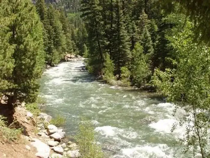 Vallecito CampgroundCampingPhoto: Recreation.gov (RIDB) / public domain6.2 mi
- Pine River CampgroundCamping8.7 mi
Source: Roamze catalog (indexable pages within 10 miles, PostGIS distance)
 Amherst MountainSummit · Next doorPhoto: Jeremiah LaRocco, CC BY-SA 2.0 (via Wikimedia Commons)
 Thunder MountainSummit · ~4 min drivePhoto: Jeremiah LaRocco, CC BY-SA 2.0 (via Wikimedia Commons)
- Irving PeakSummit · ~5 min drivePhoto: Jeremiah LaRocco, CC BY-SA 2.0 (via Wikimedia Commons)
- Jupiter MountainSummit · ~6 min drivePhoto: Jeremiah LaRocco, CC BY-SA 2.0 (via Wikimedia Commons)
- Aztec MountainSummit · ~7 min drivePhoto: Jeremiah LaRocco, CC BY-SA 2.0 (via Wikimedia Commons)
 Windom PeakSummit · ~7 min drivePhoto: Jeremiah LaRocco, CC BY-SA 2.0 (via Wikimedia Commons)
 Sunlight PeakSummit · ~8 min drivePhoto: Evil.Satellite at English Wikipedia, Public domain (via Wikimedia Commons)
 Mount EolusSummit · ~9 min drivePhoto: Evil.Satellite at English Wikipedia, Public domain (via Wikimedia Commons)
 Pigeon PeakSummit · ~12 min drivePhoto: Kcujedi, CC BY-SA 4.0 (via Wikimedia Commons)
 Vestal PeakSummit · ~15 min drivePhoto: Doug Lynne, CC BY-SA 2.0 (via Wikimedia Commons)

