Mizpah Campground
Campground
Campground · 3.9 mi from the trail
Alert in the area
The Forest Service lists 3 alerts for Arapaho and Roosevelt National Forests.
Fire Restrictions
Agency alert covering Arapaho and Roosevelt National Forests · USFS · Arapaho and Roosevelt National Forests
Slater Lake Area Closure
Agency alert covering Clear Creek Ranger District · Order 02-10-07-26-03 · USFS · Clear Creek Ranger District
Area Closure Surrounding the Devils Nose Target Range
Agency alert covering Clear Creek Ranger District · Order 02-10-07-26-01 · USFS · Clear Creek Ranger District
As of · Source: USFS · Arapaho and Roosevelt National Forests. Agencies don't list every closure — check before you go.
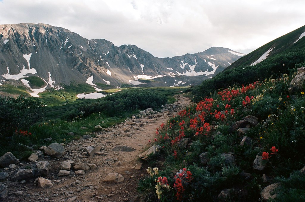
Hassell Lake is an easy out-and-back hike of about 2.1 miles in Colorado's Clear Creek Ranger District, part of the Arapaho and Roosevelt National Forests. The trail runs through the Urad Lake State Wildlife Area, which is managed by State Fish and Wildlife, and the route rises about 650 feet from a low point of 10,686 feet to a high of 11,346 feet. The trail is natural-surfaced and open to both horses and bikes, so it works for riders and pack animals as well as hikers. The trip is short enough to fit into a day, and the parking area is named Hassell Lake. Summer is the most comfortable time to go. Typical averages from the nearby Cabin Creek weather station, which sits about 1,300 feet lower, show July highs around 69°F with lows near 46°F, while winter highs stay around freezing. The trail is open from June 1 to September 30. Butler Gulch is about 0.9 miles away, and The Citadel is about 2.1 miles off. For an overnight stay, Mizpah Campground is about 3.9 miles away, and West Fork Clear Creek offers canoeing about 4.8 miles from the trail.
Mizpah Campground
Campground
 If it rainsUser:Magicpiano, CC BY-SA 4.0 · Wikimedia Commons
Historic house-museum in Georgetown, Colorado, United States
Places © OpenStreetMap contributors, Places © Overture Maps Foundation · Photos: User:Magicpiano, CC BY-SA 4.0 (commons)
More in Idaho SpringsSource: Roamze catalog (indexable pages within 10 miles, PostGIS distance)
 Watrous GulchHiking · ~4 min drivePhoto: kalestews, CC BY 2.0 (via Flickr)Mount ParnassusHiking · ~5 min drivePhoto: kalestews, CC BY 2.0 (via Flickr)
 West Ridge TrailHiking · ~10 min drivePhoto: glennharper, CC BY-SA 2.0 (via Flickr)
 Torreys PeakHiking · ~11 min drivePhoto: MCA / Mike Allyn, CC BY 2.0 (via Flickr)Mount SniktauHiking · ~10 min drivePhoto: glennharper, CC BY-SA 2.0 (via Flickr)
 Kearney GulchHiking · ~7 min drivePhoto: roland, CC BY 2.0 (via Flickr)
 Pass LakeHiking · ~11 min drivePhoto: Kimaz2412, CC BY 2.0 (via Flickr)CupidHiking · ~10 min drivePhoto: glennharper, CC BY-SA 2.0 (via Flickr)Grizzly PeakHiking · ~10 min drivePhoto: glennharper, CC BY-SA 2.0 (via Flickr)
Best months: June and September. Best months have typical highs of 55–85 °F, lows of 30 °F or warmer (32 °F where the station doesn't record snow), at most one snowy day and no more than 12 wet days.
Jan
32° / 12°
8 wet
Feb
31° / 11°
8 wet
Mar
38° / 17°
9 wet
Apr
43° / 23°
10 wet
May
53° / 31°
9 wet
Jun
64° / 40°
9 wet
Jul
69° / 46°
13 wet
Aug
67° / 44°
14 wet
Sep
61° / 38°
10 wet
Oct
50° / 29°
7 wet
Nov
39° / 19°
7 wet
Dec
32° / 12°
8 wet
Typical high / low (°F) and days with rain or snow, 1991–2020. Measured at Cabin Creek, CO, 9.8 mi away at 10,020 ft. The station sits about 1,300 ft lower than this place, so expect it a little cooler here. This station doesn't record snowfall. Source: NOAA NCEI U.S. Climate Normals 1991–2020.
