Silent Valley Club RV Resort
Campground
Campground · 2.8 mi from the trail
Wolfskill Truck Trail is a short, easy out-and-back hike on Bureau of Land Management land in the Palm Springs/S. Coast Field Office in California, about 1 mile long with a total elevation gain of about 325 feet. The trail starts at about 2,935 feet and reaches a high point of about 3,192 feet. It's a low-commitment outing, and the climb is front-loaded, with the steepest stretch at about 0.6 miles in. Spring and fall are the most comfortable times to go. Typical averages from a nearby weather station in Hemet show April highs around 75°F and October highs around 82°F, while July and August average in the mid-90s. That station sits well below the trail, so temperatures up high run cooler. The trip takes about an hour. Puppet Truck Trail lies about 2 miles away. Climbers can find G Boulder (aka Cosmos Boulder) and Roadside Corral about 2.8 miles off. Black Mountain is roughly 6 miles away.
Silent Valley Club RV Resort
Campground
 If it rainsVisitor7, CC BY-SA 3.0 · Wikimedia Commons
Places © OpenStreetMap contributors, Places © Overture Maps Foundation · Photos: Visitor7, CC BY-SA 3.0 (commons)
More in Desert Hot Springs Black MountainHikingPhoto: inkknife_2000 (7.5 million views +), CC BY-SA 2.0 (via Wikimedia Commons)6.3 mi
 Black Mountain (san Bernardino)CampingPhoto: Recreation.gov (RIDB) / public domain9.3 mi
Source: Roamze catalog (indexable pages within 10 miles, PostGIS distance)
Cinco Poses TrailHiking · ~12 min drivePhoto: inkknife_2000 (7.5 million views +), CC BY-SA 2.0 (via Wikimedia Commons)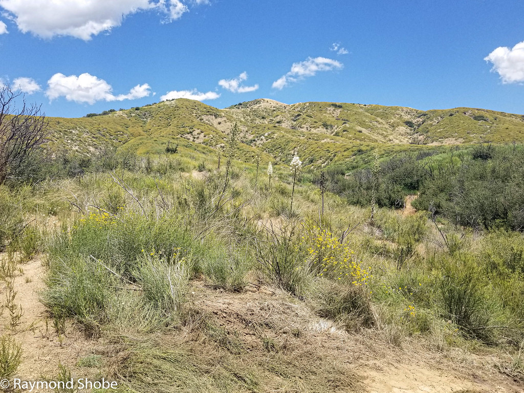 East Canyon TrailHiking · ~15 min drivePhoto: bossco, CC BY-SA 2.0 (via Flickr)
 Deer Springs TrailHiking · ~21 min drivePhoto: inkknife_2000 (7.5 million views +), CC BY-SA 2.0 (via Wikimedia Commons)
 Marion MountainHiking · ~18 min drivePhoto: inkknife_2000 (7.5 million views +), CC BY-SA 2.0 (via Wikimedia Commons)
 Bogart TrailHiking · ~15 min drivePhoto: inkknife_2000 (7.5 million views +), CC BY-SA 2.0 (via Wikimedia Commons)
 Wilshire Peak (No SurveyHiking · ~21 min drivePhoto: inkknife_2000 (7.5 million views +), CC BY-SA 2.0 (via Wikimedia Commons)
 Deer Springs TrailHiking · ~21 min drivePhoto: HikingMike, CC BY 2.0 (via Flickr)
 Bogart TrailHiking · ~16 min drivePhoto: inkknife_2000 (7.5 million views +), CC BY-SA 2.0 (via Wikimedia Commons)Black MountainHiking · ~11 min drivePhoto: inkknife_2000 (7.5 million views +), CC BY-SA 2.0 (via Wikimedia Commons)
Best months: October–May. Best months have typical highs of 55–85 °F, lows of 30 °F or warmer (32 °F where the station doesn't record snow), at most one snowy day and no more than 12 wet days.
Jan
66° / 44°
6 wet
Feb
67° / 46°
6 wet
Mar
71° / 47°
5 wet
Apr
75° / 49°
3 wet
May
81° / 54°
2 wet
Jun
89° / 56°
1 wet
Jul
96° / 65°
1 wet
Aug
97° / 66°
1 wet
Sep
92° / 62°
1 wet
Oct
82° / 55°
2 wet
Nov
73° / 49°
3 wet
Dec
65° / 43°
5 wet
Typical high / low (°F) and days with rain or snow, 1991–2020. Measured at Hemet, CA, 8.5 mi away at 1,811 ft. The station sits about 1,400 ft lower than this place, so expect it a little cooler here. Source: NOAA NCEI U.S. Climate Normals 1991–2020.
Map and trail data © OpenStreetMap contributors
