Cherry Valley Lakes RV Resort
Campground
Campground · 4.3 mi from the trail
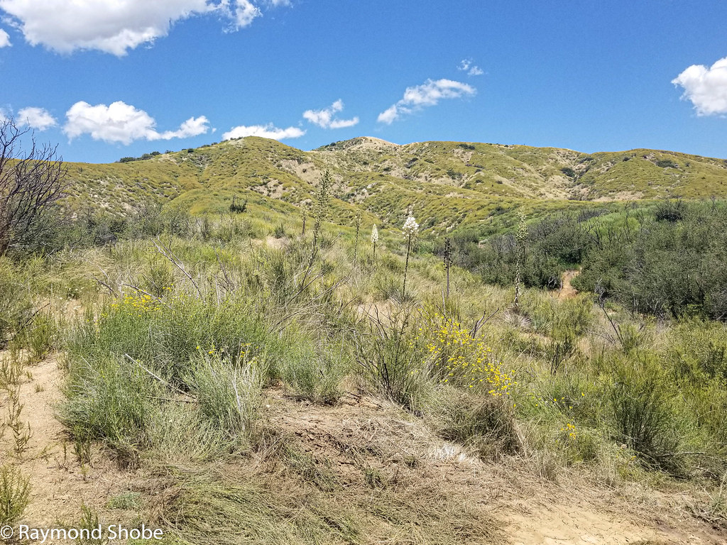 Photo: bossco, CC BY-SA 2.0 (via Flickr)
East Canyon Trail is an easy, short out-and-back hike in Bogart County Park, California, about a mile from the town of Highland Springs. The trail is on county land and covers roughly a mile round trip, with a total elevation gain of about 270 feet. The route is steady, and the steepest stretch comes about 0.4 miles in at around 7%. The most comfortable months for a visit are spring and fall. Typical averages from a nearby weather station run from highs near 73°F in April to about 78°F in October, while summer highs reach the mid-90s and winter lows hover around 40°F. The hike can be paired with Ridge Trail, about 0.3 miles away, or Bogart Trail, about 0.4 miles off. For a longer outing, Oak Tree Loop lies about 4 miles away, and paddlers can head to the San Gorgonio River, roughly 7 miles out.
Cherry Valley Lakes RV Resort
Campground
Places © OpenStreetMap contributors, Places © Overture Maps Foundation
More in Desert Hot Springs Ridge TrailHikingPhoto: inkknife_2000 (7.5 million views +), CC BY-SA 2.0 (via Wikimedia Commons)0.3 miBogart TrailHikingPhoto: inkknife_2000 (7.5 million views +), CC BY-SA 2.0 (via Wikimedia Commons)0.4 mi
 Oak Tree LoopHikingPhoto: Brück & Sohn Kunstverlag Meißen, CC0 (via Wikimedia Commons)3.9 mi
 Stetson TrailHikingPhoto: inkknife_2000 (7.5 million views +), CC BY-SA 2.0 (via Wikimedia Commons)3.9 mi
Source: Roamze catalog (indexable pages within 10 miles, PostGIS distance)
Ridge TrailHiking · Next doorPhoto: inkknife_2000 (7.5 million views +), CC BY-SA 2.0 (via Wikimedia Commons) Wilshire Peak (No SurveyHiking · ~8 min drivePhoto: inkknife_2000 (7.5 million views +), CC BY-SA 2.0 (via Wikimedia Commons)Cottonwood TrailHiking · ~8 min drivePhoto: inkknife_2000 (7.5 million views +), CC BY-SA 2.0 (via Wikimedia Commons)
 Yucaipa Ridge Truck TrailHiking · ~10 min drivePhoto: inkknife_2000 (7.5 million views +), CC BY-SA 2.0 (via Wikimedia Commons)Bogart TrailHiking · Next doorPhoto: inkknife_2000 (7.5 million views +), CC BY-SA 2.0 (via Wikimedia Commons)
 Pack TrailHiking · ~9 min drivePhoto: bossco, CC BY-SA 2.0 (via Flickr)
 Regional Park TrailHiking · ~13 min drivePhoto: inkknife_2000 (7.5 million views +), CC BY-SA 2.0 (via Wikimedia Commons)Bogart TrailHiking · ~1 min drivePhoto: inkknife_2000 (7.5 million views +), CC BY-SA 2.0 (via Wikimedia Commons)
 Wilson CreekHiking · ~10 min drivePhoto: inkknife_2000 (7.5 million views +), CC BY-SA 2.0 (via Wikimedia Commons)
 City TrailHiking · ~13 min drivePhoto: inkknife_2000 (7.5 million views +), CC BY-SA 2.0 (via Wikimedia Commons)
Best months: October–May. Best months have typical highs of 55–85 °F, lows of 30 °F or warmer (32 °F where the station doesn't record snow), at most one snowy day and no more than 12 wet days.
Jan
59° / 41°
4 wet
Feb
61° / 42°
3 wet
Mar
66° / 45°
3 wet
Apr
73° / 48°
2 wet
May
80° / 54°
1 wet
Jun
89° / 63°
0 wet
Jul
94° / 69°
1 wet
Aug
94° / 70°
1 wet
Sep
88° / 66°
1 wet
Oct
78° / 57°
1 wet
Nov
67° / 47°
2 wet
Dec
59° / 40°
4 wet
Typical high / low (°F) and days with rain or snow, 1991–2020. Measured at Morongo Valley N, CA, 23.3 mi away at 3,145 ft. This station doesn't record snowfall. Source: NOAA NCEI U.S. Climate Normals 1991–2020.
Map and trail data © OpenStreetMap contributors

