High Camp Pass Trail
- 0.4 mi
- round trip
- 339 ft
- climb
- 7,371 ft
- high point
- Out and back
- route
Is High Camp Pass Trail open right now?
Closure in the area
There's a closure order in Shasta-Trinity National Forest. It doesn't name High Camp Pass Trail, so check the source for the area it covers (2 listed).
Mud and Ash Creek Area and Road Closure
Agency closure covering Shasta-Trinity National Forest · Order 14-26-13 · USFS · Shasta-Trinity National Forest
Road Closure on Wild Mad Road
Agency closure covering Shasta-Trinity National Forest · Order 14-25-09 · USFS · Shasta-Trinity National Forest
Trout Creek Bridge Closure Order
Agency alert covering Shasta-Trinity National Forest · Order 14-26-02 · USFS · Shasta-Trinity National Forest
South Fork Suspension Bridge Closure
Agency alert covering Shasta-Trinity National Forest · Order 14-25-30 · USFS · Shasta-Trinity National Forest
Ah-Di-Na Area Closure
Agency alert covering Shasta-Trinity National Forest · Order 14-25-10 · USFS · Shasta-Trinity National Forest
As of · Source: USFS · Shasta-Trinity National Forest. Agencies don't list every closure — check before you go.
High Camp Pass Trail is a short, easy out-and-back hike of about 0.7 miles in California's Shasta-Trinity National Forest, within the Mt. Shasta Ranger District. The trail rises about 320 feet from roughly 7,066 feet to 7,371 feet at the pass, with the steepest part of the climb coming in the first 0.16 miles. The round trip adds up to about 339 feet of gain and loss, and the whole route takes about half an hour. The trail starts at an elevation of about 7,066 feet, and the pass sits at 7,371 feet. The route is rated easy, so it works well as a short outing or as a way to stretch your legs before or after another trip in the area. Nearby, High Camp and the High Camp Pass Trail STNF 6W03 are both about 0.3 miles away. For camping, Kangaroo Campground is about 3 miles off, and Toad Lake Campground is about 6.5 miles away.
- High Camp Pass Trail STNF 6W03Hiking0.3 mi
- High CampHiking0.3 mi
- KangarooCamping3.1 mi
- Plasma WallRock climbing5.8 mi
- The RoomRock climbing5.9 mi
- Toad Lake CgCamping6.5 mi
- East Fork Scott RiverCanoeing6.8 mi
- Trinity RiverCanoeing7.7 mi
Source: Roamze catalog (indexable pages within 10 miles, PostGIS distance)
 Houston CreekHiking · ~3 min drivePhoto: theforestprimeval, CC BY-SA 2.0 (via Flickr)
 Pacific Crest TrailHiking · ~4 min drivePhoto: theforestprimeval, CC BY-SA 2.0 (via Flickr)
 Eddy CreekHiking · ~4 min drivePhoto: theforestprimeval, CC BY-SA 2.0 (via Flickr)
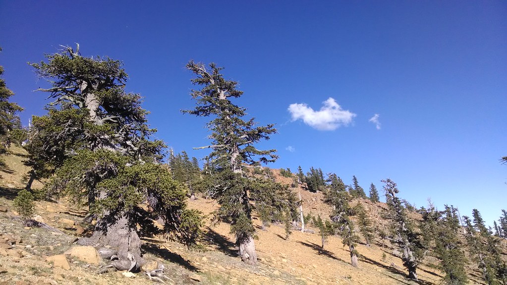 Toad LakeHiking · ~11 min drivePhoto: theforestprimeval, CC BY-SA 2.0 (via Flickr)
 Fen Nature Trail (Sisson)Hiking · ~6 min drivePhoto: Curt Kline, CC BY 3.0 (via Wikimedia Commons)
- Pacific Crest National Scenic Trail #2000Hiking · ~8 min drivePhoto: Curt Kline, CC BY 3.0 (via Wikimedia Commons)
- Kangaroo LakeHiking · ~6 min drivePhoto: Curt Kline, CC BY 3.0 (via Wikimedia Commons)
- Sisson Callahan TrailHiking · ~4 min drive
- ChilkootHiking · ~2 min drive
 Pacific Crest TrailHiking · ~17 min drivePhoto: randomduck, CC BY-SA 2.0 (via Flickr)

Map and trail data © OpenStreetMap contributors
