Camelback Mountain
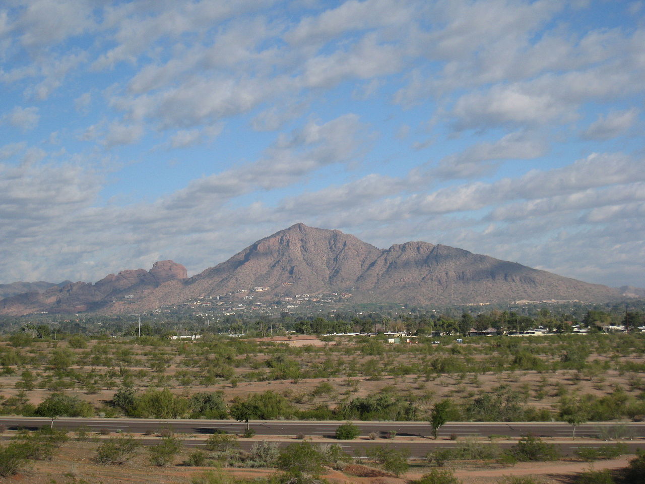 Photo: Dru Bloomfield from Scottsdale, Arizona, USA, CC BY 2.0 (via Wikimedia Commons)
- 2,702 ft
- summit
- 2
- ways up
- County Land
- managed by
- Oct–Apr
- best months
Camelback Mountain is a summit of 2,702 feet in Echo Canyon Park, on county land about 2.6 miles from Paradise Valley, Arizona. It sits among a cluster of trails and climbing areas, so it works as a destination in its own right or as a starting point for exploring the surrounding canyon. Spring and fall are the most comfortable times to visit. Typical averages from a nearby weather station at Pinnacle Peak show April highs around 79°F and October highs around 83°F, while July and August average in the upper 90s. The closest trails are the Cholla Trail and the Echo Canyon Trail, both within half a mile. Boulder Canyon and The Praying Monk, two climbing areas, are also about 0.1 mile away.
Conditions and forecast
Daily highs and lows, wind and the chance of precipitation at the summit and route start for the next 7 days, from the Open-Meteo model.
- Summit elevation
- 2,702 ft
- Land manager
- County Land
Elevation from USGS 3D Elevation Program terrain data (about 10 m resolution).
- Echo Canyon TrailHardabout 1,029 ft of climbing1.3 mi round trip
- Cholla TrailModerateabout 1,890 ft of climbing2.3 mi round trip
Compare the routes Echo Canyon Trail Cholla Trail Climbing About 1,029 ft About 1,890 ft Round trip 1.3 mi 2.3 mi Difficulty Hard Moderate Terrain Hike Hike Map © Mapbox © OpenStreetMap contributors Questions about Camelback Mountain
How tall is Camelback Mountain?
2,702 ft (824 m).
How many routes go to the summit of Camelback Mountain?
2: Echo Canyon Trail and Cholla Trail.
What is the shortest route up Camelback Mountain?
Echo Canyon Trail, about 1.3 mi round trip.
 Piestewa Peak2,596 ft · Arizona1 route4.1 mi awayPhoto: Ted Eytan, CC BY-SA 2.0 (via Wikimedia Commons)
 North Mountain2,099 ft · Arizona1 route8.0 mi awayPhoto: Aznaturalist, CC BY-SA 3.0 (via Wikimedia Commons)
 Thompson Peak3,983 ft · Arizona1 route12 mi awayPhoto: GreenGibbon, CC BY-SA 3.0 (via Wikimedia Commons)
- Goat Hill2,331 ft · Arizona2 routes15 mi away
- Deem Hills2,103 ft · Arizona1 route19 mi away
- Lousley Hill2,045 ft · Arizona1 route20 mi away
 The Praying MonkRock climbingPhoto: bobistraveling, CC BY 2.0 (via Wikimedia Commons)0.1 mi
- Boulder CanyonRock climbingPhoto: bobistraveling, CC BY 2.0 (via Wikimedia Commons)0.1 mi
- Cholla TrailHiking0.1 mi
 Echo Canyon TrailHikingPhoto: Hari Seldon, CC BY-SA 3.0 (via Wikimedia Commons)0.5 mi
 Gargoyle WallRock climbingPhoto: Spikebrennan, CC BY-SA 3.0 (via Wikimedia Commons)0.5 mi
- The HeadwallRock climbingPhoto: Spikebrennan, CC BY-SA 3.0 (via Wikimedia Commons)0.6 mi
- Arizona Canal PathHiking2.7 mi
 Salt RiverCanoeingPhoto: Alan Stark from Goodyear, AZ, United States, CC BY-SA 2.0 (via Wikimedia Commons)6.5 mi
Source: Roamze catalog (indexable pages within 10 miles, PostGIS distance)
- Piestewa PeakSummit · ~7 min drivePhoto: Ted Eytan, CC BY-SA 2.0 (via Wikimedia Commons)
- North MountainSummit · ~14 min drivePhoto: Aznaturalist, CC BY-SA 3.0 (via Wikimedia Commons)
- Thompson PeakSummit · ~21 min drivePhoto: GreenGibbon, CC BY-SA 3.0 (via Wikimedia Commons)
 Gavilan PeakSummit · ~49 min drivePhoto: Phoenix500, CC BY-SA 3.0 (via Wikimedia Commons)
 Poston ButteSummit · ~1h 17m drivePhoto: Aznaturalist, CC BY-SA 3.0 (via Wikimedia Commons)
 Pass MountainSummit · ~36 min drivePhoto: Z Glyph, CC BY 3.0 (via Wikimedia Commons)
- The Praying MonkSummit · Next door
- Goat HillSummit · ~25 min drive
- Pinnacle PeakSummit · ~27 min drive
- Deem HillsSummit · ~32 min drive
Best time to visit Camelback Mountain
Best months: October–April. Best months have typical highs of 55–85 °F, lows of 30 °F or warmer (32 °F where the station doesn't record snow), at most one snowy day and no more than 12 wet days.
Jan
64° / 43°
Feb
66° / 45°
Mar
72° / 49°
Apr
79° / 54°
May
87° / 62°
Jun
96° / 71°
Jul
99° / 76°
Aug
98° / 75°
Sep
94° / 71°
Oct
83° / 61°
Nov
72° / 50°
Dec
63° / 42°
Typical high / low (°F) and days with rain or snow, 1991–2020. Measured at Pinnacle Peak, AZ, 15.8 mi away at 2,565 ft. This station doesn't record snowfall. Source: NOAA NCEI U.S. Climate Normals 1991–2020.
