Campground East
Campground
Campground · 3.6 mi from the trail
 Photo: David Taylor from Coeur d Alene, United States, CC BY 2.0 (via Wikimedia Commons)
Alert in the area
The Forest Service lists 5 alerts for Tonto National Forest.
Rattlesnake Cove Developed Recreation Site - Post Flood Recovery and Public Safety Closure
Agency alert covering Tonto National Forest · Order 3-12-01-26-36 · USFS · Tonto National Forest
Canyon Lake Drawdown Public Safety Closure
Agency alert covering Tonto National Forest · Order 03-12-00-26-22 · USFS · Tonto National Forest
No Fire Restrictions
Agency alert covering Tonto National Forest · USFS · Tonto National Forest
Lower Salt River Seasonal Bald Eagle Closures
Agency alert covering Mesa Ranger District · Order 03-12-03-24-65 · USFS · Mesa Ranger District
Roosevelt Lake Seasonal Wildlife Closure
Agency alert covering Tonto National Forest · Order 12-16-5 · USFS · Tonto National Forest
As of · Source: USFS · Tonto National Forest. Agencies don't list every closure — check before you go.
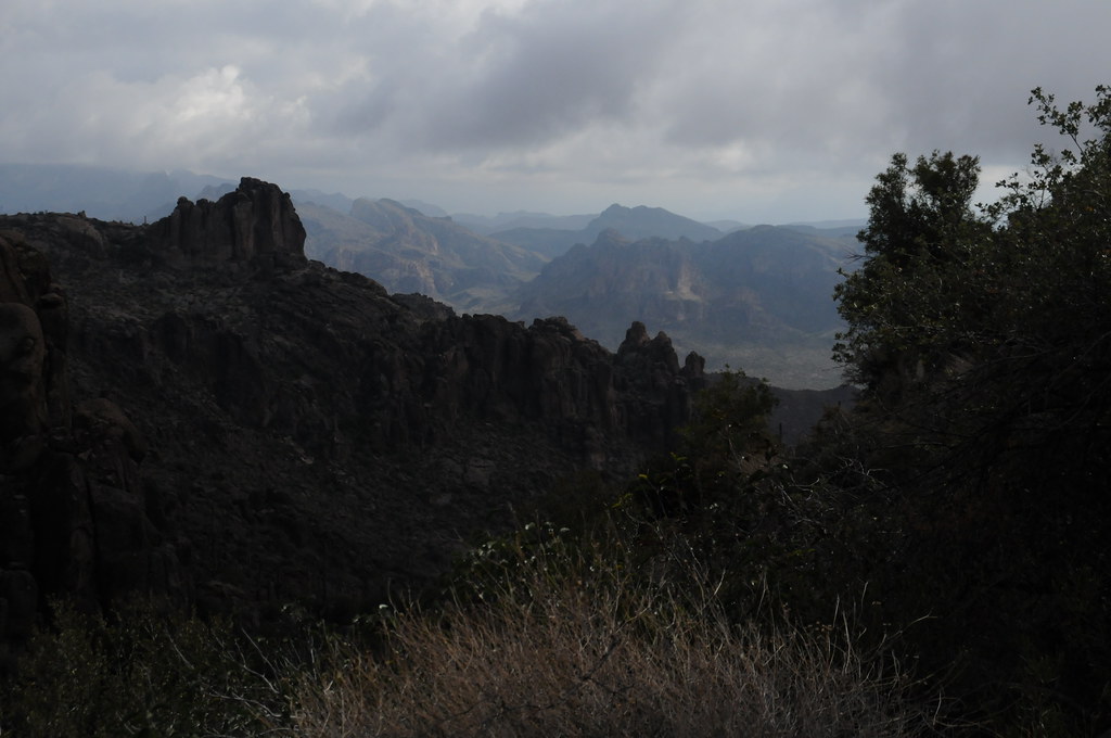
Wild Horse Wall is a climbing area in the Superstition Wilderness, part of the Mesa Ranger District of Tonto National Forest in Arizona. The Forest Service manages the land, and the area sits within designated wilderness. The climbing here is a mix of trad and sport routes, with 14 trad and 3 sport routes among the 17 listed. Grades run from 5.1 to 5.11, with the median at 5.9. Some of the named routes include Lickspittleish (5.1, trad), Mustang Sally (5.8, sport) and The Blind Leading the Naked (5.11, trad). Spring and fall are the most comfortable times to visit. Typical averages from a nearby weather station in Apache Junction show March highs around 77°F and November highs around 76°F, while July averages about 105°F. That station sits roughly 1,300 feet below the wall, so temperatures on the rock run cooler. Several other climbing areas are close by, including Myth Wall about 0.1 mile away and Barks Canyon Wall about 0.2 mile away. The Cave Trail #233 and Terrapin Trail #234 are both about 0.7 mile off.
Campground East
Campground
Queen Valley Country Club Bar & Grill
Bar
Trails End
Attraction
Places © OpenStreetMap contributors
More in SuperiorMyth WallRock climbingPhoto: David Taylor from Coeur d Alene, United States, CC BY 2.0 (via Wikimedia Commons)0.1 mi Barks Canyon WallRock climbingPhoto: David Taylor from Coeur d Alene, United States, CC BY 2.0 (via Wikimedia Commons)0.2 mi
 The CemeteryRock climbingPhoto: Alan English CPA from Scottsdale, Arizona 85254, USA, CC BY-SA 2.0 (via Wikimedia Commons)0.2 mi
 Cave Trail #233HikingPhoto: HockeyholicAZ, CC BY 2.0 (via Flickr)0.7 mi
 Terrapin Trail #234HikingPhoto: HockeyholicAZ, CC BY 2.0 (via Flickr)0.7 miPeralta Trail #102HikingPhoto: HockeyholicAZ, CC BY 2.0 (via Flickr)1.1 mi
Source: Roamze catalog (indexable pages within 10 miles, PostGIS distance)
Myth WallRock climbing · Next doorPhoto: David Taylor from Coeur d Alene, United States, CC BY 2.0 (via Wikimedia Commons)Barks Canyon WallRock climbing · Next doorPhoto: David Taylor from Coeur d Alene, United States, CC BY 2.0 (via Wikimedia Commons)The CemeteryRock climbing · Next doorPhoto: Alan English CPA from Scottsdale, Arizona 85254, USA, CC BY-SA 2.0 (via Wikimedia Commons)Nosepicker PinnaclesRock climbing · Next doorPhoto: David Taylor from Coeur d Alene, United States, CC BY 2.0 (via Wikimedia Commons)Miners NeedleRock climbing · ~3 min drivePhoto: Alan English CPA from Scottsdale, Arizona 85254, USA, CC BY-SA 2.0 (via Wikimedia Commons) Weavers NeedleRock climbing · ~3 min drivePhoto: Deborah Lee Soltesz from Flagstaff, AZ, CC0 (via Wikimedia Commons)Superstition MountainsRock climbing · ~3 min drivePhoto: Deborah Lee Soltesz from Flagstaff, AZ, CC0 (via Wikimedia Commons)
 The IcebergRock climbing · ~11 min drivePhoto: Sean Foster, CC BY 3.0 (via Wikimedia Commons)
 Siphon DrawRock climbing · ~12 min drivePhoto: The3dStudioDotCom, CC BY-SA 3.0 (via Wikimedia Commons)Northwest PinnaclesRock climbing · ~12 min drivePhoto: Sean Foster, CC BY 3.0 (via Wikimedia Commons)
Best months: November–April. Best months have typical highs of 55–85 °F, lows of 30 °F or warmer (32 °F where the station doesn't record snow), at most one snowy day and no more than 12 wet days.
Jan
67° / 43°
4 wet
Feb
70° / 44°
4 wet
Mar
77° / 48°
4 wet
Apr
85° / 53°
2 wet
May
93° / 60°
2 wet
Jun
103° / 69°
1 wet
Jul
105° / 77°
4 wet
Aug
104° / 76°
6 wet
Sep
99° / 71°
4 wet
Oct
88° / 60°
3 wet
Nov
76° / 50°
3 wet
Dec
66° / 42°
4 wet
Typical high / low (°F) and days with rain or snow, 1991–2020. Measured at Apache Junction 5 Ne, AZ, 8.2 mi away at 2,070 ft. The station sits about 1,300 ft lower than this place, so expect it a little cooler here. Source: NOAA NCEI U.S. Climate Normals 1991–2020.
