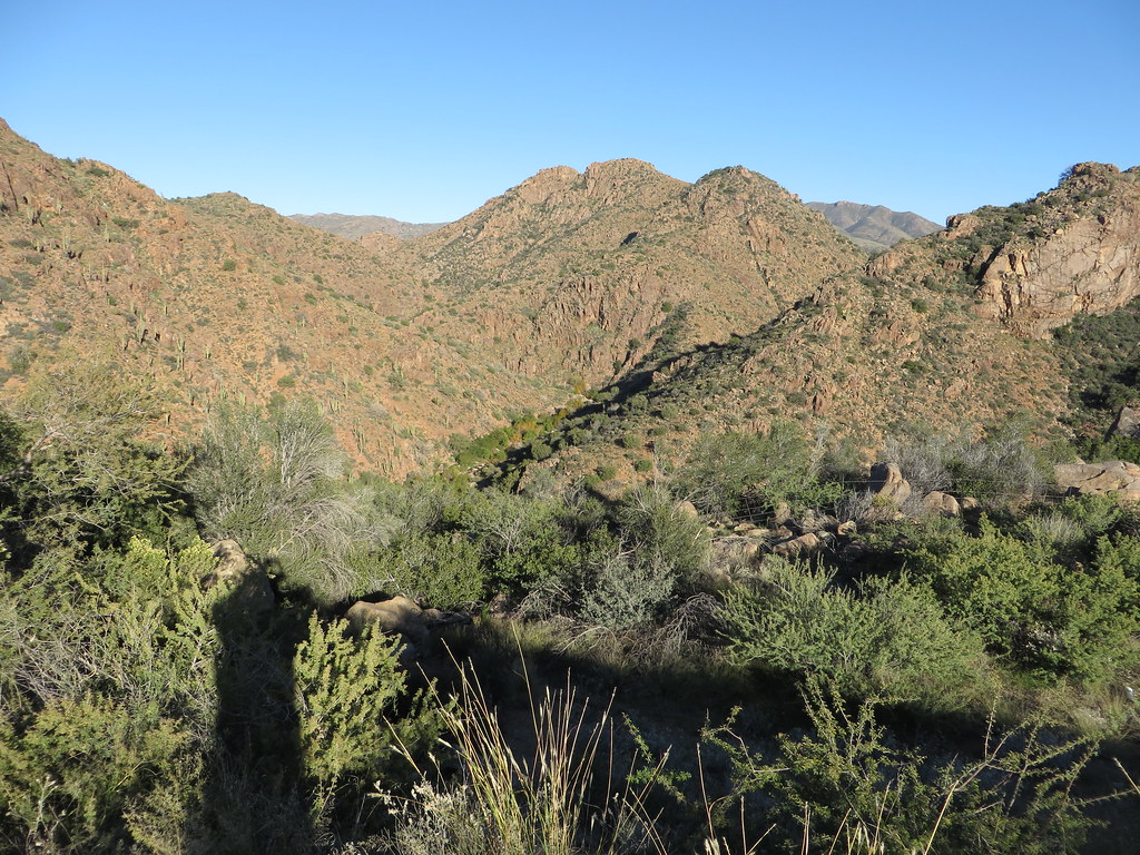
El Oso Rodeo
 Photo: Alan Levine from Mortlach, Canada, CC BY 2.0 (via Wikimedia Commons)
- 7 routes
- 5.7 – 5.11
- Trad · Sport
- Oct–Apr
- best months
Is El Oso Rodeo open right now?
Alert in the area
The Forest Service lists 5 alerts for Tonto National Forest.
Rattlesnake Cove Developed Recreation Site - Post Flood Recovery and Public Safety Closure
Agency alert covering Tonto National Forest · Order 3-12-01-26-36 · USFS · Tonto National Forest
Canyon Lake Drawdown Public Safety Closure
Agency alert covering Tonto National Forest · Order 03-12-00-26-22 · USFS · Tonto National Forest
No Fire Restrictions
Agency alert covering Tonto National Forest · USFS · Tonto National Forest
Lower Salt River Seasonal Bald Eagle Closures
Agency alert covering Mesa Ranger District · Order 03-12-03-24-65 · USFS · Mesa Ranger District
Roosevelt Lake Seasonal Wildlife Closure
Agency alert covering Tonto National Forest · Order 12-16-5 · USFS · Tonto National Forest
As of · Source: USFS · Tonto National Forest. Agencies don't list every closure — check before you go.
El Oso Rodeo is a climbing area in the Mesa Ranger District of Tonto National Forest in Arizona, managed by the Forest Service. It sits among a cluster of climbing and hiking destinations, with Boulder Mountain about 1.3 miles away and The Colony about 2.6 miles off. The climbing here is a mix of trad and sport routes, with seven routes in total. Five are trad and two are sport, and the grades run from 5.7 to 5.11. Among the named routes are No Hay Café y Algodón at 5.7, La Tierra de las Armas y la Metanfetamina at 5.8, and Bored Rotten at 5.11. Spring and fall are the most comfortable times to visit. Typical averages from a nearby weather station show March highs around 73°F and October highs around 85°F, while July averages climb to about 103°F. That station sits roughly 1,500 feet lower than the area, so temperatures at the cliff run cooler.
- Boulder MountainRock climbingPhoto: Alan Levine from Mortlach, Canada, CC BY 2.0 (via Wikimedia Commons)1.3 mi
 BallantineHikingPhoto: cogdogblog, CC BY 2.0 (via Flickr)1.6 mi
- The ColonyRock climbing2.6 mi
- Pine Creek LoopHiking2.6 mi
- Ballantine Connector TrailHiking3.6 mi
 Gun GalleryRock climbingPhoto: Chris English, CC BY-SA 3.0 (via Wikimedia Commons)4.4 mi
 Sycamore WallRock climbingPhoto: Ken Lund, CC BY-SA 2.0 (via Flickr)4.7 mi
- Arizona TrailHiking4.7 mi
Source: Roamze catalog (indexable pages within 10 miles, PostGIS distance)
- Boulder MountainRock climbing · ~2 min drivePhoto: Alan Levine from Mortlach, Canada, CC BY 2.0 (via Wikimedia Commons)
- Gun GalleryRock climbing · ~8 min drivePhoto: Chris English, CC BY-SA 3.0 (via Wikimedia Commons)
- Sycamore WallRock climbing · ~8 min drivePhoto: Ken Lund, CC BY-SA 2.0 (via Flickr)
 Upper CanyonRock climbing · ~26 min drivePhoto: davidpinter, CC BY 3.0 (via Wikimedia Commons)
 River CragRock climbing · ~26 min drivePhoto: davidpinter, CC BY 3.0 (via Wikimedia Commons)
- Lost Whiskey WallRock climbing · ~26 min drivePhoto: davidpinter, CC BY 3.0 (via Wikimedia Commons)
 Sven TowersRock climbing · ~35 min drivePhoto: HTBFTBO, CC BY-SA 4.0 (via Wikimedia Commons)
- Sven Tower 3Rock climbing · ~36 min drivePhoto: HTBFTBO, CC BY-SA 4.0 (via Wikimedia Commons)
- Girlie Man AreaRock climbing · ~36 min drivePhoto: HTBFTBO, CC BY-SA 4.0 (via Wikimedia Commons)
 Knob Hill - EastRock climbing · ~37 min drivePhoto: Carefree Sailor, Public Domain Mark (via Flickr)
Best time to visit El Oso Rodeo
Best months: October–April. Best months have typical highs of 55–85 °F, lows of 30 °F or warmer (32 °F where the station doesn't record snow), at most one snowy day and no more than 12 wet days.
Jan
61° / 32°
4 wet
Feb
66° / 36°
5 wet
Mar
73° / 41°
5 wet
Apr
81° / 47°
2 wet
May
90° / 55°
1 wet
Jun
100° / 63°
1 wet
Jul
103° / 72°
5 wet
Aug
101° / 71°
7 wet
Sep
96° / 64°
4 wet
Oct
85° / 51°
3 wet
Nov
71° / 40°
3 wet
Dec
60° / 32°
4 wet
Typical high / low (°F) and days with rain or snow, 1991–2020. Measured at Punkin Ctr, AZ, 9.9 mi away at 2,325 ft. The station sits about 1,500 ft lower than this place, so expect it a little cooler here. This station doesn't record snowfall. Source: NOAA NCEI U.S. Climate Normals 1991–2020.