Fitch Corral
- 1.0 mi
- distance
- 502 ft
- climb
- Mar–May, Aug–Nov
- best months
Is Fitch Corral open right now?
Alert in the area
The Forest Service lists 3 alerts for Coronado National Forest.
Border Barrier Construction Closure
Agency alert covering Coronado National Forest · Order 03-05-00-26-011 · USFS · Coronado National Forest
No Fire Restrictions
Agency alert covering Coronado National Forest · USFS · Coronado National Forest
Barfoot Snake Closure Order 03-05-01-24-004
Agency alert covering Coronado National Forest · USFS · Coronado National Forest
As of · Source: USFS · Coronado National Forest. Agencies don't list every closure — check before you go.
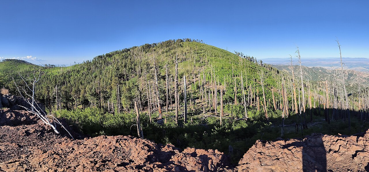
Fitch Corral is a mountain biking route in Arizona's Chiricahua Wilderness, within the Douglas Ranger District of Coronado National Forest. The Forest Service manages the land, and the route lies about a mile from the nearest town, Douglas. The climb is short, with a total length of about a mile and a total elevation gain of 502 feet. The route starts at roughly 6,449 feet and reaches about 6,973 feet. The steepest stretch comes early on, with a grade of about 22 percent at around 0.11 miles in. Spring and fall are the most comfortable times to ride. Typical averages from a nearby weather station in Paradise, Arizona, show October highs around 74°F with lows near 42°F, while June highs reach about 90°F. That station sits well below the route, so temperatures on the trail run cooler. Turkey Pen, a hike, is about 0.9 miles away, and the Rattlesnake mountain biking route is about 1.4 miles off. Pine Canyon Trail #357 and the Rock Creek mountain biking route are both about 1.7 miles away.
- Turkey PenHiking0.9 mi
- RattlesnakeMountain biking1.4 mi
- Pine Canyon Trail #357Hiking1.7 mi
 Rock CreekMountain bikingPhoto: jacobogre, CC BY-SA 4.0 (via Wikimedia Commons)1.7 mi
- SycamoreCamping3.4 mi
- Rustler ParkCamping3.4 mi
- Herb MartyrCamping6.6 mi
- Sunny FlatCamping9.7 mi
Source: Roamze catalog (indexable pages within 10 miles, PostGIS distance)
- Rock CreekMountain biking · ~3 min drivePhoto: jacobogre, CC BY-SA 4.0 (via Wikimedia Commons)
- Hughes TankMountain biking · ~3 min drivePhoto: jacobogre, CC BY-SA 4.0 (via Wikimedia Commons)
- SaulsburyMountain biking · ~4 min drivePhoto: jacobogre, CC BY-SA 4.0 (via Wikimedia Commons)
- Turkey SpurMountain biking · ~5 min drivePhoto: jacobogre, CC BY-SA 4.0 (via Wikimedia Commons)
- RattlesnakeMountain biking · ~2 min drive
- Turkey PenMountain biking · ~3 min drive
- Saulsbury Saddle Trail #263AMountain biking · ~3 min drive
- Witch RidgeMountain biking · ~3 min drive
- Saulsbury Trail #263Mountain biking · ~4 min drive
- BootleggerMountain biking · ~4 min drive
Best time to visit Fitch Corral
Best months: March–May and August–November. Best months have typical highs of 55–85 °F, lows of 30 °F or warmer (32 °F where the station doesn't record snow), at most one snowy day and no more than 12 wet days.
Jan
54° / 24°
Feb
58° / 28°
Mar
65° / 33°
Apr
72° / 39°
May
81° / 46°
Jun
90° / 55°
Jul
87° / 61°
Aug
84° / 58°
Sep
80° / 53°
Oct
74° / 42°
Nov
63° / 32°
Dec
54° / 26°
Typical high / low (°F) and days with rain or snow, 1991–2020. Measured at Paradise, AZ, 7.2 mi away at 5,460 ft. The station sits about 1,500 ft lower than this place, so expect it a little cooler here. This station doesn't record snowfall. Source: NOAA NCEI U.S. Climate Normals 1991–2020.

Map and trail data © OpenStreetMap contributors
