Jbba Trail
- 0.9 mi
- round trip
- 213 ft
- climb
- 6,895 ft
- high point
- Out and back
- route
- May–Oct
- best months
Is Jbba Trail open right now?
Closure in the area
There's a closure order in Kaibab National Forest. It doesn't name Jbba Trail, so check the source for the area it covers (3 listed).
Heavy storm damages received - use extreme caution
Agency closure covering Kaibab National Forest · USFS · Kaibab National Forest
Christmas tree permits available online beginning October 8
Agency closure covering Kaibab National Forest · USFS · Kaibab National Forest
Forest Road 354 on Kaibab & Prescott NF Temporarily Closed for Repairs
Agency closure covering Kaibab National Forest · Order 03-07-26-02 · USFS · Kaibab National Forest
As of · Source: USFS · Kaibab National Forest. Agencies don't list every closure — check before you go.
Jbba Trail is an easy hike in Arizona's Kaibab National Forest, on the Williams Ranger District. It's a short out-and-back of about 1.8 miles, with a high point of 6,895 feet and an elevation gain of 213 feet, so the climb is steady rather than steep. The trail starts and ends at a low point of 6,832 feet, and the steepest stretch comes around 0.67 miles in, with a grade of about 6%. The most comfortable months for a visit are late spring and early fall. Typical averages from a nearby weather station in Williams show May highs around 71°F and October highs around 67°F, while July and August run warmer and wetter, with about 10 to 12 wet days a month. The trip takes about half an hour, and the Forest Service manages the land. Within a few miles you'll find Powerline Trail, Kaibab Lake and the Kaibab Lake Sites and Group Areas, and Keyhole Sink.
Local outfitters
- Village Camp15 mi away
- Four Season Guides25 mi away
Not on Roamze yet. Their page has how to reach them.
- Powerline TrailHiking5.1 mi
- Kaibab Lake Sites And Group AreasPier fishing5.6 mi
- Kaibab LakeCamping5.6 mi
 Keyhole SinkHikingPhoto: Kaibab National Forest Photography — CC BY 2.0 (via Flickr)5.6 mi
- Spring Valley Connector AHiking6.5 mi
- Beale Wagon Road Historic Trail #61Hiking6.6 mi
- Spring Valley Cabin & BunkhouseCamping6.9 mi
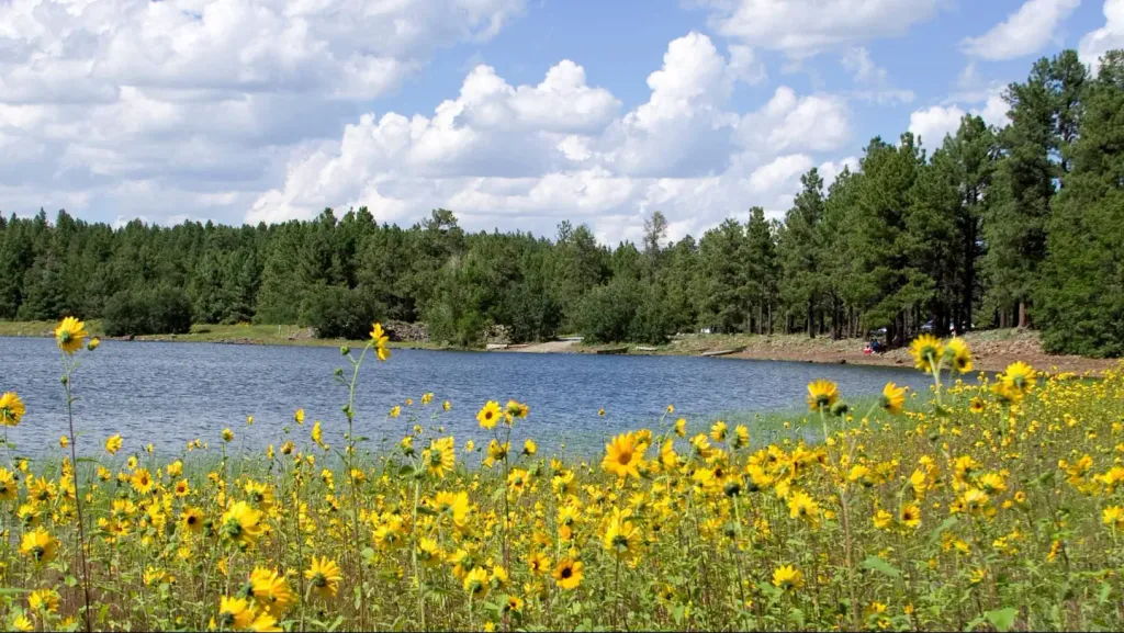 Dogtown Lake Campground and GroupCampingPhoto: Recreation.gov (RIDB) / public domain8.3 mi
Source: Roamze catalog (indexable pages within 10 miles, PostGIS distance)
- Keyhole SinkHiking · ~10 min drivePhoto: Kaibab National Forest Photography — CC BY 2.0 (via Flickr)
 Davenport HillHiking · ~14 min drivePhoto: Kaibab National Forest Photography, CC BY 2.0 (via Flickr)
 Spring Mountain TrailHiking · ~29 min drivePhoto: Coconino NF Photography, Public Domain Mark (via Flickr)
- Pumpkin Trail #39Hiking · ~21 min drive
 Route 66 HikingHiking · ~15 min drivePhoto: inkknife_2000 (7.5 million views +), CC BY-SA 2.0 (via Wikimedia Commons)
 Little L.O. #6Hiking · ~33 min drivePhoto: deborah.soltesz, Public Domain Dedication (CC0) (via Flickr)
 Sycamore RimHiking · ~23 min drivePhoto: Kaibab National Forest, CC BY-SA 2.0 (via Wikimedia Commons)
- Kendrick Mountain TrailHiking · ~21 min drive
- Dogtown LakeHiking · ~15 min drivePhoto: Kaibab National Forest Photography, CC BY 2.0 (via Flickr)
- Kelsey Spring #3Hiking · ~33 min drivePhoto: deborah.soltesz, Public Domain Dedication (CC0) (via Flickr)
Best time to visit Jbba Trail
Best months: May–October. Best months have typical highs of 55–85 °F, lows of 30 °F or warmer (32 °F where the station doesn't record snow), at most one snowy day and no more than 12 wet days.
Jan
47° / 21°
6 wet · 4 snow
Feb
49° / 23°
6 wet · 4 snow
Mar
56° / 27°
6 wet · 3 snow
Apr
62° / 31°
4 wet · 2 snow
May
71° / 39°
4 wet
Jun
82° / 48°
4 wet
Jul
84° / 54°
10 wet
Aug
82° / 52°
12 wet
Sep
76° / 47°
7 wet
Oct
67° / 36°
4 wet
Nov
56° / 28°
4 wet · 2 snow
Dec
47° / 21°
6 wet · 3 snow
Typical high / low (°F) and days with rain or snow, 1991–2020. Measured at Williams, AZ, 8.8 mi away at 6,909 ft. Source: NOAA NCEI U.S. Climate Normals 1991–2020.
Map and trail data © OpenStreetMap contributors
