Hummingbird Spring Trail
- 5.9 mi
- round trip
- 1,754 ft
- climb
- 6,503 ft
- high point
- Out and back
- route
- Mar–May, Sep–Nov
- best months
Is Hummingbird Spring Trail open right now?
Alert in the area
The Forest Service lists 3 alerts for Coronado National Forest.
Border Barrier Construction Closure
Agency alert covering Coronado National Forest · Order 03-05-00-26-011 · USFS · Coronado National Forest
No Fire Restrictions
Agency alert covering Coronado National Forest · USFS · Coronado National Forest
Barfoot Snake Closure Order 03-05-01-24-004
Agency alert covering Coronado National Forest · USFS · Coronado National Forest
As of · Source: USFS · Coronado National Forest. Agencies don't list every closure — check before you go.
Hummingbird Spring Trail is a 5.9-mile out-and-back hike in the Douglas Ranger District of Coronado National Forest in Arizona, about 0.7 miles from the town of Portal. The Forest Service manages the land, and the trail is rated easy. The route rises from about 4,700 feet to about 6,500 feet, with a total elevation gain of 1,754 feet. Bikes are not allowed. Spring and fall are the most comfortable times to go. Typical averages from a nearby weather station in Portal show April highs around 73°F and October highs around 75°F, while July and August bring the most wet days, about 12 and 13 a month. McCord Trail and Portal Trail are both within about 1.5 miles, and Cathedral Rock Trail is about 1.6 miles away. For an overnight stay, Portal CCC House is about 1.9 miles off.
 McCord TrailHikingPhoto: Georgia Harper, CC BY 2.0 (via Wikimedia Commons)1.4 mi
- Portal TrailHikingPhoto: Georgia Harper, CC BY 2.0 (via Wikimedia Commons)1.5 mi
- Cathedral Rock TrailHikingPhoto: Georgia Harper, CC BY 2.0 (via Wikimedia Commons)1.6 mi
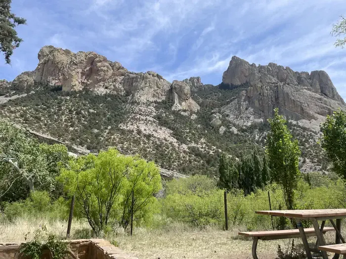 Portal CCC HouseCampingPhoto: Recreation.gov (RIDB) / public domain1.9 mi
- IdlewildeCamping2 mi
- Portal BunkhouseCamping2 mi
- StewartCamping2.5 mi
- Sunny FlatHiking3.1 mi
Source: Roamze catalog (indexable pages within 10 miles, PostGIS distance)
- Portal TrailHiking · ~3 min drivePhoto: Georgia Harper, CC BY 2.0 (via Wikimedia Commons)
- Cathedral Rock TrailHiking · ~3 min drivePhoto: Georgia Harper, CC BY 2.0 (via Wikimedia Commons)
- McCord TrailHiking · ~2 min drivePhoto: Georgia Harper, CC BY 2.0 (via Wikimedia Commons)
 Pothole Canyon TrailHiking · ~14 min drivePhoto: cogdogblog, CC BY 2.0 (via Flickr)
- Snowshed Basin TrailHiking · ~12 min drive
- South Fork Trail #243Hiking · ~7 min drive
 Barfoot Lookout TrailHiking · ~15 min drivePhoto: treegrow, CC BY 2.0 (via Flickr)
- Jhus Horse Saddle Trail #252Hiking · ~15 min drive
- BasinHiking · ~11 min drive
 Long Park Trail #42DHiking · ~16 min drivePhoto: Jon Roanhaus, CC BY-SA 4.0 (via Wikimedia Commons)
Best time to visit Hummingbird Spring Trail
Best months: March–May and September–November. Best months have typical highs of 55–85 °F, lows of 30 °F or warmer (32 °F where the station doesn't record snow), at most one snowy day and no more than 12 wet days.
Jan
56° / 25°
5 wet · 1 snow
Feb
60° / 28°
4 wet
Mar
66° / 32°
4 wet
Apr
73° / 37°
2 wet
May
81° / 43°
2 wet
Jun
89° / 52°
5 wet
Jul
88° / 58°
12 wet
Aug
85° / 57°
13 wet
Sep
81° / 51°
8 wet
Oct
75° / 41°
4 wet
Nov
64° / 32°
4 wet
Dec
55° / 26°
5 wet · 1 snow
Typical high / low (°F) and days with rain or snow, 1991–2020. Measured at Portal 4 Sw, AZ, 4.8 mi away at 5,390 ft. The station sits about 1,100 ft lower than this place, so expect it a little cooler here. Source: NOAA NCEI U.S. Climate Normals 1991–2020.
Map and trail data © OpenStreetMap contributors
