Cape Final
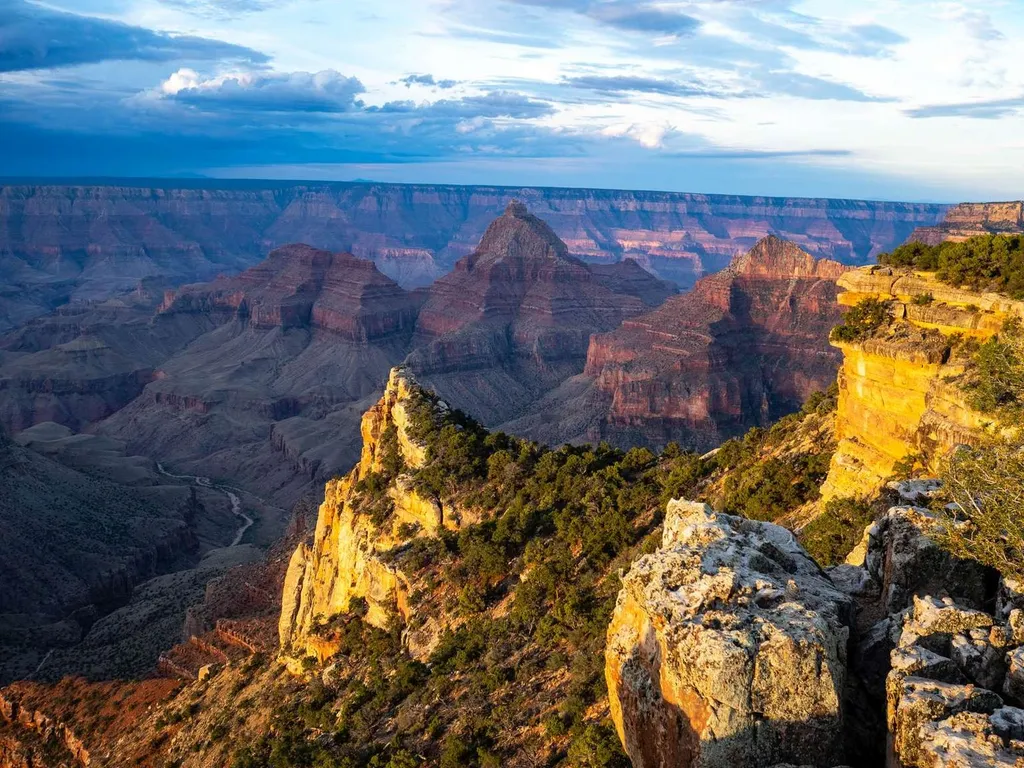 Photo: NPS / public domain
- May–Oct
- best months
Is Cape Final open right now?
Closure in the area
There's a closure order in Grand Canyon National Park. It doesn't name Cape Final, so check the source for the area it covers.
INNER CANYON TRAIL CLOSURES
Park closure covering Grand Canyon National Park · NPS · Grand Canyon National Park
Overnight Lodging Suspended and Parkwide Stage 4 Water Restrictions
Park alert covering Grand Canyon National Park · NPS · Grand Canyon National Park
INNER CANYON WATER SHUTOFFS
Park alert covering Grand Canyon National Park · NPS · Grand Canyon National Park
Critical Backcountry Updates/Closures
Park alert covering Grand Canyon National Park · NPS · Grand Canyon National Park
As of · Source: NPS · Grand Canyon National Park. Agencies don't list every closure — check before you go.
On May 15, the North Rim reopened for the season. Visitors should plan ahead and be prepared for a more remote experience this year, with limited services available as the park continues recovery and restoration work. The 2026 season will focus mainly on day use and limited backcountry access, with some scenic drives, viewpoints, and trails open to visitors. Please keep in mind that potable water will not be available on the North Rim, so be sure to bring plenty of water and food for your visit. North Rim - Current Status and Closures Cape Final Overlook Open during the 2026 season, Cape Final is reached by driving Cape Royal Road, parking, then hiking the Cape Final Trail. Note: Post-fire hazards and weather events may result in a temporary closure of this location. Named by geologist Clarence Dutton in 1880, this scenic viewpoint rewards hikers for their 4.2 miles (6.8 km) round-trip hike on the Cape Final Trail. The viewpoint overlooks the eastern Grand Canyon with expansive views of Jupiter, Venus, and Apollo Temples. Far below, the Colorado River winds through the canyon within a vast panorama extending toward the Painted Desert. Looking southwest, visitors can also spot Fraya Castle and Vishnu Temple. According to Dutton, "Point Final is doubtless the most interesting spot on the Kaibab." Backcountry camping is available at Cape Final, but you must first obtain a permit in advance from the North Rim Backcountry Office. There are a few primitive campsites near the viewpoint, offering a rare opportunity to camp with a canyon view. NOTE: RVs over 22 feet long, and vehicle-trailer combinations with a total length over 22 feet, are not permitted on Cape Royal Road and the Scenic Drive due to narrow, windy roads with blind corners.
Local outfitters
- Buck Wild Hummer Tours17 mi away
- Wander Camp29 mi away
Not on Roamze yet. Their page has how to reach them.
Best time to go · May–Oct
Best time to visit Cape Final
Best months: May–October. Best months have typical highs of 55–85 °F, lows of 30 °F or warmer (32 °F where the station doesn't record snow), at most one snowy day and no more than 12 wet days.
Jan
36° / 18°
7 wet
Feb
37° / 19°
7 wet
Mar
44° / 23°
6 wet
Apr
52° / 28°
4 wet
May
62° / 36°
4 wet
Jun
73° / 43°
3 wet
Jul
77° / 49°
8 wet
Aug
74° / 48°
11 wet
Sep
67° / 42°
7 wet
Oct
56° / 33°
5 wet
Nov
45° / 24°
5 wet
Dec
36° / 17°
6 wet
Typical high / low (°F) and days with rain or snow, 1991–2020. Measured at Bright Angel Rs, AZ, 10 mi away at 8,000 ft. This station doesn't record snowfall. Source: NOAA NCEI U.S. Climate Normals 1991–2020.
Keep exploring — more trails worth the drive
HIKE
Cape Final Trail
~3 min drive
On May 15, the North Rim reopened for the season. Visitors should plan ahead and be prepared for a more remote experience this year, with limited services available as the park continues recovery and restoration work. The 2026 season will focus mainly on day use and limited b…
 Photo: mtnscll, CC BY-SA 2.0 (via Flickr)
Cape Royal Trail
~5 min drive
0.79-mile out-and-back trail in Arizona with 4 ft of elevation gain.
 Photo: RuggyBearLA, CC BY 2.0 (via Flickr)
Walhalla Glades Trail
~11 min drive
14.51-mile out-and-back hike in Arizona with 1,103 ft gain.
Photo: RuggyBearLA, CC BY 2.0 (via Flickr)Francois Matthes Trail
~11 min drive
10.66-mile out-and-back hike in Arizona with 235 ft gain and 779 ft loss.
 Photo: Robert Anders, CC BY 2.0 (via Flickr)
Old Bright Angel Trail
~13 min drive
10.08-mile out-and-back hike on the historic Bright Angel Trail in Arizona's Grand Canyon, gaining 3,970 feet.
 Photo: GSEC, CC BY 2.0 (via Flickr)
Walhalla Glades Pueblo
~3 min drive
On May 15, the North Rim reopened for the season. Visitors should plan ahead and be prepared for a more remote experience this year, with limited services available as the park continues recovery and restoration work. The 2026 season will focus mainly on day use and limited b…
 Photo: Grand Canyon National Park, CC BY 2.0 (via Wikimedia Commons)
Walhalla Spur Trail
~6 min drive
5.40-mile out-and-back trail in Arizona with 210 ft elevation gain.
 Photo: Don Graham from Redlands, CA, USA - God bless it!, CC BY-SA 2.0 (via Wikimedia Commons)
Escalante Route
~12 min drive
22.79-mile out-and-back trail in Arizona with 1,187 ft elevation gain.
 Photo: RuggyBearLA, CC BY 2.0 (via Flickr)
Komo Point Trail
~13 min drive
9.95-mile out-and-back hike in Arizona with 193 ft gain and 657 ft loss.
 Photo: niklas.tenhaef1, CC BY 2.0 (via Flickr)
Grandview Trail
~14 min drive
8.58-mile out-and-back hike in Arizona with 2,875 ft of elevation gain.

