Walhalla Glades Pueblo
 Photo: GSEC, CC BY 2.0 (via Flickr)
- May–Oct
- best months
Is Walhalla Glades Pueblo open right now?
Closure in the area
There's a closure order in Grand Canyon National Park. It doesn't name Walhalla Glades Pueblo, so check the source for the area it covers.
INNER CANYON TRAIL CLOSURES
Park closure covering Grand Canyon National Park · NPS · Grand Canyon National Park
Overnight Lodging Suspended and Parkwide Stage 4 Water Restrictions
Park alert covering Grand Canyon National Park · NPS · Grand Canyon National Park
INNER CANYON WATER SHUTOFFS
Park alert covering Grand Canyon National Park · NPS · Grand Canyon National Park
Critical Backcountry Updates/Closures
Park alert covering Grand Canyon National Park · NPS · Grand Canyon National Park
As of · Source: NPS · Grand Canyon National Park. Agencies don't list every closure — check before you go.
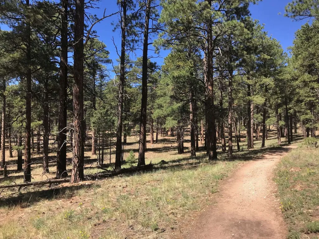
On May 15, the North Rim reopened for the season. Visitors should plan ahead and be prepared for a more remote experience this year, with limited services available as the park continues recovery and restoration work. The 2026 season will focus mainly on day use and limited backcountry access, with some scenic drives, viewpoints, and trails open to visitors. Please keep in mind that potable water will not be available on the North Rim, so be sure to bring plenty of water and food for your visit. North Rim - Current Status and Closures Walhalla Glades Pueblo is open during the 2026 season Note: Post-fire hazards and weather events may result in a temporary closure of this location. Click and save me before you visit: Walhalla Glades Pueblo Walking Tour Guide History Located along Cape Royal Road, this Ancestral site is hidden among the ponderosa pines of the Walhalla Plateau. The site preserves the remains of a small masonry pueblo built around 900 years ago. Archeological sites like this one are sacred to the region's tribes today, and require respect and care when visiting them. Walhalla Glades Pueblo is reached by a short self-guided trail near the Walhalla Overlook area on Cape Royal Road. Today, visitors can see the outlines of several stone rooms with low walls within a forest clearing. Though only the foundations remain, the layout gives a sense of how people once lived on the North Rim centuries before the national park existed. Because archaeological sites are fragile and culturally important, visitors are asked to stay on designated paths and leave artifacts exactly where they are found. Under federal law, removing artifacts or disturbing ruins in national parks is prohibited. One of the most interesting aspects of Walhalla Glades Pueblo is its location. The North Rim’s high elevation and relatively short growing season might seem challenging for farming, but ancestral communities carefully used small meadows, seasonal moisture, and nearby water sources to grow crops like corn, beans, and squash. Limestone in this area is fairly soft (for a rock) and may have been one reason people decided to settle here. Wood, plentiful on the canyon ridges overlooking the canyon, is another. Kettle holes and ponds in the bedrock and nearby landscape may have been a source of water. Seeps and springs, like those found along Cliff Spring Trail (further south on Cape Royal Road), would have been another. Excavated by Douglas W. Schwartz during the 1960's, this archaeological site is a sample of what used to be at least nine rooms, occupied from 1,100 to 1,150 CE.
Local outfitters
- Buck Wild Hummer Tours15 mi away
- Wander Camp28 mi away
Not on Roamze yet. Their page has how to reach them.
 Cliff Spring TrailHikingPhoto: GSEC, CC BY 2.0 (via Flickr)0.8 mi
 Cape Final TrailHikingPhoto: NPS / public domain0.9 mi
 Cape Royal TrailHikingPhoto: mtnscll, CC BY-SA 2.0 (via Flickr)0.9 mi
 Cape FinalHikingPhoto: NPS / public domain1.9 mi
 Grand Canyon National ParkRock climbingPhoto: brewbooks from near Seattle, USA, CC BY-SA 2.0 (via Wikimedia Commons)4.5 mi
- TemplesRock climbing4.9 mi
 UnconventionalsRock climbingPhoto: brewbooks from near Seattle, USA, CC BY-SA 2.0 (via Wikimedia Commons)8.5 mi
- North Rim Campground (AZ)Camping8.5 mi
Source: Roamze catalog (indexable pages within 10 miles, PostGIS distance)
- Cliff Spring TrailHiking · ~1 min drivePhoto: GSEC, CC BY 2.0 (via Flickr)
- Cape Royal TrailHiking · ~2 min drivePhoto: mtnscll, CC BY-SA 2.0 (via Flickr)
 Escalante RouteHiking · ~11 min drivePhoto: Don Graham from Redlands, CA, USA - God bless it!, CC BY-SA 2.0 (via Wikimedia Commons)
 Francois Matthes TrailHiking · ~11 min drivePhoto: RuggyBearLA, CC BY 2.0 (via Flickr)
 Grandview TrailHiking · ~12 min drivePhoto: niklas.tenhaef1, CC BY 2.0 (via Flickr)
- Cape Final TrailHiking · ~1 min drive
 Walhalla Spur TrailHiking · ~5 min drivePhoto: Grand Canyon National Park, CC BY 2.0 (via Wikimedia Commons)
 Crystal Creek RouteHiking · ~11 min drivePhoto: HockeyholicAZ, CC BY 2.0 (via Flickr)
 Komo Point TrailHiking · ~12 min drivePhoto: RuggyBearLA, CC BY 2.0 (via Flickr)
 East TontoHiking · ~14 min drivePhoto: Nate Loper • #ArizonaGuide ️, CC BY 2.0 (via Flickr)
Best time to visit Walhalla Glades Pueblo
Best months: May–October. Best months have typical highs of 55–85 °F, lows of 30 °F or warmer (32 °F where the station doesn't record snow), at most one snowy day and no more than 12 wet days.
Jan
36° / 18°
7 wet
Feb
37° / 19°
7 wet
Mar
44° / 23°
6 wet
Apr
52° / 28°
4 wet
May
62° / 36°
4 wet
Jun
73° / 43°
3 wet
Jul
77° / 49°
8 wet
Aug
74° / 48°
11 wet
Sep
67° / 42°
7 wet
Oct
56° / 33°
5 wet
Nov
45° / 24°
5 wet
Dec
36° / 17°
6 wet
Typical high / low (°F) and days with rain or snow, 1991–2020. Measured at Bright Angel Rs, AZ, 8.8 mi away at 8,000 ft. This station doesn't record snowfall. Source: NOAA NCEI U.S. Climate Normals 1991–2020.
