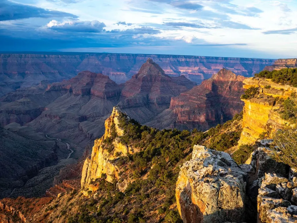
Butchart Butte
 Photo: HarshLight, CC BY 3.0 (via Wikimedia Commons)
- 7,573 ft
- summit
- National Park Service
- managed by
- Apr–Oct
- best months
Is Butchart Butte open right now?
Closure in the area
There's a closure order in Grand Canyon National Park. It doesn't name Butchart Butte, so check the source for the area it covers.
INNER CANYON TRAIL CLOSURES
Park closure covering Grand Canyon National Park · NPS · Grand Canyon National Park
Overnight Lodging Suspended and Parkwide Stage 4 Water Restrictions
Park alert covering Grand Canyon National Park · NPS · Grand Canyon National Park
INNER CANYON WATER SHUTOFFS
Park alert covering Grand Canyon National Park · NPS · Grand Canyon National Park
Critical Backcountry Updates/Closures
Park alert covering Grand Canyon National Park · NPS · Grand Canyon National Park
As of · Source: NPS · Grand Canyon National Park. Agencies don't list every closure — check before you go.
Butchart Butte is a summit of 7,573 feet in Grand Canyon National Park in Arizona, managed by the National Park Service. The nearest town is Grand Canyon Village, about 18 miles away. The most comfortable months for a visit are typically May and September. Typical averages from a nearby weather station show May highs around 67°F and September highs around 75°F, with lows near 42°F and 51°F. Winter is cold, with January highs around 41°F and lows near 24°F. Several trails lie within a few miles. Roosevelt Point Loop is about 3 miles away, and Walhalla Spur Trail and Walhalla Glades Trail are each a little over 3 miles off. North Rim Campground (AZ) is about 9 miles away.
Conditions and forecast
Daily highs and lows, wind and the chance of precipitation at the summit for the next 7 days, from the Open-Meteo model.
- Summit elevation
- 7,573 ft
- Land manager
- National Park Service
Elevation from USGS 3D Elevation Program terrain data (about 10 m resolution).
We don't know of a mapped trail or route to the summit of Butchart Butte. Plan the approach with local maps, a guidebook or a local guide, and check conditions before you go.
Questions about Butchart Butte
How tall is Butchart Butte?
7,573 ft (2,308 m).
Is there a trail to the top of Butchart Butte?
We don't know of a mapped trail or route to the summit. Plan the approach with local maps, a guidebook or a local guide.
- Grandeur Point7,042 ft · Arizona2 routes16 mi away
 Red Butte7,329 ft · Arizona1 route29 mi awayPhoto: Curtis Clark, CC BY-SA 2.5 (via Wikimedia Commons)
- Slate Mountain8,215 ft · Arizona1 route49 mi away
- Buckskin Mountains6,386 ft · Arizona2 routes53 mi away
- Top Rock5,556 ft · Arizona1 route54 mi away
 Kendrick Peak10,417 ft · Arizona2 routes55 mi awayPhoto: Chris Jones, CC BY-SA 2.5 (via Wikimedia Commons)
 Roosevelt Point LoopHikingPhoto: Ken Lund, CC BY-SA 2.0 (via Flickr)3.3 mi
 Walhalla Spur TrailHikingPhoto: Grand Canyon National Park, CC BY 2.0 (via Wikimedia Commons)3.6 mi
 Walhalla Glades TrailHikingPhoto: RuggyBearLA, CC BY 2.0 (via Flickr)4.1 mi
- Francois Matthes TrailHikingPhoto: RuggyBearLA, CC BY 2.0 (via Flickr)4.1 mi
 Cape FinalHikingPhoto: NPS / public domain4.3 mi
 Grand Canyon National ParkRock climbingPhoto: brewbooks from near Seattle, USA, CC BY-SA 2.0 (via Wikimedia Commons)6.7 mi
- North Rim Campground (AZ)Camping9.2 mi
- TemplesRock climbing9.3 mi
Source: Roamze catalog (indexable pages within 10 miles, PostGIS distance)
 Alsap ButteSummit · ~7 min drivePhoto: George Billingsley, U.S. Geological Survey, Public domain (via Wikimedia Commons)
 Brahma TempleSummit · ~16 min drivePhoto: Miguel Hermoso Cuesta, CC BY-SA 3.0 (via Wikimedia Commons)
 Cedar MountainSummit · ~21 min drivePhoto: Regi51, CC BY-SA 3.0 (via Wikimedia Commons)
 Confucius TempleSummit · ~31 min drivePhoto: Eggbones, CC BY-SA 4.0 (via Wikimedia Commons)
 Diana TempleSummit · ~37 min drivePhoto: Grand Canyon National Park, CC BY 2.0 (via Wikimedia Commons)
 Masonic TempleSummit · ~44 min drivePhoto: Eggbones, CC BY-SA 4.0 (via Wikimedia Commons)
 Fan IslandSummit · ~45 min drivePhoto: Eric Hall, CC BY 3.0 (via Wikimedia Commons)
- Red ButteSummit · ~49 min drivePhoto: Curtis Clark, CC BY-SA 2.5 (via Wikimedia Commons)
 Red MountainSummit · ~1h 21m drivePhoto: Brady Smith; Coconino National Forest, CC BY-SA 2.0 (via Wikimedia Commons)
 Marsh ButteSummit · ~35 min drivePhoto: John Hayes, CC BY-SA 2.0 (via Wikimedia Commons)
Best time to visit Butchart Butte
Best months: April–October. Best months have typical highs of 55–85 °F, lows of 30 °F or warmer (32 °F where the station doesn't record snow), at most one snowy day and no more than 12 wet days.
Jan
41° / 24°
Feb
43° / 25°
Mar
51° / 29°
Apr
58° / 35°
May
67° / 42°
Jun
80° / 55°
Jul
84° / 59°
Aug
81° / 57°
Sep
75° / 51°
Oct
63° / 41°
Nov
51° / 30°
Dec
41° / 23°
Typical high / low (°F) and days with rain or snow, 1991–2020. Measured at Grand Canyon E Entrance, AZ, 12.2 mi away at 7,480 ft. This station doesn't record snowfall. Source: NOAA NCEI U.S. Climate Normals 1991–2020.
