Red Mountain
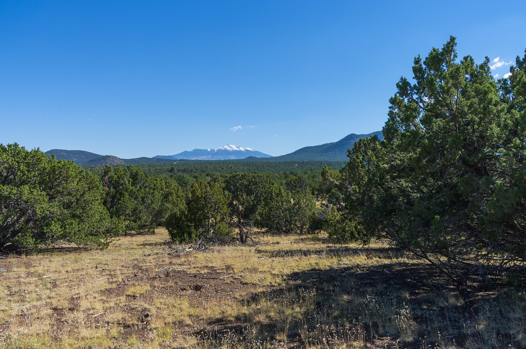
 Photo: Brady Smith; Coconino National Forest, CC BY-SA 2.0 (via Wikimedia Commons)
At a glance
Red Mountain is a summit of 7,967 feet in the Flagstaff Ranger District of Coconino National Forest in northern Arizona, about 16 miles from the community of Fort Valley. The Forest Service manages the land. Late spring and early fall tend to be the most comfortable times to go. Typical averages from a nearby weather station in Fort Valley show May highs around 71°F and September highs around 76°F, with lows near freezing in winter. That station sits a few hundred feet lower than the summit, so temperatures on top run a little cooler. Red Mountain Trail #159 lies about 1.4 miles away and is the closest route. Slate Mountain Trail #128 is about 3.4 miles off, and the Arizona Trail passes within about 6 miles. Kendrick Mountain Trail is roughly 9.4 miles away.
- summit
- 7,967 ft
- managed by
- Forest Service
- best months
- May–Jul, Sep
Where it is: Flagstaff Ranger District · Coconino National Forest
Near: Flagstaff
Best time to visit Red Mountain
Best months: May–July and September. Best months have typical highs of 55–85 °F, lows of 30 °F or warmer (32 °F where the station doesn't record snow), at most one snowy day and no more than 12 wet days.
Jan
46°
17°
8 wet
Feb
48°
20°
8 wet
Mar
54°
24°
7 wet
Apr
62°
27°
5 wet
May
71°
33°
4 wet
Jun
82°
40°
3 wet
Jul
84°
49°
11 wet
Aug
81°
49°
13 wet
Sep
76°
41°
8 wet
Oct
66°
30°
5 wet
Nov
55°
23°
5 wet
Dec
46°
16°
7 wet
Typical high / low (°F) and days with rain or snow, 1991–2020. Measured at Ft Valley, AZ, 19.1 mi away at 7,347 ft. The station sits about 600 ft lower than this place, so expect it a little cooler here. This station doesn't record snowfall. Source: NOAA NCEI U.S. Climate Normals 1991–2020.
Been here? Tell people how it was.
We don't know of a mapped trail or route to the summit of Red Mountain. Plan the approach with local maps, a guidebook or a local guide, and check conditions before you go.
- Slate Mountain8,215 ft · Arizona1 route2.7 mi away
 Kendrick Peak10,417 ft · Arizona2 routes8.0 mi awayPhoto: Chris Jones, CC BY-SA 2.5 (via Wikimedia Commons)
 Humphreys Peak12,632 ft · Arizona2 routes17 mi awayPhoto: Bob Blasi; Coconino National Forest, CC BY-SA 2.0 (via Wikimedia Commons)
 O'Leary Peak8,918 ft · Arizona1 route21 mi awayPhoto: Jstuby at English Wikipedia, Public domain (via Wikimedia Commons)
- Dry Lake Hills8,829 ft · Arizona1 route23 mi away
- Little Elden Mountain9,001 ft · Arizona1 route23 mi away
 Red Mountain Trail #159HikingPhoto: Coconino NF Photography, Public Domain Dedication (CC0) (via Flickr)1.4 mi
 Slate Mountain Trail #128HikingPhoto: Coconino NF Photography, Public Domain Dedication (CC0) (via Flickr)3.4 mi
- Arizona TrailHiking5.9 mi
- Bull Basin Trail #40Hiking6 mi
- Connector Trail #80Hiking6.6 mi
- Pumpkin Trail #39Hiking7 mi
- Kendrick Mountain TrailHiking9.4 mi
- Kendrick PeakSummitPhoto: Chris Jones, CC BY-SA 2.5 (via Wikimedia Commons)~14 min drive
 Agassiz PeakSummitPhoto: Flegar, CC BY-SA 3.0 (via Wikimedia Commons)~30 min drive
 Fremont PeakSummitPhoto: Alan English CPA from Scottsdale, Arizona 85254, USA, CC BY-SA 2.0 (via Wikimedia Commons)~31 min drive
- Doyle PeakSummitPhoto: Alan English CPA from Scottsdale, Arizona 85254, USA, CC BY-SA 2.0 (via Wikimedia Commons)~32 min drive
- O'Leary PeakSummitPhoto: Jstuby at English Wikipedia, Public domain (via Wikimedia Commons)~37 min drive
 Red ButteSummitPhoto: Curtis Clark, CC BY-SA 2.5 (via Wikimedia Commons)~41 min drive
 Cinder HillsSummitPhoto: Clyde Charles Brown, CC BY-SA 4.0 (via Wikimedia Commons)~46 min drive
 Cedar MountainSummitPhoto: Regi51, CC BY-SA 3.0 (via Wikimedia Commons)~1h 3m drive
 Wilson MountainSummitPhoto: Deborah Lee Soltesz, CC0 (via Wikimedia Commons)~1h 13m drive
 Brahma TempleSummitPhoto: Miguel Hermoso Cuesta, CC BY-SA 3.0 (via Wikimedia Commons)~1h 13m drive
Conditions and forecast
Daily highs and lows, wind and the chance of precipitation at the summit for the next 7 days, from the Open-Meteo model.
Questions about Red Mountain
How tall is Red Mountain?
7,967 ft (2,428 m).
Is there a trail to the top of Red Mountain?
We don't know of a mapped trail or route to the summit. Plan the approach with local maps, a guidebook or a local guide.
Ask about this place
Questions about Red Mountain: conditions, access, timing. Answers say when something isn't known.
