Red Butte
 Photo: Curtis Clark, CC BY-SA 2.5 (via Wikimedia Commons)
- 7,329 ft
- summit
- 1
- way up
- Forest Service
- managed by
- May–Sep
- best months
Is Red Butte open right now?
Closure in the area
There's a closure order in Kaibab National Forest. It doesn't name Red Butte, so check the source for the area it covers (3 listed).
Heavy storm damages received - use extreme caution
Agency closure covering Kaibab National Forest · USFS · Kaibab National Forest
Christmas tree permits available online beginning October 8
Agency closure covering Kaibab National Forest · USFS · Kaibab National Forest
Forest Road 354 on Kaibab & Prescott NF Temporarily Closed for Repairs
Agency closure covering Kaibab National Forest · Order 03-07-26-02 · USFS · Kaibab National Forest
As of · Source: USFS · Kaibab National Forest. Agencies don't list every closure — check before you go.
Red Butte is a summit of 7,329 feet in the Tusayan Ranger District of Kaibab National Forest in northern Arizona, about 9.5 miles from the town of Tusayan. The Forest Service manages the surrounding land, and the Red Butte Trail #37 starts just 0.1 mile away, making it the natural way to approach the peak. Spring and fall are the most comfortable times to visit. Typical averages from a nearby weather station at Grand Canyon National Park show May highs around 71°F and October highs around 66°F, while July and August bring highs near 85°F and the most wet days of the year. Other places within a short drive include Tusayan - Montane campground and the Ten-X Nature Trail, both about 8.3 miles away, and Trail 6 Ylw, roughly 6.5 miles off.
Conditions and forecast
Daily highs and lows, wind and the chance of precipitation at the summit and route start for the next 7 days, from the Open-Meteo model.
- Summit elevation
- 7,329 ft
- Land manager
- Forest Service
Elevation from USGS 3D Elevation Program terrain data (about 10 m resolution).
Map © Mapbox © OpenStreetMap contributors Questions about Red Butte
How tall is Red Butte?
7,329 ft (2,234 m).
How many routes go to the summit of Red Butte?
One: Red Butte Trail #37.
Where do the routes up Red Butte start?
Red Butte Trail #37 starts at RED BUTTE TRAILHEAD (about 7,329 ft).
- Grandeur Point7,042 ft · Arizona2 routes17 mi away
- Slate Mountain8,215 ft · Arizona1 route26 mi away
 Kendrick Peak10,417 ft · Arizona2 routes31 mi awayPhoto: Chris Jones, CC BY-SA 2.5 (via Wikimedia Commons)
 Humphreys Peak12,632 ft · Arizona2 routes40 mi awayPhoto: Bob Blasi; Coconino National Forest, CC BY-SA 2.0 (via Wikimedia Commons)
- Davenport Hill7,794 ft · Arizona1 route41 mi away
 O'Leary Peak8,918 ft · Arizona1 route43 mi awayPhoto: Jstuby at English Wikipedia, Public domain (via Wikimedia Commons)
 Red Butte Trail #37HikingPhoto: Matt Lavin, CC BY-SA 2.0 (via Flickr)0.1 mi
 Trail 6 YlwHikingPhoto: Kaibab National Forest, CC BY-SA 2.0 (via Wikimedia Commons)6.5 mi
- Tusayan - MontaneCamping8.3 mi
- Ten-X Nature TrailHiking8.3 mi
Source: Roamze catalog (indexable pages within 10 miles, PostGIS distance)
 Brahma TempleSummit · ~37 min drivePhoto: Miguel Hermoso Cuesta, CC BY-SA 3.0 (via Wikimedia Commons)
 Diana TempleSummit · ~39 min drivePhoto: Grand Canyon National Park, CC BY 2.0 (via Wikimedia Commons)
 Red MountainSummit · ~41 min drivePhoto: Brady Smith; Coconino National Forest, CC BY-SA 2.0 (via Wikimedia Commons)
 Cedar MountainSummit · ~41 min drivePhoto: Regi51, CC BY-SA 3.0 (via Wikimedia Commons)
 Confucius TempleSummit · ~44 min drivePhoto: Eggbones, CC BY-SA 4.0 (via Wikimedia Commons)
 Butchart ButteSummit · ~49 min drivePhoto: HarshLight, CC BY 3.0 (via Wikimedia Commons)
 Alsap ButteSummit · ~53 min drivePhoto: George Billingsley, U.S. Geological Survey, Public domain (via Wikimedia Commons)
- Kendrick PeakSummit · ~54 min drivePhoto: Chris Jones, CC BY-SA 2.5 (via Wikimedia Commons)
 Fan IslandSummit · ~58 min drivePhoto: Eric Hall, CC BY 3.0 (via Wikimedia Commons)
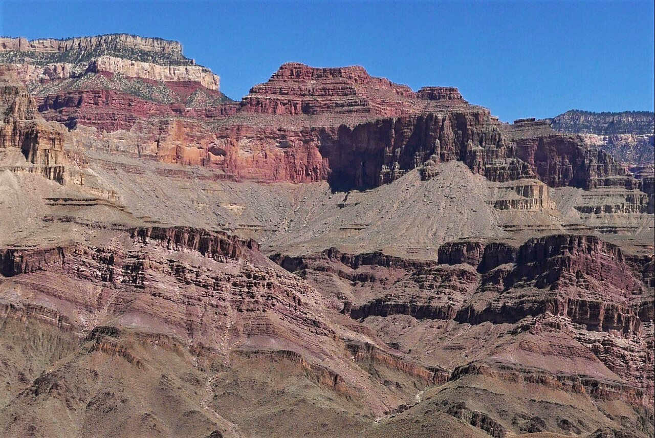 Masonic TempleSummit · ~59 min drivePhoto: Eggbones, CC BY-SA 4.0 (via Wikimedia Commons)
Best time to visit Red Butte
Best months: May–September. Best months have typical highs of 55–85 °F, lows of 30 °F or warmer (32 °F where the station doesn't record snow), at most one snowy day and no more than 12 wet days.
Jan
44° / 16°
6 wet
Feb
47° / 17°
6 wet
Mar
55° / 22°
6 wet
Apr
61° / 25°
5 wet
May
71° / 32°
4 wet
Jun
83° / 38°
3 wet
Jul
85° / 49°
10 wet
Aug
83° / 49°
11 wet
Sep
77° / 40°
7 wet
Oct
66° / 30°
4 wet
Nov
54° / 21°
4 wet
Dec
44° / 14°
6 wet
Typical high / low (°F) and days with rain or snow, 1991–2020. Measured at Grand Canyon Np Ap, AZ, 9.4 mi away at 6,606 ft. The station sits about 700 ft lower than this place, so expect it a little cooler here. This station doesn't record snowfall. Source: NOAA NCEI U.S. Climate Normals 1991–2020.
