Gros Ventre Campground
Campground
Campground · 1.9 mi from the trail
 Photo: Wade Bartlett, CC BY 3.0 (via Wikimedia Commons)
Alert in the area
The National Park Service lists 2 alerts for Grand Teton National Park.
Construction in the South End of the Park
Park alert covering Grand Teton National Park · NPS · Grand Teton National Park
Construction on HWY 26/89/191
Park alert covering Grand Teton National Park · NPS · Grand Teton National Park
As of · Source: NPS · Grand Teton National Park. Agencies don't list every closure — check before you go.
Blacktail Butte is a summit of 7,688 feet in Grand Teton National Park in Wyoming, managed by the National Park Service. The nearest town is Kelly, about 3 miles away. Summer is the most comfortable time to visit. Typical averages from a nearby weather station in Moose show July highs around 82°F with lows near 44°F, and the butte sits higher than that station, so temperatures on top run cooler. Several other destinations sit within a couple of miles. Albright View Turnout is about a mile away, and the Upper Blacktail Butte climbing area is about 1.3 miles off. Lower Blacktail Butte is about 1.8 miles away. For an overnight stay, Curtis Canyon Campground is about 8.5 miles away.
Gros Ventre Campground
Campground
Places © OpenStreetMap contributors
More in JacksonDaily highs and lows, wind and the chance of precipitation at the summit for the next 7 days, from the Open-Meteo model.
Elevation from USGS 3D Elevation Program terrain data (about 10 m resolution).
We don't know of a mapped trail or route to the summit of Blacktail Butte. Plan the approach with local maps, a guidebook or a local guide, and check conditions before you go.
7,688 ft (2,343 m).
We don't know of a mapped trail or route to the summit. Plan the approach with local maps, a guidebook or a local guide.


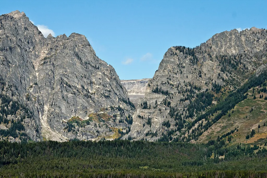 Albright View TurnoutHikingPhoto: Acroterion — Wikimedia Commons (CC BY-SA 4.0)1.2 mi
 Moose Jct to Antelope Flats RdHikingPhoto: InSapphoWeTrust from Los Angeles, California, USA, CC BY-SA 2.0 (via Wikimedia Commons)1.3 mi
 Upper Blacktail ButteRock climbingPhoto: jtstewart, CC BY-SA 2.0 (via Flickr)1.3 miTeton Park RdHikingPhoto: InSapphoWeTrust from Los Angeles, California, USA, CC BY-SA 2.0 (via Wikimedia Commons)1.5 mi
Source: Roamze catalog (indexable pages within 10 miles, PostGIS distance)
 Static PeakSummit · ~12 min drivePhoto: Acroterion, CC BY-SA 4.0 (via Wikimedia Commons)
 Buck MountainSummit · ~13 min drivePhoto: Acroterion, CC BY-SA 4.0 (via Wikimedia Commons)Shadow MountainSummit · ~13 min drivePhoto: LikeGrantTookRichmond, CC BY-SA 3.0 (via Wikimedia Commons)
 Mount WisterSummit · ~13 min drivePhoto: Acroterion, CC BY-SA 4.0 (via Wikimedia Commons)
 Nez PerceSummit · ~13 min drivePhoto: Acroterion, CC BY-SA 4.0 (via Wikimedia Commons)
 Prospectors MountainSummit · ~14 min drivePhoto: Ron Clausen, CC BY-SA 4.0 (via Wikimedia Commons)
 Disappointment PeakSummit · ~14 min drivePhoto: Acroterion, CC BY-SA 4.0 (via Wikimedia Commons)
 Mount HuntSummit · ~14 min drivePhoto: Acroterion, CC BY-SA 4.0 (via Wikimedia Commons)
 South TetonSummit · ~15 min drivePhoto: Acroterion, CC BY-SA 4.0 (via Wikimedia Commons)
 Middle TetonSummit · ~15 min drivePhoto: Acroterion, CC BY-SA 4.0 (via Wikimedia Commons)
Also worth it near here
Moose Jct to Antelope Flats RdHiking · ~2 min drivePhoto: InSapphoWeTrust from Los Angeles, California, USA, CC BY-SA 2.0 (via Wikimedia Commons)Upper Blacktail ButteRock climbing · ~2 min drivePhoto: jtstewart, CC BY-SA 2.0 (via Flickr)Best months: May–September. Best months have typical highs of 55–85 °F, lows of 30 °F or warmer (32 °F where the station doesn't record snow), at most one snowy day and no more than 12 wet days.
Jan
27° / 1°
16 wet
Feb
32° / 6°
14 wet
Mar
42° / 15°
12 wet
Apr
50° / 24°
10 wet
May
62° / 33°
12 wet
Jun
71° / 39°
11 wet
Jul
82° / 44°
9 wet
Aug
81° / 42°
9 wet
Sep
71° / 34°
9 wet
Oct
56° / 25°
9 wet
Nov
39° / 15°
11 wet
Dec
28° / 4°
16 wet
Typical high / low (°F) and days with rain or snow, 1991–2020. Measured at Moose, WY, 1.8 mi away at 6,444 ft. The station sits about 1,200 ft lower than this place, so expect it a little cooler here. This station doesn't record snowfall. Source: NOAA NCEI U.S. Climate Normals 1991–2020.
