Gros Ventre Campground
Campground
Campground · 2.8 mi from the trail
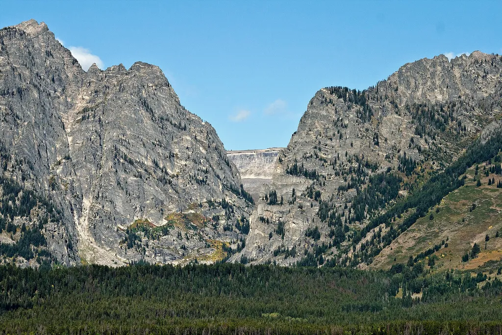 Photo: Acroterion — Wikimedia Commons (CC BY-SA 4.0)
Closure in the area
There's a closure order in Grand Teton National Park. It doesn't name Albright View Turnout, so check the source for the area it covers.
Death Canyon Trailhead Construction Closure
Park closure covering Grand Teton National Park · NPS · Grand Teton National Park
Construction in the South End of the Park
Park alert covering Grand Teton National Park · NPS · Grand Teton National Park
Construction on HWY 26/89/191
Park alert covering Grand Teton National Park · NPS · Grand Teton National Park
As of · Source: NPS · Grand Teton National Park. Agencies don't list every closure — check before you go.
Albright View Turnout is a National Park Service turnout in Grand Teton National Park in Wyoming, about 1.3 miles from the Moose Jct to Antelope Flats Rd and Teton Park Rd routes. The surrounding area includes the Murie Homestead Cabin, also about 1.3 miles away. Summer is the most comfortable time to visit. Typical July averages from the nearby Moose weather station run to a high of 82°F and a low of 44°F, while winter highs there sit near 27°F in January. The turnout is a simple stop rather than a long hike, and it lies along the road network that serves several other destinations in the park. For more to do in the area, Upper Blacktail Butte is about 1.8 miles away, and Lower Blacktail Butte is about 2.2 miles away. Curtis Canyon Campground and Atherton Creek Campground, both roughly 9.8 miles off, offer places to stay.
Gros Ventre Campground
Campground
Places © OpenStreetMap contributors
More in JacksonNot on Roamze yet. Their page has how to reach them.
Best months: May–September. Best months have typical highs of 55–85 °F, lows of 30 °F or warmer (32 °F where the station doesn't record snow), at most one snowy day and no more than 12 wet days.
Jan
27° / 1°
16 wet
Feb
32° / 6°
14 wet
Mar
42° / 15°
12 wet
Apr
50° / 24°
10 wet
May
62° / 33°
12 wet
Jun
71° / 39°
11 wet
Jul
82° / 44°
9 wet
Aug
81° / 42°
9 wet
Sep
71° / 34°
9 wet
Oct
56° / 25°
9 wet
Nov
39° / 15°
11 wet
Dec
28° / 4°
16 wet
Typical high / low (°F) and days with rain or snow, 1991–2020. Measured at Moose, WY, 1.4 mi away at 6,444 ft. This station doesn't record snowfall. Source: NOAA NCEI U.S. Climate Normals 1991–2020.
HIKE
Murie Homestead Cabin
~2 min drive
 Photo: InSapphoWeTrust from Los Angeles, California, USA, CC BY-SA 2.0 (via Wikimedia Commons)
Moose Jct to Antelope Flats Rd
~2 min drive
Easy out-and-back walk from Moose Jct to Antelope Flats Rd in Wyoming.
Photo: InSapphoWeTrust from Los Angeles, California, USA, CC BY-SA 2.0 (via Wikimedia Commons)Teton Park Rd
~2 min drive
Moderate out-and-back hike along Teton Park Rd with mountain views.
HIKE
Sleeping Indian Turnout
~2 min drive
Sleeping Indian turnout along US Highway 89/26/191 gives you sweeping views of both the Teton and Gros Ventre Range. The Gros Ventre Mountains—impressive in their own right—surround the southeast portion of the valley. One peak in the range stands out prominently. Nicknamed…
Photo: InSapphoWeTrust from Los Angeles, California, USA, CC BY-SA 2.0 (via Wikimedia Commons)Murie Ranch Trail
~2 min drive
Easy out-and-back trail near historic Murie Ranch in Jackson Hole.
 Photo: inkknife_2000 (7.5 million views +), CC BY-SA 2.0 (via Wikimedia Commons)
Blacktail Butte Trail
~4 min drive
Short out-and-back hike to butte summit with expansive views.
 Photo: Jrozwado, CC BY-SA 4.0 (via Wikimedia Commons)
Transportation Barn
~3 min drive
The Transportation Barn houses a collection of wagons and coaches representing frontier transportation. The settlement of Jackson Hole was accomplished before paved highways and modern vehicles. Covered wagons brought families full of hope to a new home in Jackson Hole.…
HIKE
Old Ranch Trail
~4 min drive
Easy 1.19-mile out-and-back trail near historic ranch lands in Wyoming.
HIKE
Death Canyon Trailhead
~6 min drive
Location: Access the Death Canyon trailhead from the Moose-Wilson Road. Travel three miles south from Moose and turn north on a spur road. The last mile leading to the trailhead is a narrow, rough dirt road recommended for high-clearance vehicles. Notes: Facilities include a…
Photo: Jrozwado, CC BY-SA 4.0 (via Wikimedia Commons)Menors Ferry - East Side
~3 min drive
West of Dornans, Holiday Menor homesteaded along the east bank of the Snake River in 1908. He moved here to join his brother Bill who homesteaded across the river and operated a ferry and general store. Under the shed next to the river is one of the pontoons from the…


