The Gallatin Range
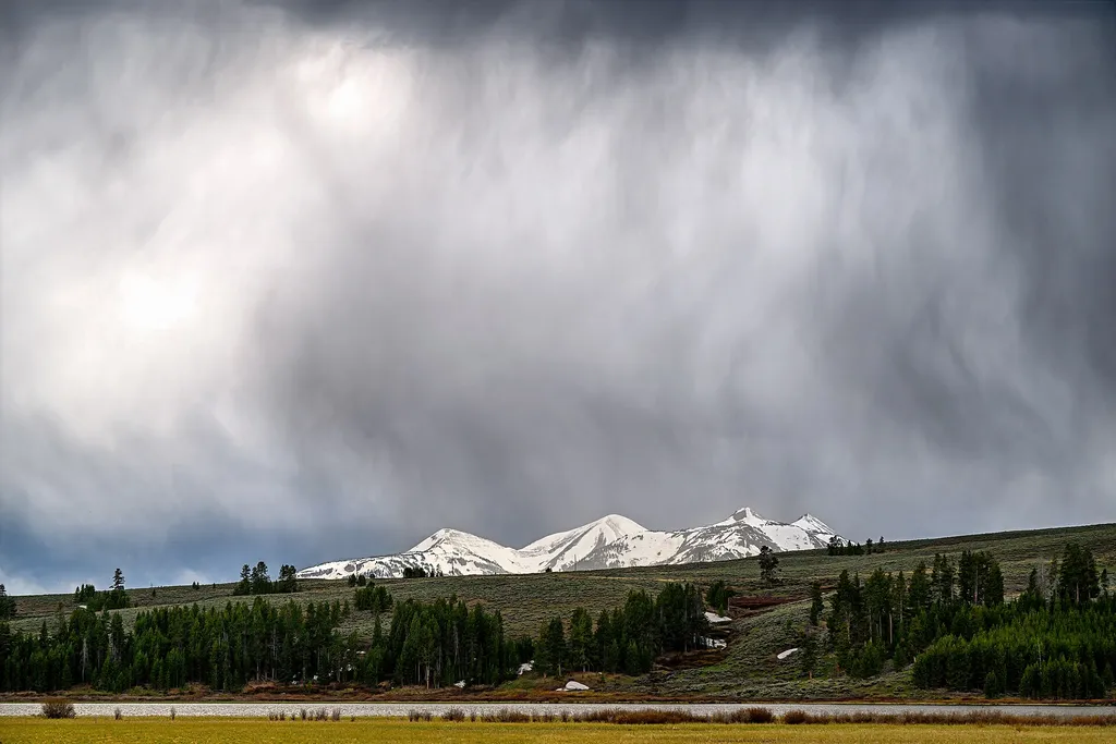 Photo: Eric Kilby — Wikimedia Commons (CC BY-SA 2.0)
- Jul–Sep
- best months
Clear at last check
Weather is good · OpenWeather · checked 15 h ago
Is The Gallatin Range open right now?
Closure in the area
There's a closure order in Yellowstone National Park. It doesn't name The Gallatin Range, so check the source for the area it covers (2 listed).
Most Park Roads Closed to All Vehicles
Park closure covering Yellowstone National Park · NPS · Yellowstone National Park
Biscuit Basin Closed Due to Hydrothermal Explosion
Park closure covering Yellowstone National Park · NPS · Yellowstone National Park
As of · Source: NPS · Yellowstone National Park. Agencies don't list every closure — check before you go.
The Gallatin Range is a hiking destination in Wyoming's Yellowstone National Park, managed by the National Park Service. It sits within the park's boundaries, and a fee is charged for visits. Summer is the most comfortable time to go. Typical averages from a nearby weather station at Mammoth show July highs around 81°F with lows near 48°F, and snow is common from November through April. That station sits about 1,100 feet lower than the range, so temperatures up high run cooler. The Bunsen Peak Trail and its trailhead, Bunsen Peak Trailhead (1K4), are both about 0.8 miles away. Golden Gate is about 1.1 miles off, and the Gardner River, a paddling route, is about 1.7 miles away.
Best time to go · Jul–Sep
Best time to visit The Gallatin Range
Best months: July–September. Best months have typical highs of 55–85 °F, lows of 30 °F or warmer (32 °F where the station doesn't record snow), at most one snowy day and no more than 12 wet days.
Jan
31° / 12°
11 wet · 9 snow
Feb
34° / 12°
11 wet · 9 snow
Mar
42° / 19°
11 wet · 7 snow
Apr
50° / 26°
11 wet · 5 snow
May
60° / 35°
13 wet · 2 snow
Jun
69° / 42°
13 wet
Jul
81° / 48°
10 wet
Aug
80° / 47°
9 wet
Sep
69° / 39°
9 wet · 1 snow
Oct
54° / 29°
9 wet · 3 snow
Nov
39° / 19°
10 wet · 7 snow
Dec
30° / 12°
12 wet · 10 snow
Typical high / low (°F) and days with rain or snow, 1991–2020. Measured at Yellowstone Park Mammoth, WY, 4.3 mi away at 6,195 ft. The station sits about 1,100 ft lower than this place, so expect it a little cooler here. Source: NOAA NCEI U.S. Climate Normals 1991–2020.
Keep exploring — more trails worth the drive
 Photo: cchadek, CC BY 3.0 (via Wikimedia Commons)
Bunsen Peak Trail
~1 min drive
8.42-mile out-and-back trail to Bunsen Peak in Wyoming with 502 ft gain.
HIKE
Golden Gate
~2 min drive
The development of a road system was essential in making Yellowstone more accessible to the public. Engineer Hiram Chittenden replaced many wooden bridges with steel or concrete throughout the park. His most difficult project was the replacement of the rickety trestle at…
 Photo: cchadek, CC BY 3.0 (via Wikimedia Commons)
Clagett Butte Trail
~5 min drive
Short out-and-back climb to Clagett Butte with expansive views.
Photo: cchadek, CC BY 3.0 (via Wikimedia Commons)Sportsman Lake Trail
~5 min drive
Challenging 17.57-mile out-and-back hike to a scenic alpine lake in Wyoming.
 Photo: R. Sieben, CC BY 3.0 (via Wikimedia Commons)
Lava Creek Trail
~9 min drive
Accessible out-and-back hike through Wyoming's volcanic landscape and thermal features.
HIKE
Bunsen Peak Trailhead (1K4)
~1 min drive
Bunsen Peak prominently sits south of Mammoth Hot Springs. From this trailhead, you can embark on the following trails: Bunsen Peak Trail Bunsen Peak Road Trail Osprey Falls Trail Parking is limited. Winter trailhead access requires a snow coach drop-off, or skiing up from…
HIKE
Sheepeater Cliff
~3 min drive
Sheepeater Cliff is made up of columnar basalt deposited by lava flows roughly 500,000 years ago. The Gardner River flows through the valley, exposing the flow and forming the cliff. The basalt of Sheepeater Cliff are known as columnar basalt due to the hexagonal fracture…
Photo: cchadek, CC BY 3.0 (via Wikimedia Commons)Snow Pass Trail
~5 min drive
Short out-and-back climb to a scenic alpine pass in Wyoming.
HIKE
Bighorn Pass Trail
~5 min drive
Challenging 19.35-mile out-and-back to an alpine pass in the Bighorn Mountains.
HIKE
Howard Eaton Trail: Mammoth-Golden Gate
~5 min drive
Out-and-back thermal features trail from Mammoth to Golden Gate in Yellowstone.
Also worth it near here
SEE
Swan Lake
Next door
 Photo: James St. John, CC BY 2.0 (via Wikimedia Commons)
Rustic Falls
~2 min drive
 Photo: Mike, Public domain (via Wikimedia Commons)
Bunsen Peak
~3 min drive
 Photo: Jo Suderman, Public domain (via Wikimedia Commons)
Gardner River
~3 min drive
 Photo: Ken Lund, CC BY-SA 2.0 (via Flickr)
The Hoodoos
~3 min drive
