Golden Gate
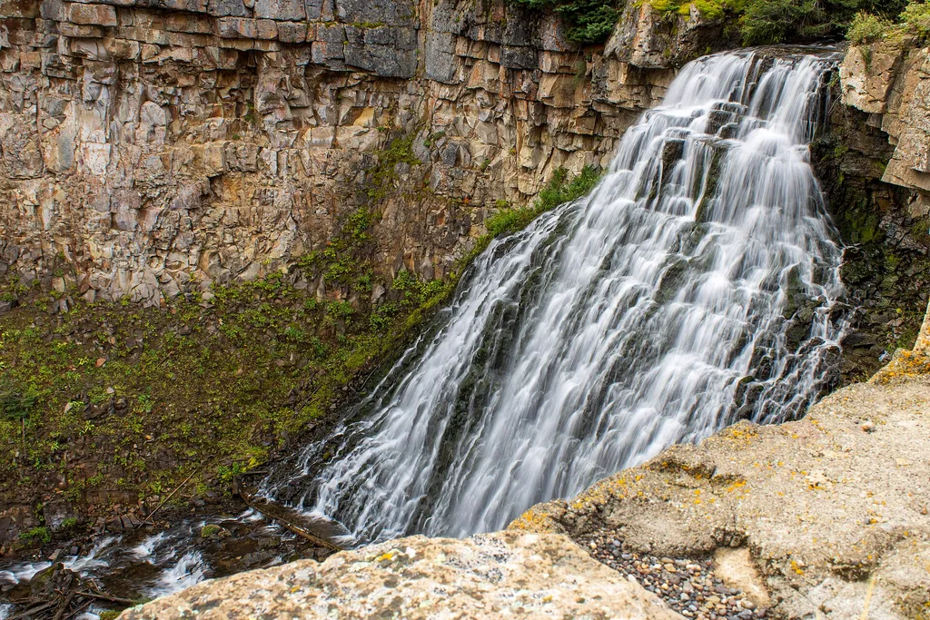 Photo: USGS Communications and Publishing — Wikimedia Commons (Public domain)
- Jul–Sep
- best months
Is Golden Gate open right now?
Closure in the area
There's a closure order in Yellowstone National Park. It doesn't name Golden Gate, so check the source for the area it covers (2 listed).
Most Park Roads Closed to All Vehicles
Park closure covering Yellowstone National Park · NPS · Yellowstone National Park
Biscuit Basin Closed Due to Hydrothermal Explosion
Park closure covering Yellowstone National Park · NPS · Yellowstone National Park
As of · Source: NPS · Yellowstone National Park. Agencies don't list every closure — check before you go.
The development of a road system was essential in making Yellowstone more accessible to the public. Engineer Hiram Chittenden replaced many wooden bridges with steel or concrete throughout the park. His most difficult project was the replacement of the rickety trestle at Golden Gate with a 200-foot viaduct and a series of 11 concrete arches built into the cliff wall over a canyon. Over the years the Golden Gate viaduct had to be reconstructed, and the bridge over the Yellowstone River was condemned in 1959. A campaign to preserve the original bridge by building the new Chittenden Memorial Bridge in a different place was thwarted by the discovery that Chittenden had used the only logical location. Expect Travel Hazards and Delays Stay behind rock walls. Drive cautiously and defensively. Allow time for road congestion. Do not stop on or block a road. Use pullouts; stay in your car to watch animals. Think Safety, Act Safely Yellowstone is a Dangerous Place
Best time to go · Jul–Sep
Best time to visit Golden Gate
Best months: July–September. Best months have typical highs of 55–85 °F, lows of 30 °F or warmer (32 °F where the station doesn't record snow), at most one snowy day and no more than 12 wet days.
Jan
31° / 12°
11 wet · 9 snow
Feb
34° / 12°
11 wet · 9 snow
Mar
42° / 19°
11 wet · 7 snow
Apr
50° / 26°
11 wet · 5 snow
May
60° / 35°
13 wet · 2 snow
Jun
69° / 42°
13 wet
Jul
81° / 48°
10 wet
Aug
80° / 47°
9 wet
Sep
69° / 39°
9 wet · 1 snow
Oct
54° / 29°
9 wet · 3 snow
Nov
39° / 19°
10 wet · 7 snow
Dec
30° / 12°
12 wet · 10 snow
Typical high / low (°F) and days with rain or snow, 1991–2020. Measured at Yellowstone Park Mammoth, WY, 3.2 mi away at 6,195 ft. The station sits about 1,000 ft lower than this place, so expect it a little cooler here. Source: NOAA NCEI U.S. Climate Normals 1991–2020.
Keep exploring — more trails worth the drive
HIKE
Bunsen Peak Trailhead (1K4)
Next door
Bunsen Peak prominently sits south of Mammoth Hot Springs. From this trailhead, you can embark on the following trails: Bunsen Peak Trail Bunsen Peak Road Trail Osprey Falls Trail Parking is limited. Winter trailhead access requires a snow coach drop-off, or skiing up from…
HIKE
The Gallatin Range
~2 min drive
This view from this relatively flat meadow known as Swan Lake Flat gives a commanding view of Swan Lake and the Gallatin Range to the west. The peaks visible from this location while looking to the west are (from south to north): Trilobite Point (10,010 feet / 3,051 m) Mount…
HIKE
Snow Pass Trailhead (1K2)
~3 min drive
This trailhead is nestled into the forests south of the Upper Terraces of Mammoth Hot Springs. This trailhead provides access to: Snow Pass Trail Parking is available at a nearby pullout. Snow Pass Trail A moderate 2.4-mile (3.8 km) there-and back trail that climbs to the…
 Photo: cchadek, CC BY 3.0 (via Wikimedia Commons)
Sportsman Lake Trail
~4 min drive
Challenging 17.57-mile out-and-back hike to a scenic alpine lake in Wyoming.
 Photo: R. Sieben, CC BY 3.0 (via Wikimedia Commons)
Lava Creek Trail
~8 min drive
Accessible out-and-back hike through Wyoming's volcanic landscape and thermal features.
 Photo: cchadek, CC BY 3.0 (via Wikimedia Commons)
Bunsen Peak Trail
Next door
8.42-mile out-and-back trail to Bunsen Peak in Wyoming with 502 ft gain.
HIKE
White Elephant Back Terrace
~4 min drive
A fissure right through this part of the Upper Terrace of Mammoth Hot Springs allows hot water saturated with calcium carbonate to reach the surface. The calcium carbonate precipitates out of the water to form a terrace along the entire length of the fissure.
Photo: cchadek, CC BY 3.0 (via Wikimedia Commons)Clagett Butte Trail
~3 min drive
Short out-and-back climb to Clagett Butte with expansive views.
HIKE
Bighorn Pass Trail
~7 min drive
Challenging 19.35-mile out-and-back to an alpine pass in the Bighorn Mountains.
 Photo: cchadek, CC BY 3.0 (via Wikimedia Commons)
Blacktail Deer Creek Trail
~11 min drive
Easy out-and-back creek hike through Wyoming's scenic drainage.
Also worth it near here
 Photo: James St. John, CC BY 2.0 (via Wikimedia Commons)
Rustic Falls
Next door
 Photo: Ken Lund, CC BY-SA 2.0 (via Flickr)
The Hoodoos
~1 min drive
 Photo: Mike, Public domain (via Wikimedia Commons)
Bunsen Peak
~2 min drive
SEE
Swan Lake
~2 min drive
 Photo: Jo Suderman, Public domain (via Wikimedia Commons)
Gardner River
~3 min drive
