Gros Ventre Campground
Campground
Campground · 3.5 mi from the trail
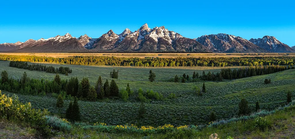
 Photo: inkknife_2000 (7.5 million views +), CC BY-SA 2.0 (via Wikimedia Commons)
Alert in the area
The National Park Service lists 2 alerts for Grand Teton National Park.
Construction in the South End of the Park
Park alert covering Grand Teton National Park · NPS · Grand Teton National Park
Construction on HWY 26/89/191
Park alert covering Grand Teton National Park · NPS · Grand Teton National Park
As of · Source: NPS · Grand Teton National Park. Agencies don't list every closure — check before you go.
Blacktail Butte Trail is a 2.8-mile moderate hike in Grand Teton National Park in Wyoming, about a mile from the town of Moose. The trail is an out-and-back that climbs to a high point of 7,451 feet, with a total elevation gain of 1,409 feet over the round trip. The route is front-loaded, with the steepest stretch at about 0.6 miles from the trailhead, where the grade reaches 29 percent. Summer is the most comfortable time to go. Typical averages from a nearby weather station in Moose show July highs around 79°F and lows near 43°F, with August the driest month at about eight wet days. That station sits roughly 1,000 feet below the trail, so temperatures on the butte run cooler. The trailhead is named Blacktail Butte Trailhead, and the hike takes about 2.5 hours. Horses are allowed, so the route works for riders as well as hikers. The trail starts close to several other destinations. Ditch Creek Pathway Access and the Lower Blacktail Butte and Blacktail Butte climbing areas are all about 0.1 mile away. Dornans is about 0.7 mile off.
Gros Ventre Campground
Campground
Places © OpenStreetMap contributors
More in JacksonNot on Roamze yet. Their page has how to reach them.
 Ditch Creek Pathway AccessHikingPhoto: Sheila Sund from Salem, United States — Wikimedia Commons (CC BY 2.0)0.1 mi
 Upper Blacktail ButteRock climbingPhoto: jtstewart, CC BY-SA 2.0 (via Flickr)0.5 mi
Source: Roamze catalog (indexable pages within 10 miles, PostGIS distance)
 Menors Ferry - East SideHiking · ~1 min drivePhoto: Jrozwado, CC BY-SA 4.0 (via Wikimedia Commons)
 Moose Jct to Antelope Flats RdHiking · ~1 min drivePhoto: InSapphoWeTrust from Los Angeles, California, USA, CC BY-SA 2.0 (via Wikimedia Commons)Teton Park RdHiking · ~2 min drivePhoto: InSapphoWeTrust from Los Angeles, California, USA, CC BY-SA 2.0 (via Wikimedia Commons)
 SmokehouseHiking · ~1 min drivePhoto: Magicpiano, CC BY-SA 4.0 (via Wikimedia Commons)Murie Ranch TrailHiking · ~2 min drivePhoto: InSapphoWeTrust from Los Angeles, California, USA, CC BY-SA 2.0 (via Wikimedia Commons)OuthouseHiking · ~1 min drivePhoto: Magicpiano, CC BY-SA 4.0 (via Wikimedia Commons)Chapel of the TransfigurationHiking · ~2 min drivePhoto: Jrozwado, CC BY-SA 4.0 (via Wikimedia Commons)
Best months: June–September. Best months have typical highs of 55–85 °F, lows of 30 °F or warmer (32 °F where the station doesn't record snow), at most one snowy day and no more than 12 wet days.
Jan
24° / 2°
17 wet
Feb
28° / 7°
16 wet
Mar
38° / 15°
15 wet
Apr
47° / 24°
14 wet
May
60° / 32°
14 wet
Jun
69° / 37°
11 wet
Jul
79° / 43°
10 wet
Aug
78° / 41°
8 wet
Sep
68° / 35°
9 wet
Oct
53° / 25°
11 wet
Nov
36° / 15°
13 wet
Dec
25° / 3°
17 wet
Typical high / low (°F) and days with rain or snow, 1991–2020. Measured at Moose 1 Nne, WY, 0.7 mi away at 6,466 ft. The station sits about 1,000 ft lower than this place, so expect it a little cooler here. This station doesn't record snowfall. Source: NOAA NCEI U.S. Climate Normals 1991–2020.

