Gros Ventre Campground
Campground
Campground · 3.5 mi from the trail
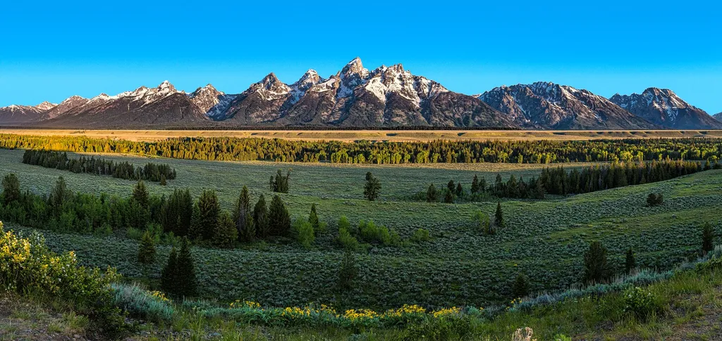 Photo: Sheila Sund from Salem, United States — Wikimedia Commons (CC BY 2.0)
Closure in the area
There's a closure order in Grand Teton National Park. It doesn't name Ditch Creek Pathway Access, so check the source for the area it covers.
Death Canyon Trailhead Construction Closure
Park closure covering Grand Teton National Park · NPS · Grand Teton National Park
Construction in the South End of the Park
Park alert covering Grand Teton National Park · NPS · Grand Teton National Park
Construction on HWY 26/89/191
Park alert covering Grand Teton National Park · NPS · Grand Teton National Park
As of · Source: NPS · Grand Teton National Park. Agencies don't list every closure — check before you go.
The pathway section from Moose Junction to the Antelope Flats Road is the most recent addition to the multi-use pathway system. This section allows bicyclists to complete a loop on the secondary roads from Antelope Flats to Kelly and return to Gros Ventre Junction without riding on the main highway. There is parking available at the small lot on the north end Blacktail Butte just south of Antelope Flats Road. ADA compliant. Regulations Do not access the pathway from dusk to dawn for your safety and wildlife's safety. Please do not walk your dog on the pathway. Guide dogs-used for the sole purpose of aiding a person with a physical disability-may travel on the pathway. Electric bicycles (e-bikes) are premitted if they have fully operable pedals and an electric motor of less than 750 watts (1hp). Persons with physical disabilities may use other forms of electric and battery operated transportation. The multi-use pathway is closed from dusk to dawn for wildlife and public safety. Name Origin Named for the ditches dug by prospectors looking for gold in the 1860s and 1870s.
Gros Ventre Campground
Campground
Places © OpenStreetMap contributors
More in JacksonNot on Roamze yet. Their page has how to reach them.
Best months: June–September. Best months have typical highs of 55–85 °F, lows of 30 °F or warmer (32 °F where the station doesn't record snow), at most one snowy day and no more than 12 wet days.
Jan
24° / 2°
17 wet
Feb
28° / 7°
16 wet
Mar
38° / 15°
15 wet
Apr
47° / 24°
14 wet
May
60° / 32°
14 wet
Jun
69° / 37°
11 wet
Jul
79° / 43°
10 wet
Aug
78° / 41°
8 wet
Sep
68° / 35°
9 wet
Oct
53° / 25°
11 wet
Nov
36° / 15°
13 wet
Dec
25° / 3°
17 wet
Typical high / low (°F) and days with rain or snow, 1991–2020. Measured at Moose 1 Nne, WY, 0.7 mi away at 6,466 ft. This station doesn't record snowfall. Source: NOAA NCEI U.S. Climate Normals 1991–2020.
 Photo: inkknife_2000 (7.5 million views +), CC BY-SA 2.0 (via Wikimedia Commons)
Blacktail Butte Trail
Next door
Short out-and-back hike to butte summit with expansive views.
HIKE
Blacktail Butte Trailhead
Next door
Location: Access the Blacktail Butte Trailhead from US 26/89/191. The parking lot is one mile north of Moose Junction on the east side of the highway. Notes: There are no facilities at this trailhead-remember to bring water and use a restroom before you arrive. Bears may be…
 Photo: InSapphoWeTrust from Los Angeles, California, USA, CC BY-SA 2.0 (via Wikimedia Commons)
Moose Jct to Antelope Flats Rd
~1 min drive
Easy out-and-back walk from Moose Jct to Antelope Flats Rd in Wyoming.
Photo: InSapphoWeTrust from Los Angeles, California, USA, CC BY-SA 2.0 (via Wikimedia Commons)Teton Park Rd
~2 min drive
Moderate out-and-back hike along Teton Park Rd with mountain views.
 Photo: Jrozwado, CC BY-SA 4.0 (via Wikimedia Commons)
Menors Ferry - East Side
~1 min drive
West of Dornans, Holiday Menor homesteaded along the east bank of the Snake River in 1908. He moved here to join his brother Bill who homesteaded across the river and operated a ferry and general store. Under the shed next to the river is one of the pontoons from the…
Photo: InSapphoWeTrust from Los Angeles, California, USA, CC BY-SA 2.0 (via Wikimedia Commons)Murie Ranch Trail
~2 min drive
Easy out-and-back trail near historic Murie Ranch in Jackson Hole.
HIKE
Taggart Lake Trail
~5 min drive
7.26-mile out-and-back hike in Wyoming with 231 ft gain.
 Photo: Magicpiano, CC BY-SA 4.0 (via Wikimedia Commons)
Smokehouse
~1 min drive
The Smokehouse Trail is located in Wyoming and is managed by the National Park Service. This trail offers hikers an opportunity to explore the natural landscapes within the National Park Service system in the Wyoming area. The trail is maintained by the National Park Service…
HIKE
Taggart Lake Trailhead
~5 min drive
Location: Access the Taggart Lake trailhead from the Teton Park Road three and a half miles northwest from Moose Junction. Notes: Visitor services include a modest-sized parking lot, a vault toilet, map brochure box, bike rack and a trailhead sign. Remember to bring water…
Photo: Magicpiano, CC BY-SA 4.0 (via Wikimedia Commons)Outhouse
~1 min drive
The Outhouse Trail is located in Wyoming and is managed by the National Park Service. This trail offers access to backcountry areas within the park system. The exact distance and elevation gain have not been documented in available records, so hikers should contact the…


