Beckler River Campground
Campground
Campground · 2.0 mi from the trail
 Photo: Danust, CC BY-SA 4.0 (via Wikimedia Commons)
Closure in the area
There's a closure order in Mt. Baker-Snoqualmie National Forest. It doesn't name Beckler Peak, so check the source for the area it covers (2 listed).
Grand Park 2 Fire Closure Update
Agency closure covering Mt. Baker-Snoqualmie National Forest · Order 06-05-26-16 · USFS · Mt. Baker-Snoqualmie National Forest
Bell Creek Bridge Damaged
Agency closure covering Mt. Baker-Snoqualmie National Forest · USFS · Mt. Baker-Snoqualmie National Forest
Rescission of Shooting Restrictions
Agency alert covering Mt. Baker-Snoqualmie National Forest · USFS · Mt. Baker-Snoqualmie National Forest
Electric Fire Closure Order
Agency alert covering Mt. Baker-Snoqualmie National Forest · Order 06-05-26-19 · USFS · Mt. Baker-Snoqualmie National Forest
Mountain Goats Have Been Present on Yellow Aster Butte
Agency alert covering Mt. Baker-Snoqualmie National Forest · USFS · Mt. Baker-Snoqualmie National Forest
As of · Source: USFS · Mt. Baker-Snoqualmie National Forest. Agencies don't list every closure — check before you go.
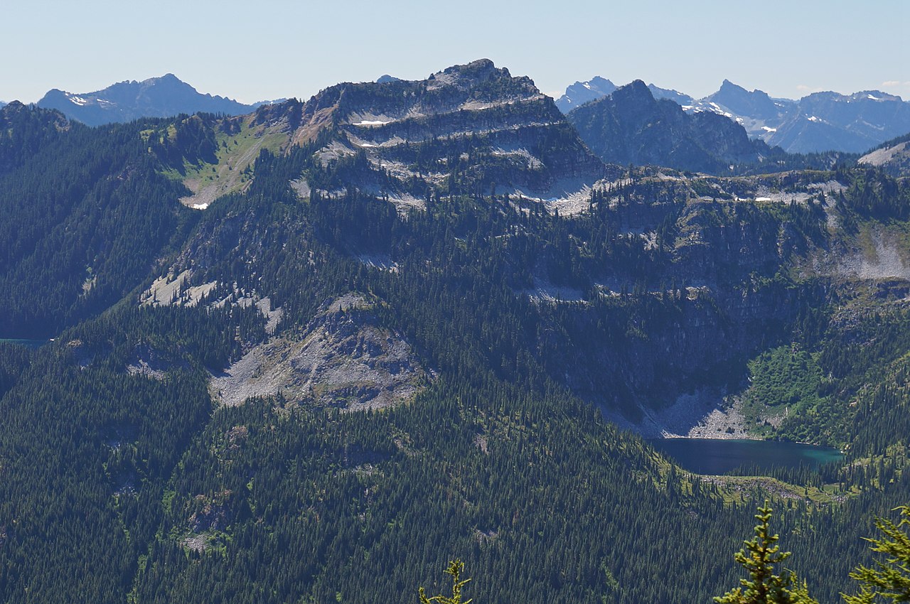
Beckler Peak is a summit of 5,050 feet in Washington's Wild Sky Wilderness, within the Skykomish Ranger District of Mt. Baker-Snoqualmie National Forest. The nearest town is Skykomish, about 3.6 miles away. Summer is the most comfortable time to go. Typical averages from a nearby weather station at Stampede Pass show July and August highs around 68 to 69°F with only seven or eight wet days a month, while winter months bring highs near freezing and rain on about 20 days. The Beckler Peak Trail starts just 0.4 miles from the summit. Beckler River Campground is about 2 miles away, and the Alpine Baldy Trail is about 2.5 miles off. Eagle Creek, a canoeing spot, lies about 4.2 miles away.
Beckler River Campground
Campground
Smokey's Restaurant & Brewery
Restaurant
Skykomish Historical Society
Museum
Places © OpenStreetMap contributors
More in Gold BarDaily highs and lows, wind and the chance of precipitation at the summit for the next 7 days, from the Open-Meteo model.
Elevation from USGS 3D Elevation Program terrain data (about 10 m resolution).
We don't know of a mapped trail or route to the summit of Beckler Peak. Plan the approach with local maps, a guidebook or a local guide, and check conditions before you go.
5,050 ft (1,539 m).
We don't know of a mapped trail or route to the summit. Plan the approach with local maps, a guidebook or a local guide.
 Beckler River CampgroundCampingPhoto: Recreation.gov (RIDB) / public domain2 mi
 Money Creek CampgroundCampingPhoto: Recreation.gov (RIDB) / public domain5.5 mi
Source: Roamze catalog (indexable pages within 10 miles, PostGIS distance)
 Merchant PeakSummit · ~13 min drivePhoto: Peter Stevens, CC BY 2.0 (via Wikimedia Commons)
 Terrace MountainSummit · ~15 min drivePhoto: Martin Bravenboer, CC BY 2.0 (via Wikimedia Commons)
 Gunn PeakSummit · ~16 min drivePhoto: Ron Clausen, CC BY-SA 4.0 (via Wikimedia Commons)
 Thunder MountainSummit · ~16 min drivePhoto: Martin Bravenboer, CC BY 2.0 (via Wikimedia Commons)
 Lichtenberg MountainSummit · ~17 min drivePhoto: Danust, CC BY-SA 4.0 (via Wikimedia Commons)
 Mount HinmanSummit · ~21 min drivePhoto: Ron Clausen, CC BY-SA 4.0 (via Wikimedia Commons)
 Philadelphia MountainSummit · ~21 min drivePhoto: Another Believer, CC BY-SA 4.0 (via Wikimedia Commons)
 Jim Hill MountainSummit · ~22 min drivePhoto: Martin Bravenboer, CC BY 3.0 (via Wikimedia Commons)
 Mount IndexSummit · ~24 min drivePhoto: Steven Pavlov, CC BY-SA 4.0 (via Wikimedia Commons)
 Bears Breast MountainSummit · ~24 min drivePhoto: Allison Wildman, CC BY 2.0 (via Wikimedia Commons)
Also worth it near here
 Deception Falls TrailHiking · ~8 min drivePhoto: pfly from Pugetopolis, CC BY-SA 2.0 (via Wikimedia Commons)
 Deception FallsWaterfall · ~8 min drivePhoto: Jonathan Miske from United States, CC BY-SA 2.0 (via Wikimedia Commons)
Best months: July–September. Best months have typical highs of 55–85 °F, lows of 30 °F or warmer (32 °F where the station doesn't record snow), at most one snowy day and no more than 12 wet days.
Jan
32° / 25°
20 wet
Feb
35° / 26°
17 wet
Mar
40° / 29°
20 wet
Apr
46° / 33°
19 wet
May
53° / 38°
17 wet
Jun
60° / 43°
14 wet
Jul
68° / 50°
8 wet
Aug
69° / 51°
7 wet
Sep
63° / 47°
10 wet
Oct
49° / 38°
16 wet
Nov
38° / 30°
19 wet
Dec
32° / 24°
20 wet
Typical high / low (°F) and days with rain or snow, 1991–2020. Measured at Stampede Pass, WA, 31.8 mi away at 3,959 ft. The station sits about 1,100 ft lower than this place, so expect it a little cooler here. This station doesn't record snowfall. Source: NOAA NCEI U.S. Climate Normals 1991–2020.
Campfire Ban in Effect Forest-wide
Mt. Baker-Snoqualmie National Forest · Order dated July 21, 2026; seen Aug 23, 2026 → lifted Sep 15, 2026 · Forest Service
