Heybrook Lookout
Campground
Campground · 3.2 mi from the trail
 Photo: Steven Pavlov, CC BY-SA 4.0 (via Wikimedia Commons)
Closure in the area
There's a closure order in Mt. Baker-Snoqualmie National Forest. It doesn't name Mount Index, so check the source for the area it covers (2 listed).
Grand Park 2 Fire Closure Update
Agency closure covering Mt. Baker-Snoqualmie National Forest · Order 06-05-26-16 · USFS · Mt. Baker-Snoqualmie National Forest
Bell Creek Bridge Damaged
Agency closure covering Mt. Baker-Snoqualmie National Forest · USFS · Mt. Baker-Snoqualmie National Forest
Rescission of Shooting Restrictions
Agency alert covering Mt. Baker-Snoqualmie National Forest · USFS · Mt. Baker-Snoqualmie National Forest
Electric Fire Closure Order
Agency alert covering Mt. Baker-Snoqualmie National Forest · Order 06-05-26-19 · USFS · Mt. Baker-Snoqualmie National Forest
Mountain Goats Have Been Present on Yellow Aster Butte
Agency alert covering Mt. Baker-Snoqualmie National Forest · USFS · Mt. Baker-Snoqualmie National Forest
As of · Source: USFS · Mt. Baker-Snoqualmie National Forest. Agencies don't list every closure — check before you go.
Mount Index is a summit of about 5,988 feet in King County, Washington, within the Skykomish Ranger District of Mt. Baker-Snoqualmie National Forest. The Forest Service manages the land, and the nearest town is Index, about 3.4 miles away. Several trails start close by. Lake Serene Trail is about 0.9 miles away and Bridal Veil Falls Trail about 1.2 miles. Heybrook Lookout, a campground, is about 3.2 miles off, and the North Fork Tolt River offers paddling about 3.3 miles away.
Heybrook Lookout
Campground
The Mt Index Sand-Bar
Bar
Camlann Medieval Village
Museum
British living museum in US
Places © OpenStreetMap contributors, Places © Overture Maps Foundation
More in Gold BarDaily highs and lows, wind and the chance of precipitation at the summit for the next 7 days, from the Open-Meteo model.
Elevation from USGS 3D Elevation Program terrain data (about 10 m resolution).
We don't know of a mapped trail or route to the summit of Mount Index. Plan the approach with local maps, a guidebook or a local guide, and check conditions before you go.
5,988 ft (1,825 m).
We don't know of a mapped trail or route to the summit. Plan the approach with local maps, a guidebook or a local guide.


 Lake Serene TrailHikingPhoto: striatic — CC BY 2.0 (via Flickr)0.9 mi
 The WartRock climbingPhoto: Laurel Fan, CC BY-SA 2.0 (via Flickr)2.9 mi
Source: Roamze catalog (indexable pages within 10 miles, PostGIS distance)
 Philadelphia MountainSummit · ~3 min drivePhoto: Another Believer, CC BY-SA 4.0 (via Wikimedia Commons)
 Mount PersisSummit · ~3 min drivePhoto: Ron Clausen, CC BY-SA 4.0 (via Wikimedia Commons)Gunn PeakSummit · ~12 min drivePhoto: Ron Clausen, CC BY-SA 4.0 (via Wikimedia Commons)
 Merchant PeakSummit · ~13 min drivePhoto: Peter Stevens, CC BY 2.0 (via Wikimedia Commons)
 Beckler PeakSummit · ~24 min drivePhoto: Danust, CC BY-SA 4.0 (via Wikimedia Commons)
 Silvertip PeakSummit · ~27 min drivePhoto: Trailspotter, CC BY 2.0 (via Wikimedia Commons)
 Del Campo PeakSummit · ~27 min drivePhoto: Ron Clausen, CC BY-SA 4.0 (via Wikimedia Commons)
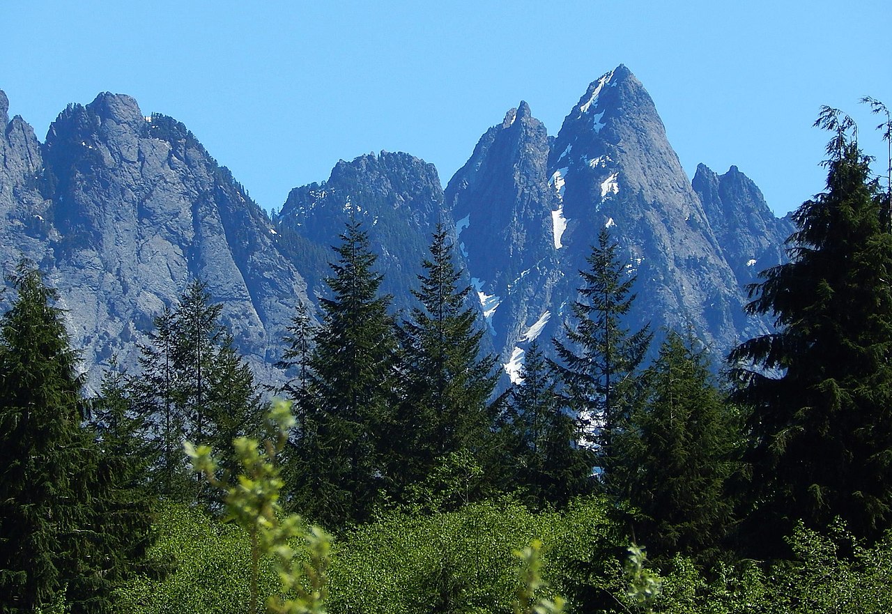 Garfield MountainSummit · ~27 min drivePhoto: Ron Clausen, CC BY-SA 4.0 (via Wikimedia Commons)
 Morning Star PeakSummit · ~28 min drivePhoto: Martin Bravenboer, CC BY 3.0 (via Wikimedia Commons)
 Columbia PeakSummit · ~28 min drivePhoto: CC BY-SA 3.0 us (via Wikimedia Commons)

