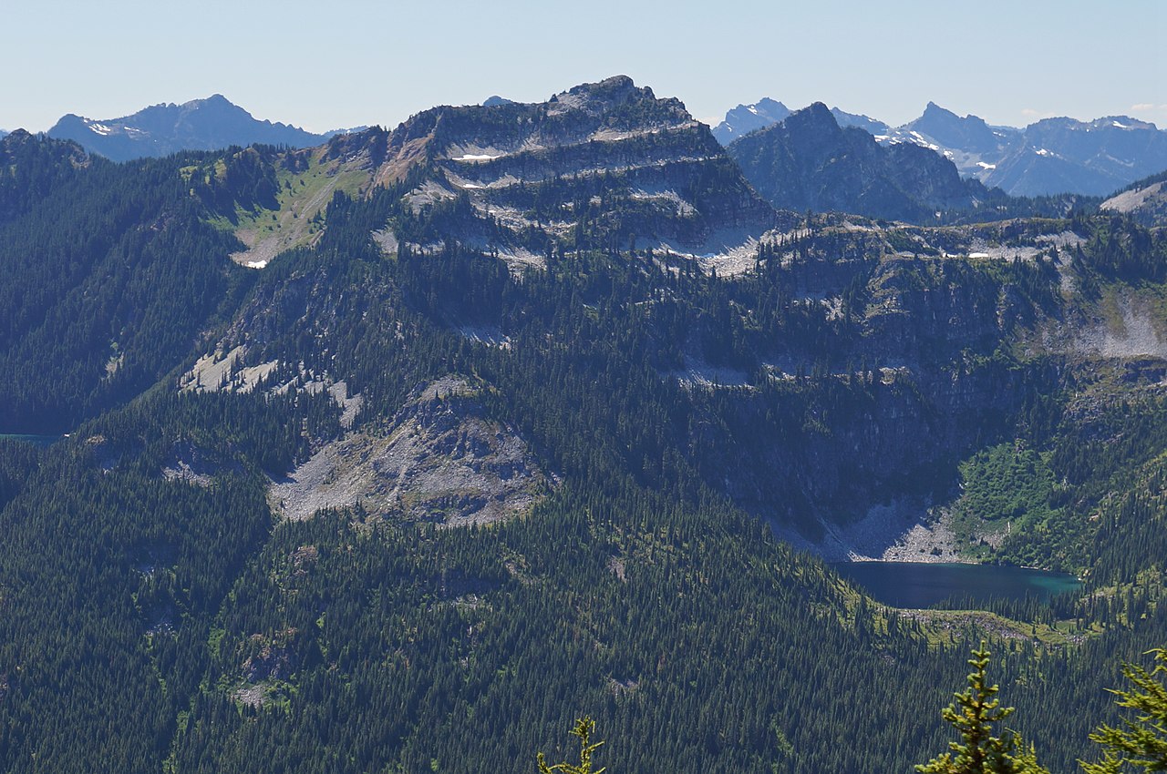
Mount Hinman
 Photo: Ron Clausen, CC BY-SA 4.0 (via Wikimedia Commons)
- 7,500 ft
- summit
- 1
- way up
- Forest Service
- managed by
Is Mount Hinman open right now?
Closure in the area
There's a closure order in Mt. Baker-Snoqualmie National Forest. It doesn't name Mount Hinman, so check the source for the area it covers (2 listed).
Grand Park 2 Fire Closure Update
Agency closure covering Mt. Baker-Snoqualmie National Forest · Order 06-05-26-16 · USFS · Mt. Baker-Snoqualmie National Forest
Bell Creek Bridge Damaged
Agency closure covering Mt. Baker-Snoqualmie National Forest · USFS · Mt. Baker-Snoqualmie National Forest
Rescission of Shooting Restrictions
Agency alert covering Mt. Baker-Snoqualmie National Forest · USFS · Mt. Baker-Snoqualmie National Forest
Electric Fire Closure Order
Agency alert covering Mt. Baker-Snoqualmie National Forest · Order 06-05-26-19 · USFS · Mt. Baker-Snoqualmie National Forest
Mountain Goats Have Been Present on Yellow Aster Butte
Agency alert covering Mt. Baker-Snoqualmie National Forest · USFS · Mt. Baker-Snoqualmie National Forest
As of · Source: USFS · Mt. Baker-Snoqualmie National Forest. Agencies don't list every closure — check before you go.
Mount Hinman is a summit in Kittitas County, Washington, inside the Alpine Lakes Wilderness on the Mt. Baker-Snoqualmie National Forest, which the Forest Service manages. The nearest town is Skykomish, about 12 miles away. The Mount Hinman West Ridge Trail starts right beside the summit, and the Chain Lakes Trail and La Bohn Lakes Route are each within about 2 miles. For an overnight base, Fish Lake campground is roughly 7 miles away.
Conditions and forecast
Daily highs and lows, wind and the chance of precipitation at the summit and route start for the next 7 days, from the Open-Meteo model.
- Summit elevation
- 7,500 ft
- Land manager
- Forest Service
Elevation from USGS 3D Elevation Program terrain data (about 10 m resolution).
Map © Mapbox © OpenStreetMap contributors Questions about Mount Hinman
How tall is Mount Hinman?
7,500 ft (2,286 m).
How many routes go to the summit of Mount Hinman?
One: Mount Hinman West Ridge Trail.
 Mount Daniel7,896 ft · Washington1 route2.1 mi awayPhoto: Walter Siegmund, CC BY 2.5 (via Wikimedia Commons)
- Trico Mountain6,657 ft · Washington1 route5.2 mi away
- Surprise Mountain6,314 ft · Washington1 route6.3 mi away
- Mount Sawyer5,500 ft · Washington1 route6.8 mi away
- Spark Plug Mountain6,302 ft · Washington1 route6.8 mi away
 Hibox Mountain6,556 ft · Washington1 route10 mi awayPhoto: Michael Cline, CC BY-SA 2.0 (via Wikimedia Commons)
- Mount Hinman West Ridge TrailHiking0.1 mi
- Chain Lakes TrailHiking1.3 mi
- La Bohn Lakes RouteHiking1.6 mi
- East Fork Foss RiverCanoeing3.6 mi
- West Fork Foss RiverCanoeing5.3 mi
- Fish LakeCamping7.4 mi
- Western Alpine LakesRock climbing8.5 mi
- Ministry of Magic BoulderRock climbing9 mi
Source: Roamze catalog (indexable pages within 10 miles, PostGIS distance)
 Bears Breast MountainSummit · ~4 min drivePhoto: Allison Wildman, CC BY 2.0 (via Wikimedia Commons)
 Terrace MountainSummit · ~6 min drivePhoto: Martin Bravenboer, CC BY 2.0 (via Wikimedia Commons)
 Cathedral RockSummit · ~7 min drivePhoto: Walter Siegmund, CC BY 2.5 (via Wikimedia Commons)
 Summit Chief MountainSummit · ~7 min drivePhoto: U.S. Forest Service- Pacific Northwest Region, Public domain (via Wikimedia Commons)
 Overcoat PeakSummit · ~9 min drivePhoto: U.S. Forest Service- Pacific Northwest Region, Public domain (via Wikimedia Commons)
- Chimney RockSummit · ~9 min drivePhoto: U.S. Forest Service- Pacific Northwest Region, Public domain (via Wikimedia Commons)
 Thunder MountainSummit · ~12 min drivePhoto: Martin Bravenboer, CC BY 2.0 (via Wikimedia Commons)
 Chikamin PeakSummit · ~13 min drivePhoto: Ron Clausen, CC BY-SA 4.0 (via Wikimedia Commons)
 Huckleberry MountainSummit · ~15 min drivePhoto: Walter Siegmund, CC BY 2.5 (via Wikimedia Commons)
- Hibox MountainSummit · ~18 min drivePhoto: Michael Cline, CC BY-SA 2.0 (via Wikimedia Commons)

