Terrace Mountain
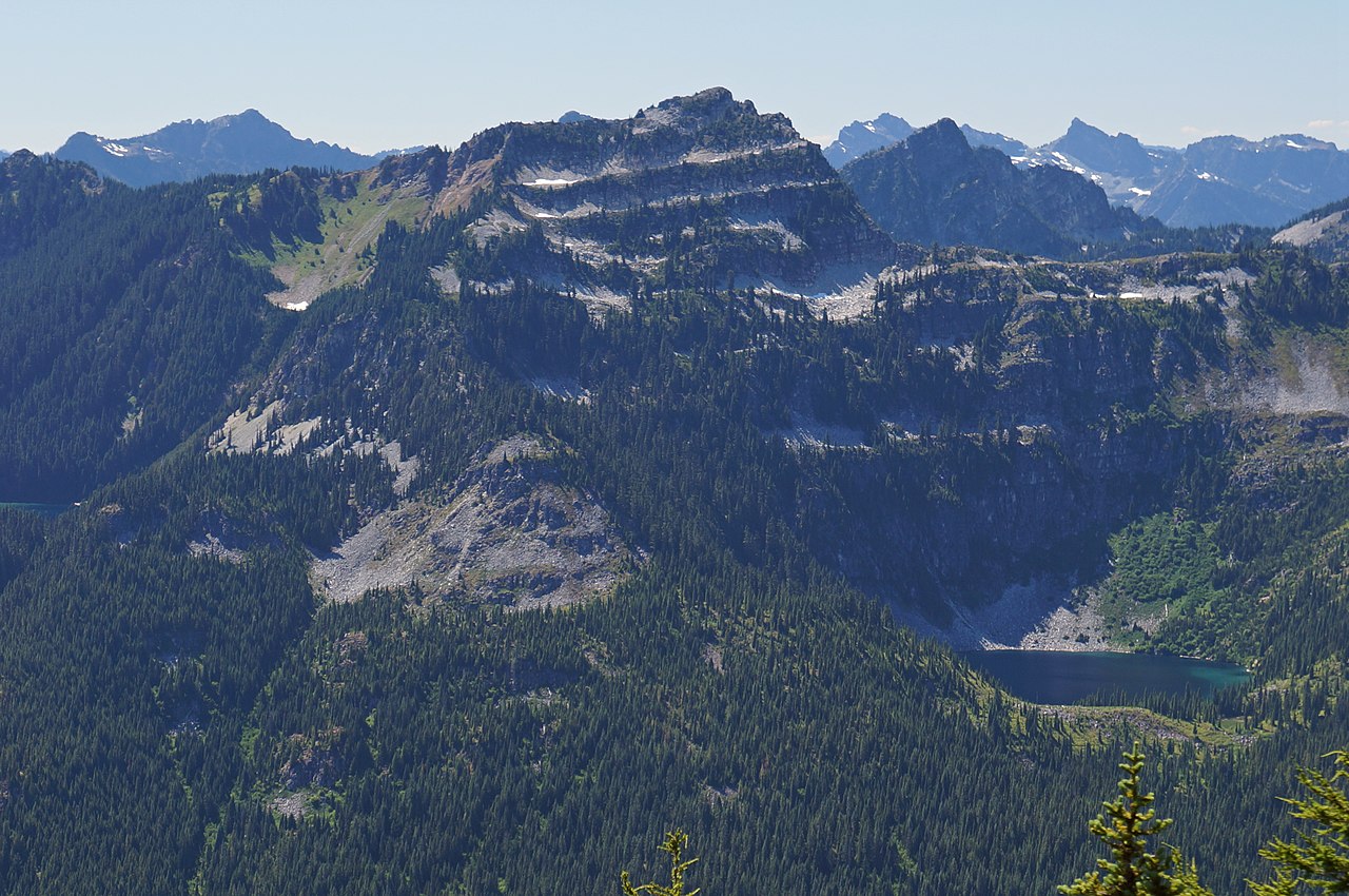 Photo: Martin Bravenboer, CC BY 2.0 (via Wikimedia Commons)
- 6,359 ft
- summit
- Forest Service
- managed by
Is Terrace Mountain open right now?
Closure in the area
There's a closure order in Mt. Baker-Snoqualmie National Forest. It doesn't name Terrace Mountain, so check the source for the area it covers (2 listed).
Grand Park 2 Fire Closure Update
Agency closure covering Mt. Baker-Snoqualmie National Forest · Order 06-05-26-16 · USFS · Mt. Baker-Snoqualmie National Forest
Bell Creek Bridge Damaged
Agency closure covering Mt. Baker-Snoqualmie National Forest · USFS · Mt. Baker-Snoqualmie National Forest
Rescission of Shooting Restrictions
Agency alert covering Mt. Baker-Snoqualmie National Forest · USFS · Mt. Baker-Snoqualmie National Forest
Electric Fire Closure Order
Agency alert covering Mt. Baker-Snoqualmie National Forest · Order 06-05-26-19 · USFS · Mt. Baker-Snoqualmie National Forest
Mountain Goats Have Been Present on Yellow Aster Butte
Agency alert covering Mt. Baker-Snoqualmie National Forest · USFS · Mt. Baker-Snoqualmie National Forest
As of · Source: USFS · Mt. Baker-Snoqualmie National Forest. Agencies don't list every closure — check before you go.
Terrace Mountain is a summit of about 6,359 feet in King County, Washington, inside the Alpine Lakes Wilderness. It lies within the Skykomish Ranger District of Mt. Baker-Snoqualmie National Forest, which the Forest Service manages, and the nearest town is Skykomish, about 10 miles away. Two trails start close by: Lake Clarice Trail is under a mile away and Marmot Lake Trail is just over a mile away. For an overnight base, Fish Lake campground sits about 9 miles off, and Beckler River Campground is about 10 miles away.
Conditions and forecast
Daily highs and lows, wind and the chance of precipitation at the summit for the next 7 days, from the Open-Meteo model.
- Summit elevation
- 6,359 ft
- Land manager
- Forest Service
Elevation from USGS 3D Elevation Program terrain data (about 10 m resolution).
We don't know of a mapped trail or route to the summit of Terrace Mountain. Plan the approach with local maps, a guidebook or a local guide, and check conditions before you go.
Questions about Terrace Mountain
How tall is Terrace Mountain?
6,359 ft (1,938 m).
Is there a trail to the top of Terrace Mountain?
We don't know of a mapped trail or route to the summit. Plan the approach with local maps, a guidebook or a local guide.
- Surprise Mountain6,314 ft · Washington1 route3.0 mi away
- Spark Plug Mountain6,302 ft · Washington1 route3.2 mi away
- Mount Sawyer5,500 ft · Washington1 route3.4 mi away
 Mount Hinman7,500 ft · Washington1 route3.7 mi awayPhoto: Ron Clausen, CC BY-SA 4.0 (via Wikimedia Commons)
 Mount Daniel7,896 ft · Washington1 route4.2 mi awayPhoto: Walter Siegmund, CC BY 2.5 (via Wikimedia Commons)
- Trico Mountain6,657 ft · Washington1 route4.3 mi away
 Lake Clarice TrailHikingPhoto: U.S. Forest Service- Pacific Northwest Region, Public domain (via Wikimedia Commons)0.8 mi
- Marmot Lake TrailHikingPhoto: U.S. Forest Service- Pacific Northwest Region, Public domain (via Wikimedia Commons)0.9 mi
- East Fork Foss RiverCanoeing2 mi
- West Fork Foss RiverCanoeing5.4 mi
- Hideout BouldersRock climbing8.3 mi
- Coexist BoulderRock climbing8.3 mi
- Fish LakeCamping9 mi
 Beckler River CampgroundCampingPhoto: Recreation.gov (RIDB) / public domain9.9 mi
Source: Roamze catalog (indexable pages within 10 miles, PostGIS distance)
- Mount HinmanSummit · ~6 min drivePhoto: Ron Clausen, CC BY-SA 4.0 (via Wikimedia Commons)
 Thunder MountainSummit · ~7 min drivePhoto: Martin Bravenboer, CC BY 2.0 (via Wikimedia Commons)
 Cathedral RockSummit · ~9 min drivePhoto: Walter Siegmund, CC BY 2.5 (via Wikimedia Commons)
 Bears Breast MountainSummit · ~10 min drivePhoto: Allison Wildman, CC BY 2.0 (via Wikimedia Commons)
 Summit Chief MountainSummit · ~13 min drivePhoto: U.S. Forest Service- Pacific Northwest Region, Public domain (via Wikimedia Commons)
 Overcoat PeakSummit · ~15 min drivePhoto: U.S. Forest Service- Pacific Northwest Region, Public domain (via Wikimedia Commons)
- Chimney RockSummit · ~15 min drivePhoto: U.S. Forest Service- Pacific Northwest Region, Public domain (via Wikimedia Commons)
 Beckler PeakSummit · ~15 min drivePhoto: Danust, CC BY-SA 4.0 (via Wikimedia Commons)
 Chikamin PeakSummit · ~20 min drivePhoto: Ron Clausen, CC BY-SA 4.0 (via Wikimedia Commons)
 Jim Hill MountainSummit · ~20 min drivePhoto: Martin Bravenboer, CC BY 3.0 (via Wikimedia Commons)
