East Mountain
- 2,346 ft
- summit
- Apr–Oct
- best months
Is East Mountain open right now?
Closure in the area
There's a closure order in Green Mountain and Finger Lakes National Forests. It doesn't name East Mountain, so check the source for the area it covers (4 listed).
Klondike Fire Incident Report
Agency closure covering Green Mountain and Finger Lakes National Forests · USFS · Green Mountain and Finger Lakes National Forests
List of trail closures post-Hurricane Helene
Park closure covering Appalachian National Scenic Trail · NPS · Appalachian National Scenic Trail
Heavily damaged or closed trails
Agency closure covering Green Mountain and Finger Lakes National Forests · USFS · Green Mountain and Finger Lakes National Forests
Glastenbury fire tower is closed to public use
Agency closure covering Green Mountain and Finger Lakes National Forests · USFS · Green Mountain and Finger Lakes National Forests
Black Bears Frequenting the McAfee Knob Area in Virginia
Park alert covering Appalachian National Scenic Trail · NPS · Appalachian National Scenic Trail
As of · Source: USFS · Green Mountain and Finger Lakes National Forests. Agencies don't list every closure — check before you go.
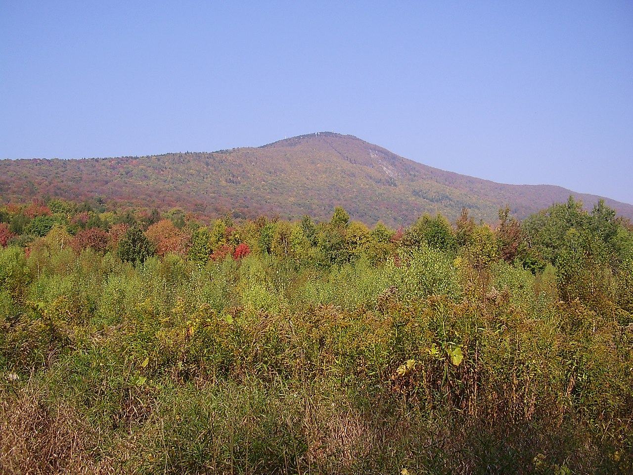
East Mountain is a summit in southern Vermont, within the Manchester Ranger District of the Green Mountain and Finger Lakes National Forests and along the corridor of the Appalachian National Scenic Trail. The nearest town is Williamstown, Massachusetts, about 3.4 miles away, just across the state line. Summer into early fall is the most comfortable stretch for a visit. Typical averages from the nearby Pownal weather station show highs around 75°F in June and 72°F in September. That station sits roughly 1,200 feet below the summit, so expect cooler temperatures up top. Several other outings are close by. The Broad Brook and Agawon hikes are each about 1.5 miles away, the Dome Trail for mountain biking is about 1.6 miles off, and the Old Seth Warner Shelter Site, around 2.1 miles away, offers a spot to camp.
Conditions and forecast
Daily highs and lows, wind and the chance of precipitation at the summit for the next 7 days, from the Open-Meteo model.
- Summit elevation
- 2,346 ft
Elevation from USGS 3D Elevation Program terrain data (about 10 m resolution).
We don't know of a mapped trail or route to the summit of East Mountain. Plan the approach with local maps, a guidebook or a local guide, and check conditions before you go.
Questions about East Mountain
How tall is East Mountain?
2,346 ft (715 m).
Is there a trail to the top of East Mountain?
We don't know of a mapped trail or route to the summit. Plan the approach with local maps, a guidebook or a local guide.
- Mason Hill1,131 ft · Massachusetts4 routes2.1 mi away
- Stony Ledge2,582 ft · Massachusetts1 route7.2 mi away
 Mount Greylock3,492 ft · Massachusetts2 routes7.5 mi awayPhoto: Jstergis, CC BY 3.0 (via Wikimedia Commons)
- Harmon Hill2,331 ft · Vermont1 route8.8 mi away
- Mount Anthony2,344 ft · Vermont1 route9.1 mi away
- Prospect Mountain2,772 ft · Vermont2 routes10 mi away
- Broad BrookHiking1.3 mi
- AgawonHiking1.5 mi
- Dome TrailMountain biking1.6 mi
- Old Seth Warner Shelter SiteCamping2.1 mi
- Seth Warner ShelterCamping4.2 mi
- Clark CragRock climbing4.4 mi
- North Branch Hoosic RiverCanoeing5.5 mi
- Monroe State ForestRock climbing8.6 mi
Source: Roamze catalog (indexable pages within 10 miles, PostGIS distance)
- Mount GreylockSummit · ~13 min drivePhoto: Jstergis, CC BY 3.0 (via Wikimedia Commons)
 Stone MountainSummit · ~34 min drivePhoto: KyleAndMelissa22, Public domain (via Wikimedia Commons)
 Hogback MountainSummit · ~35 min drivePhoto: Madereugeneandrew, CC BY-SA 4.0 (via Wikimedia Commons)
 Stratton MountainSummit · ~45 min drivePhoto: Doc Searls from Santa Barbara, USA, CC BY-SA 2.0 (via Wikimedia Commons)
 Equinox MountainSummit · ~50 min drivePhoto: NEWND, Public domain (via Wikimedia Commons)
- Mason HillSummit · ~4 min drive
- Mount WilliamsSummit · ~9 min drive
- Mount FitchSummit · ~11 min drive
- Stony LedgeSummit · ~12 min drive
- Harmon HillSummit · ~15 min drive
Best time to visit East Mountain
Best months: April–October. Best months have typical highs of 55–85 °F, lows of 30 °F or warmer (32 °F where the station doesn't record snow), at most one snowy day and no more than 12 wet days.
Jan
31° / 12°
Feb
33° / 13°
Mar
42° / 22°
Apr
56° / 33°
May
68° / 43°
Jun
75° / 52°
Jul
81° / 57°
Aug
78° / 55°
Sep
72° / 49°
Oct
59° / 39°
Nov
47° / 29°
Dec
36° / 20°
Typical high / low (°F) and days with rain or snow, 1991–2020. Measured at Pownal 1 Ne, VT, 4.7 mi away at 1,110 ft. The station sits about 1,200 ft lower than this place, so expect it a little cooler here. This station doesn't record snowfall. Source: NOAA NCEI U.S. Climate Normals 1991–2020.

