East Fork Sevier River
- 90.0 mi
- distance
- 8,069 ft
- high point
- Jun–Sep
- best months
Is East Fork Sevier River open right now?
Alert in the area
The Forest Service lists 3 alerts for Dixie National Forest.
Duck Creek OHV Trail Closure
Agency alert covering Dixie National Forest · Order 0407-26-11 · USFS · Dixie National Forest
Pine Valley Ranger District Area and Trail and Road Closure
Agency alert covering Dixie National Forest · Order 0407-26-01 · USFS · Dixie National Forest
Cedar City Temporary Road Closure Webster Flat Road (Order 0407-25-02)
Agency alert covering Dixie National Forest · Order 0407-25-02 · USFS · Dixie National Forest
As of · Source: USFS · Dixie National Forest. Agencies don't list every closure — check before you go.
The East Fork Sevier River is a 90-mile paddling stretch near Tropic, Utah, on the Powell Ranger District of Dixie National Forest. The Forest Service manages the land along it. The river is intermittent and may run dry in some seasons, so confirm the flow before heading out. Typical averages from a nearby weather station at Bryce Canyon put July highs around 81°F with lows near 45°F, and June and September are also comfortable, with highs in the mid-70s. Winter is cold, with January highs around 36°F and lows near 6°F. The river's average flow is about 196 cubic feet per second, and its gradient is about 23.1 feet per mile. Paddlers can pair the trip with hiking on the North Fork Prospect Creek Tra, South Fork Prospect and Rock Creek Trail, all within about 2 miles.
Local outfitters
- Big Rock Adventure44 mi away
- Big Rock Candy Mountain44 mi away
Not on Roamze yet. Their page has how to reach them.
- North Fork Prospect Creek TraHiking0.9 mi
- South Fork ProspectHiking1.5 mi
- Rock Creek TrailHiking1.6 mi
- Middle Cottonwood TrailMountain biking4.8 mi
- Upper Cottonwood TrailMountain biking5.9 mi
- Cottonwood Creek TrailHiking6.3 mi
- North Fork Cottonwood TrailMountain biking6.4 mi
- South Central UtahRock climbing6.7 mi
Source: Roamze catalog (indexable pages within 10 miles, PostGIS distance)
 Otter CreekCanoeing · ~1h 8m drivePhoto: Murray Foubister, CC BY-SA 2.0 (via Wikimedia Commons)
 Escalante RiverCanoeing · ~1h 11m drivePhoto: Reid Priedhorsky (R27182818), CC BY-SA 2.5 (via Wikimedia Commons)
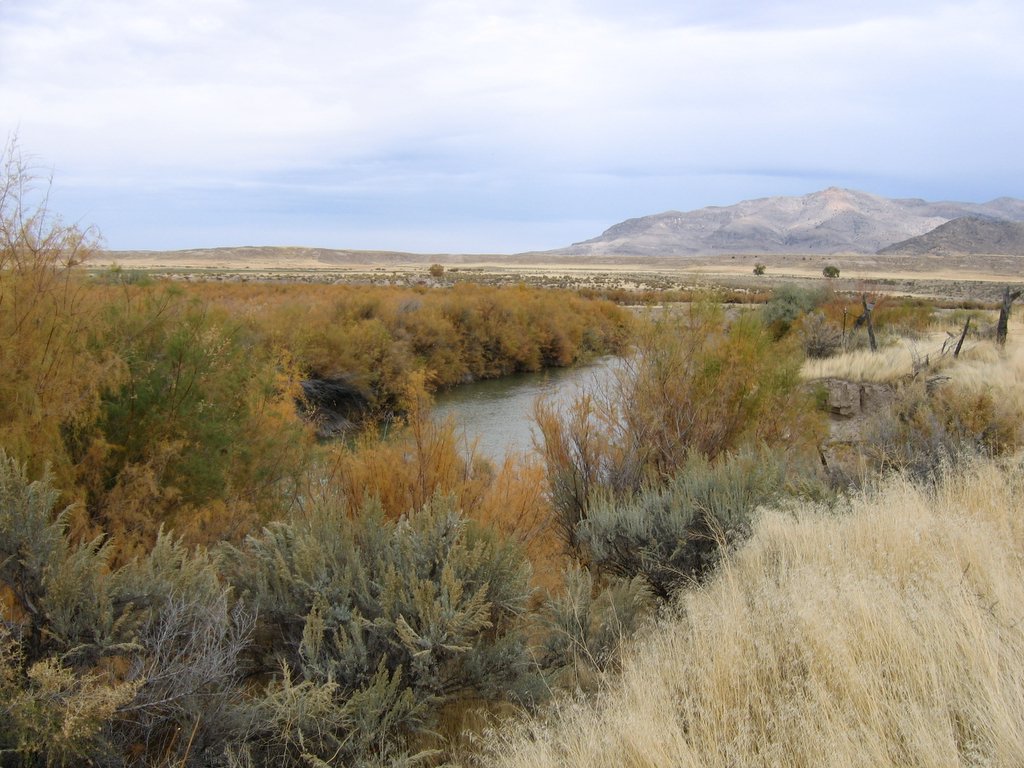 Sevier RiverCanoeing · ~1h 12m drivePhoto: w:Flickr user rcstanley, CC BY 2.0 (via Wikimedia Commons)
 Mammoth CreekCanoeing · ~58 min drivePhoto: inkknife_2000 (7.5 million views +), CC BY-SA 2.0 (via Wikimedia Commons)
- Fremont RiverCanoeing · ~1h 21m drive
- Clear CreekCanoeing · ~1h 26m drive
- Tropic Reservoir Boat RampBoat launch · ~36 min drive
- Panguitch Lake Boat Launch (north)Boat launch · ~54 min drive
- Panguitch LakeTubing · ~53 min drive
Also worth it near here
 Flake MountainSummit · ~15 min drivePhoto: An Errant Knight, CC BY-SA 4.0 (via Wikimedia Commons)
- Pine Lake CampgroundCamping · ~22 min drive
 Cassidy TrailMountain biking · ~22 min drivePhoto: inkknife_2000 (7.5 million views +), CC BY-SA 2.0 (via Wikimedia Commons)
- Long Willow BottomLake fishing · ~23 min drive
Best time to visit East Fork Sevier River
Best months: June–September. Best months have typical highs of 55–85 °F, lows of 30 °F or warmer (32 °F where the station doesn't record snow), at most one snowy day and no more than 12 wet days.
Jan
36° / 6°
6 wet
Feb
38° / 10°
7 wet
Mar
45° / 18°
7 wet
Apr
54° / 24°
6 wet
May
64° / 31°
6 wet
Jun
76° / 37°
4 wet
Jul
81° / 45°
9 wet
Aug
79° / 45°
11 wet
Sep
71° / 37°
7 wet
Oct
59° / 26°
5 wet
Nov
46° / 15°
5 wet
Dec
35° / 6°
6 wet
Typical high / low (°F) and days with rain or snow, 1991–2020. Measured at Bryce Canyon Ap, UT, 12.9 mi away at 7,586 ft. This station doesn't record snowfall. Source: NOAA NCEI U.S. Climate Normals 1991–2020.
