Fremont River
- 60.4 mi
- distance
- 8,829 ft
- high point
- May–Oct
- best months
Is Fremont River open right now?
Alert in the area
The Forest Service lists 2 alerts for Fishlake National Forest.
PST 66 Rock Canyon Trail Temporarily Closed
Agency alert covering Fishlake National Forest · USFS · Fishlake National Forest
TERMINATION OF STAGE 1 FIRE RESTRICTION ORDER
Agency alert covering Fishlake National Forest · Order 0408-26-10 · USFS · Fishlake National Forest
As of · Source: USFS · Fishlake National Forest. Agencies don't list every closure — check before you go.
The Fremont River is a paddling run in the Fremont River Ranger District of Fishlake National Forest in Utah, managed by the Forest Service. It is a long stretch of water, about 60 miles, and it sits in a landscape where other outings sit close by, including the Hell's Hole Trail, the Great Western Trail and the Sand Flat hike, all within about a mile. For an overnight base, Sunglow Campground is about 3.4 miles away. Summer is the most comfortable time to paddle. Typical averages from a nearby weather station run to highs around 80°F in July and 77°F in August, with lows in the low 50s. That station sits roughly 1,300 feet lower than the river, so temperatures on the water run cooler. Nearby, the Hell's Hole Trail is 0.5 miles away, and Sand Flat and the Great Western Trail - Utah are both about 1.1 miles off. For camping, Sunglow Campground is 3.4 miles away.
Local outfitters
- Big Rock Adventure45 mi away
- Big Rock Candy Mountain45 mi away
Not on Roamze yet. Their page has how to reach them.
- Hell's Hole TrailHiking0.5 mi
- Sand FlatHiking1.1 mi
- Great Western Trail - UtahHiking1.1 mi
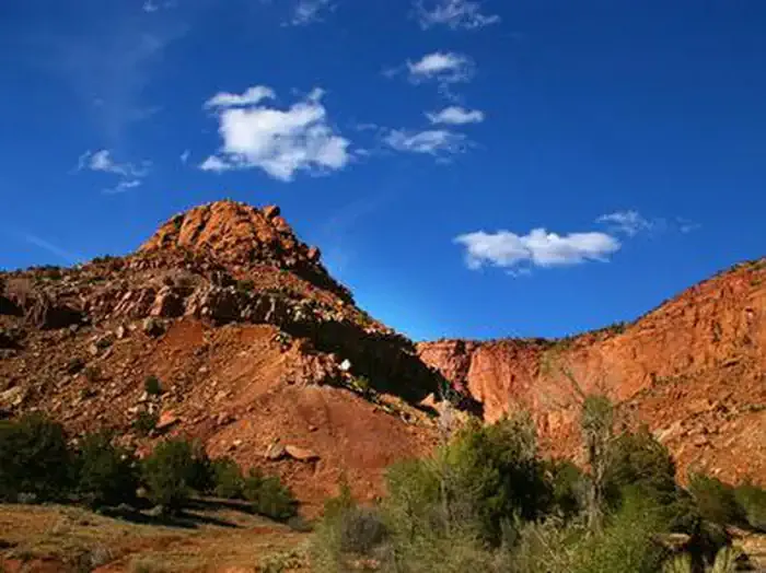 Sunglow CampgroundCampingPhoto: Recreation.gov (RIDB) / public domain3.4 mi
- Sunglow - Rec SiteCamping3.5 mi
 Cooks MesaRock climbingPhoto: runt35, CC BY 3.0 (via Wikimedia Commons)4.9 mi
 White Harlem WallRock climbingPhoto: snikrap, CC BY 2.0 (via Wikimedia Commons)5.3 mi
- Fremont River Ranger DistrictRiver fishing9.1 mi
Source: Roamze catalog (indexable pages within 10 miles, PostGIS distance)
 Otter CreekCanoeing · ~42 min drivePhoto: Murray Foubister, CC BY-SA 2.0 (via Wikimedia Commons)
- Forsyth Reservoir Boat Ramp Rec SiteBoat launch · ~21 min drive
 Muddy CreekCanoeing · ~59 min drivePhoto: Doc Searls from Santa Barbara, USA, CC BY 2.0 (via Wikimedia Commons)
- Johnson Reservoir Rec Site Boating SiteBoat launch · ~35 min drive
 Escalante RiverCanoeing · ~1h 16m drivePhoto: Reid Priedhorsky (R27182818), CC BY-SA 2.5 (via Wikimedia Commons)
- Koosharem Rec SiteBoat launch · ~47 min drive
- Ivie CreekCanoeing · ~54 min drive
- Chute of Muddy LaunchBoat launch · ~58 min drive
- Salina CreekCanoeing · ~1h 11m drive
- Mill Meadow Reservoir Boat Ramp Rec SiteBoat launch · ~21 min drive
Also worth it near here
 Indian SpringsMountain biking · ~4 min drivePhoto: runt35, CC BY 3.0 (via Wikimedia Commons)
- Sunglow CampgroundCamping · ~6 min drive
 South 300 East StreetHiking · ~7 min drivePhoto: Greg Willis from Denver, CO, usa, CC BY-SA 2.0 (via Wikimedia Commons)
- Cooks MesaRock climbing · ~8 min drivePhoto: runt35, CC BY 3.0 (via Wikimedia Commons)
Best time to visit Fremont River
Best months: May–October. Best months have typical highs of 55–85 °F, lows of 30 °F or warmer (32 °F where the station doesn't record snow), at most one snowy day and no more than 12 wet days.
Jan
33° / 16°
8 wet
Feb
35° / 18°
8 wet
Mar
43° / 24°
8 wet
Apr
50° / 29°
8 wet
May
61° / 37°
7 wet
Jun
73° / 45°
5 wet
Jul
80° / 53°
7 wet
Aug
77° / 51°
9 wet
Sep
69° / 43°
8 wet
Oct
55° / 33°
7 wet
Nov
41° / 22°
6 wet
Dec
32° / 15°
7 wet
Typical high / low (°F) and days with rain or snow, 1991–2020. Measured at Salina 24 E, UT, 38.8 mi away at 7,560 ft. The station sits about 1,300 ft lower than this place, so expect it a little cooler here. This station doesn't record snowfall. Source: NOAA NCEI U.S. Climate Normals 1991–2020.
