Great Western Trail - Utah
- 9.0 mi
- round trip
- 2,151 ft
- climb
- 9,988 ft
- high point
- Out and back
- route
Is Great Western Trail - Utah open right now?
Alert in the area
The Forest Service lists 2 alerts for Fishlake National Forest.
PST 66 Rock Canyon Trail Temporarily Closed
Agency alert covering Fishlake National Forest · USFS · Fishlake National Forest
TERMINATION OF STAGE 1 FIRE RESTRICTION ORDER
Agency alert covering Fishlake National Forest · Order 0408-26-10 · USFS · Fishlake National Forest
As of · Source: USFS · Fishlake National Forest. Agencies don't list every closure — check before you go.
The Great Western Trail in Utah is a 18-mile out-and-back route in the Fremont River Ranger District of Fishlake National Forest. The trail climbs from about 8,150 feet to nearly 10,000 feet, with a total elevation gain of 2,151 feet, and is rated hard. The trail is managed by the Forest Service, and the route is set in the Fremont River Ranger District of Fishlake National Forest. It is an out-and-back, so the 9-mile distance listed is one way. The climb is steep, and the route gains about 2,150 feet from its low point of 8,149 feet to the high point of 9,988 feet. Sand Flat lies just 0.2 miles away, and the Great Western Trail, Loa, a mountain biking section, is about half a mile off. For a longer stay, the Fremont River is about a mile away for canoeing, and Sunglow Campground is about 4.4 miles away. Cooks Mesa, a climbing area, is roughly 4 miles from the trail.
Local outfitters
- Sand Creek RV Park & Campground4 mi away
- Muddy Creek Mining Co.40 mi away
Not on Roamze yet. Their page has how to reach them.
- Sand FlatHiking0.2 mi
 Great Western Trail, LoaMountain bikingPhoto: runt35, CC BY 3.0 (via Wikimedia Commons)0.5 mi
- Fremont RiverCanoeing1.1 mi
 Cooks MesaRock climbingPhoto: runt35, CC BY 3.0 (via Wikimedia Commons)4.1 mi
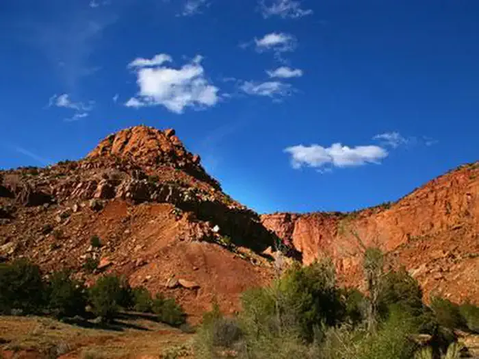 Sunglow CampgroundCampingPhoto: Recreation.gov (RIDB) / public domain4.4 mi
- Sunglow - Rec SiteCamping4.6 mi
 White Harlem WallRock climbingPhoto: snikrap, CC BY 2.0 (via Wikimedia Commons)4.6 mi
- Fremont River Ranger DistrictRiver fishing8.7 mi
Source: Roamze catalog (indexable pages within 10 miles, PostGIS distance)
 South 300 East StreetHiking · ~8 min drivePhoto: Greg Willis from Denver, CO, usa, CC BY-SA 2.0 (via Wikimedia Commons)
 Chimney Rock LoopHiking · ~14 min drivePhoto: Ken Lund — CC BY-SA 2.0 (via Flickr)
- Sand FlatHiking · Next door
- River View RoadHiking · ~9 min drivePhoto: Greg Willis from Denver, CO, usa, CC BY-SA 2.0 (via Wikimedia Commons)
 Cooks Mesa TrailHiking · ~7 min drivePhoto: Frans-Banja Mulder, CC BY 3.0 (via Wikimedia Commons)
- Hell's HoleHiking · ~7 min drive
- River View DriveHiking · ~10 min drivePhoto: Greg Willis from Denver, CO, usa, CC BY-SA 2.0 (via Wikimedia Commons)
- Hell's Hole TrailHiking · ~3 min drive
- Upper Spring CanyonHiking · ~7 min drive
- Indian SpringsHiking · ~5 min drive
Map and trail data © OpenStreetMap contributors
