Amphitheater Trail
 Photo: Klaus Eltrop, CC BY-SA 3.0 (via Wikimedia Commons)
- 0.4 mi
- round trip
- 56 ft
- climb
- 6,505 ft
- high point
- Out and back
- route
- Apr–Jun, Aug–Oct
- best months
Is Amphitheater Trail open right now?
No closures listed
The National Park Service lists no closures for Natural Bridges National Monument.
As of · Source: NPS · Natural Bridges National Monument. Agencies don't list every closure — check before you go.
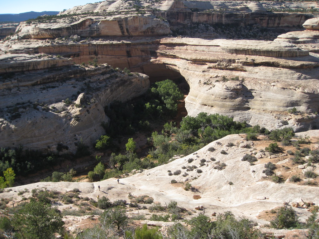
Amphitheater Trail is a short, easy out-and-back hike in Natural Bridges National Monument in Utah, managed by the National Park Service. The trail is about 0.36 miles long, and the round trip covers roughly 0.72 miles with a total elevation gain of about 56 feet. The route is nearly flat, with the steepest stretch at about 0.21 miles in, where the grade reaches about 3 percent. The most comfortable months for a visit are typically May and September. Typical averages from a nearby weather station at the monument show May highs around 71°F and September highs around 77°F, while July averages about 89°F and winter highs hover near 39°F. A fee is charged for the visit. Plan on about half an hour for the trip. The trail sits within the monument, so the nearest town is the monument's own visitor center and facilities. Nearby hikes include Mesa Top Trail, about 1.8 miles away, and Sipapu Trail, about 2 miles away. Canyon Trail and Kachina Trail are both within about 3 miles.
Local outfitters
- Coral Sands RV Park32 mi away
- Sacred Monument Tours43 mi away
Not on Roamze yet. Their page has how to reach them.
- Mesa Top TrailHiking1.8 mi
 Sipapu TrailHikingPhoto: Klaus Eltrop, CC BY-SA 3.0 (via Wikimedia Commons)2 mi
 Canyon TrailHikingPhoto: SkybirdForever, CC BY-SA 3.0 (via Wikimedia Commons)2.7 mi
 Kachina TrailHikingPhoto: brewbooks — CC BY-SA 2.0 (via Flickr)2.8 mi
- Hole-in-the-RockHiking4 mi
 Bears Ears LoopMountain bikingPhoto: brewbooks from near Seattle, USA, CC BY-SA 2.0 (via Wikimedia Commons)5.3 mi
- Short Point TrailHiking5.9 mi
- Emigrant TrailHiking6.4 mi
Source: Roamze catalog (indexable pages within 10 miles, PostGIS distance)
- Sipapu TrailHiking · ~3 min drivePhoto: Klaus Eltrop, CC BY-SA 3.0 (via Wikimedia Commons)
 Grand Gulch TrailHiking · ~12 min drivePhoto: Greg Willis, CC BY-SA 3.0 (via Wikimedia Commons)
 West Rim Texas CanyonHiking · ~17 min drivePhoto: Ken Lund from Reno, Nevada, USA, CC BY-SA 2.0 (via Wikimedia Commons)
 Grand Gulch TrailHiking · ~20 min drivePhoto: Greg Willis, CC BY-SA 3.0 (via Wikimedia Commons)
- Canyon TrailHiking · ~5 min drivePhoto: SkybirdForever, CC BY-SA 3.0 (via Wikimedia Commons)
- Kane Gulch TrailHiking · ~12 min drivePhoto: Greg Willis, CC BY-SA 3.0 (via Wikimedia Commons)
- Texas TrailHiking · ~17 min drivePhoto: Ken Lund from Reno, Nevada, USA, CC BY-SA 2.0 (via Wikimedia Commons)
 Bullet Canyon TrailHiking · ~21 min drivePhoto: Greg Willis, CC BY-SA 3.0 (via Wikimedia Commons)
- Kachina TrailHiking · ~5 min drivePhoto: brewbooks — CC BY-SA 2.0 (via Flickr)
 Todie Canyon TrailHiking · ~14 min drivePhoto: Greg Willis, CC BY-SA 3.0 (via Wikimedia Commons)
Also worth it near here
Best time to visit Amphitheater Trail
Best months: April–June and August–October. Best months have typical highs of 55–85 °F, lows of 30 °F or warmer (32 °F where the station doesn't record snow), at most one snowy day and no more than 12 wet days.
Jan
39° / 20°
6 wet · 4 snow
Feb
43° / 24°
6 wet · 3 snow
Mar
53° / 30°
5 wet · 2 snow
Apr
60° / 35°
5 wet · 1 snow
May
71° / 44°
5 wet
Jun
83° / 54°
3 wet
Jul
89° / 60°
7 wet
Aug
85° / 58°
8 wet
Sep
77° / 51°
6 wet
Oct
63° / 39°
5 wet
Nov
50° / 29°
4 wet · 2 snow
Dec
39° / 20°
6 wet · 4 snow
Typical high / low (°F) and days with rain or snow, 1991–2020. Measured at Natural Bridges Nm, UT, 0 mi away at 6,508 ft. Source: NOAA NCEI U.S. Climate Normals 1991–2020.
Closures we've recorded since August 2026
Amphitheater Trail temporarily closed for construction
Natural Bridges National Monument · seen Aug 23, 2026 → lifted Aug 28, 2026 · National Park Service

