Trail Canyon
- 9.3 mi
- round trip
- 1,281 ft
- climb
- 7,804 ft
- high point
- Out and back
- route
- Apr–Jun, Aug–Oct
- best months
Is Trail Canyon open right now?
No closures listed
The Forest Service lists no closures for Manti-La Sal National Forest.
As of · Source: USFS · Manti-La Sal National Forest. Agencies don't list every closure — check before you go.
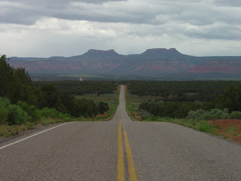
Trail Canyon is a hard hike in Utah's Dark Canyon Wilderness, part of the Monticello Ranger District of Manti-La Sal National Forest. The route is an out-and-back of about 9.3 miles, with a total elevation gain of 1,281 feet from a low point of 6,525 feet to a high of 7,804 feet. The trail is on natural surface and allows horses. The most comfortable months for a visit are typically May and September, when typical averages from a nearby weather station run from highs around 71°F to 77°F. That station sits about 1,300 feet lower than the trail's high point, so temperatures on the ridge run cooler. Several other hikes lie within a few miles. The White Rim Trail West is about a mile away, and the Big Spring Spur is about 2 miles off. The Trail Canyon To Dark Canyon Connect and the White Rim Trail East are both within about 4 miles.
Local outfitters
- Coral Sands RV Park44 mi away
- Red Desert RV Park48 mi away
Not on Roamze yet. Their page has how to reach them.
Best time to go · Apr–Jun, Aug–Oct
Best time to visit Trail Canyon
Best months: April–June and August–October. Best months have typical highs of 55–85 °F, lows of 30 °F or warmer (32 °F where the station doesn't record snow), at most one snowy day and no more than 12 wet days.
Jan
39° / 20°
6 wet · 4 snow
Feb
43° / 24°
6 wet · 3 snow
Mar
53° / 30°
5 wet · 2 snow
Apr
60° / 35°
5 wet · 1 snow
May
71° / 44°
5 wet
Jun
83° / 54°
3 wet
Jul
89° / 60°
7 wet
Aug
85° / 58°
8 wet
Sep
77° / 51°
6 wet
Oct
63° / 39°
5 wet
Nov
50° / 29°
4 wet · 2 snow
Dec
39° / 20°
6 wet · 4 snow
Typical high / low (°F) and days with rain or snow, 1991–2020. Measured at Natural Bridges Nm, UT, 18.3 mi away at 6,508 ft. The station sits about 1,300 ft lower than this place, so expect it a little cooler here. Source: NOAA NCEI U.S. Climate Normals 1991–2020.
Keep exploring — more trails worth the drive
 Photo: Ken Lund from Reno, Nevada, USA, CC BY-SA 2.0 (via Wikimedia Commons)
Dark Canyon
~8 min drive
26.83-mile out-and-back trail in Utah with 642 ft elevation gain.
Photo: Ken Lund from Reno, Nevada, USA, CC BY-SA 2.0 (via Wikimedia Commons)Rig Canyon Trail - 5161
~8 min drive
5.96-mile out-and-back hike in Utah with 1,512 ft gain and 8,135 ft max elevation.
HIKE
Big Spring Spur
~3 min drive
1.78-mile out-and-back trail in Utah with 137 ft of elevation gain.
HIKE
Salt Creek
~19 min drive
21.09-mile out-and-back trail in Utah with 504 ft gain and 1,953 ft loss.
 Photo: Ken Lund from Reno, Nevada, USA, CC BY-SA 2.0 (via Wikimedia Commons)
Woodenshoe Trail
~13 min drive
28.87-mile out-and-back trail in Utah managed by the Forest Service.
HIKE
Poison Canyon Overlook
~9 min drive
4.09-mile out-and-back trail in Utah with 543 ft elevation gain.
HIKE
Trail Canyon To Dark Canyon Connect
~4 min drive
4.34-mile out-and-back trail in Utah with 894 ft elevation gain
HIKE
WHITE RIM TRAIL WEST
~2 min drive
13.7-mile out-and-back trail in Utah with 2,779 ft elevation gain and loss.
HIKE
Horse Mountain Trail
~12 min drive
3.52-mile out-and-back trail in Utah with 1,179 ft elevation gain.
HIKE
WHITE RIM TRAIL EAST
~7 min drive
1.82-mile out-and-back trail in Utah with 390 ft elevation gain