Owachomo Bridge
 Photo: W. Bulach, CC BY-SA 4.0 (via Wikimedia Commons)
- 5,888 ft
- elevation
- National Park Service
- managed by
- Apr–Jun, Aug–Oct
- best months
Is Owachomo Bridge open right now?
No closures listed
The National Park Service lists no closures for Natural Bridges National Monument.
As of · Source: NPS · Natural Bridges National Monument. Agencies don't list every closure — check before you go.
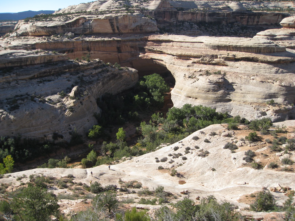
Owachomo Bridge is a natural arch in Natural Bridges National Monument in southeastern Utah, managed by the National Park Service. It sits at about 5,888 feet, and the nearest town is Fry Canyon, about 8.5 miles away. Spring and fall are the most comfortable times to visit. Typical averages from a nearby weather station show May highs around 71°F and October highs around 63°F, while July averages about 89°F and winter brings highs near 39°F with a few snowy days each month. The Canyon Trail starts just 0.1 mile away, and the Kachina Trail is about 1.3 miles off. The Mesa Top Trail and Sipapu Trail are both within about 2.3 miles.
- Elevation
- 5,888 ft
- Land manager
- National Park Service
Elevation from USGS 3D Elevation Program terrain data (about 10 m resolution).
 Canyon TrailHikingPhoto: SkybirdForever, CC BY-SA 3.0 (via Wikimedia Commons)0.1 mi
 Kachina TrailHikingPhoto: brewbooks — CC BY-SA 2.0 (via Flickr)1.3 mi
- Mesa Top TrailHiking2.2 mi
 Sipapu TrailHikingPhoto: Klaus Eltrop, CC BY-SA 3.0 (via Wikimedia Commons)2.3 mi
 Amphitheater TrailHikingPhoto: Klaus Eltrop, CC BY-SA 3.0 (via Wikimedia Commons)2.8 mi
- Emigrant TrailHiking4.4 mi
- Hole-in-the-RockHiking5.6 mi
 Kane Gulch TrailHikingPhoto: Greg Willis, CC BY-SA 3.0 (via Wikimedia Commons)6.9 mi
Source: Roamze catalog (indexable pages within 10 miles, PostGIS distance)
 Kachina BridgeNatural arch · ~3 min drivePhoto: brewbooks from near Seattle, USA, CC BY-SA 2.0 (via Wikimedia Commons)
 Sipapu BridgeNatural arch · ~5 min drivePhoto: Daniel Schwen, CC BY-SA 4.0 (via Wikimedia Commons)
 Druid ArchNatural arch · ~1h 2m drivePhoto: J. Benjamin Wildeboer (talk · contribs), Ben W on flickr, CC BY-SA 2.0 (via Wikimedia Commons)
 Paul Bunyans PottyNatural arch · ~1h 9m drivePhoto: CanyonlandsNPS, Public domain (via Wikimedia Commons)
- The ShoeNatural arch · Next door
- Indian FootNatural arch · ~3 min drive
- Stimper ArchNatural arch · ~11 min drive
- Cathedral ArchNatural arch · ~24 min drive
- Nevills ArchNatural arch · ~27 min drive
- Shaw ArchNatural arch · ~30 min drive
Also worth it near here
Best time to visit Owachomo Bridge
Best months: April–June and August–October. Best months have typical highs of 55–85 °F, lows of 30 °F or warmer (32 °F where the station doesn't record snow), at most one snowy day and no more than 12 wet days.
Jan
39° / 20°
6 wet · 4 snow
Feb
43° / 24°
6 wet · 3 snow
Mar
53° / 30°
5 wet · 2 snow
Apr
60° / 35°
5 wet · 1 snow
May
71° / 44°
5 wet
Jun
83° / 54°
3 wet
Jul
89° / 60°
7 wet
Aug
85° / 58°
8 wet
Sep
77° / 51°
6 wet
Oct
63° / 39°
5 wet
Nov
50° / 29°
4 wet · 2 snow
Dec
39° / 20°
6 wet · 4 snow
Typical high / low (°F) and days with rain or snow, 1991–2020. Measured at Natural Bridges Nm, UT, 2.8 mi away at 6,508 ft. The station sits about 600 ft higher than this place, so expect it a little warmer here. Source: NOAA NCEI U.S. Climate Normals 1991–2020.

