Sutton Creek Loop
 Photo: Kris Arnold from New York, USA, CC BY-SA 2.0 (via Wikimedia Commons)
- 1.3 mi
- loop
- 13 ft
- climb
- 62 ft
- high point
- Loop
- route
- Jun–Sep
- best months
Is Sutton Creek Loop open right now?
Closure in the area
There's a closure order in Siuslaw National Forest. It doesn't name Sutton Creek Loop, so check the source for the area it covers.
Homestead Trailhead Closure
Agency closure covering Siuslaw National Forest · Order 06-12-10-26-11 · USFS · Siuslaw National Forest
Sutton Lake Boat Ramp Closure
Agency alert covering Siuslaw National Forest · Order 06-12-10-26-07 · USFS · Siuslaw National Forest
As of · Source: USFS · Siuslaw National Forest. Agencies don't list every closure — check before you go.
Sutton Creek Loop is a 1.3-mile loop on a natural-surface trail in Oregon's Siuslaw National Forest, within the Central Coast Ranger District-ODNRA. The Forest Service manages the land. The loop rises from about 49 feet to about 62 feet, a gain of just 13 feet, and is rated easy. The route is short and level. The steepest stretch, about 3%, comes at roughly a third of the way around the loop. Bikes are allowed on this trail, so it works for riders as well as hikers. Summer is the most comfortable time to visit. Typical averages from the Florence #2 weather station, 4.4 miles away, show July highs around 68°F and only about five wet days. Winter runs colder and damper, with highs near 49°F in January and about 21 wet days. Sutton Creek Bolduc's Meadow Trail starts just 0.1 mile away. Sutton Creek, a canoeing spot, is about 0.3 mile off. Sutton Campground and the Sutton Campground Tie Trail are both within a mile.
Local outfitters
- Handy Haven RV Park25 mi away
- All Depth Charters39 mi away
Not on Roamze yet. Their page has how to reach them.
Best time to go · Jun–Sep
Best time to visit Sutton Creek Loop
Best months: June–September. Best months have typical highs of 55–85 °F, lows of 30 °F or warmer (32 °F where the station doesn't record snow), at most one snowy day and no more than 12 wet days.
Jan
49° / 39°
21 wet
Feb
51° / 37°
19 wet
Mar
53° / 39°
22 wet
Apr
56° / 40°
18 wet
May
60° / 43°
14 wet
Jun
64° / 46°
10 wet
Jul
68° / 50°
5 wet
Aug
67° / 49°
6 wet
Sep
66° / 46°
10 wet
Oct
61° / 44°
16 wet
Nov
53° / 40°
19 wet
Dec
48° / 37°
21 wet
Typical high / low (°F) and days with rain or snow, 1991–2020. Measured at Florence #2, OR, 4.4 mi away at 75 ft. This station doesn't record snowfall. Source: NOAA NCEI U.S. Climate Normals 1991–2020.
Keep exploring — more trails worth the drive
 Photo: Tony Webster, CC BY 2.0 (via Flickr)
Sutton Creek Bolduc's Meadow Trail
Next door
2.32-mile out-and-back hike in Oregon with 211 ft of elevation gain.
 Photo: lather head, CC BY 2.0 (via Flickr)
Scurvy Ridge (Cape Mtn. Trail)
~6 min drive
4.94-mile out-and-back hike to Scurvy Ridge in Oregon with 737 ft gain.
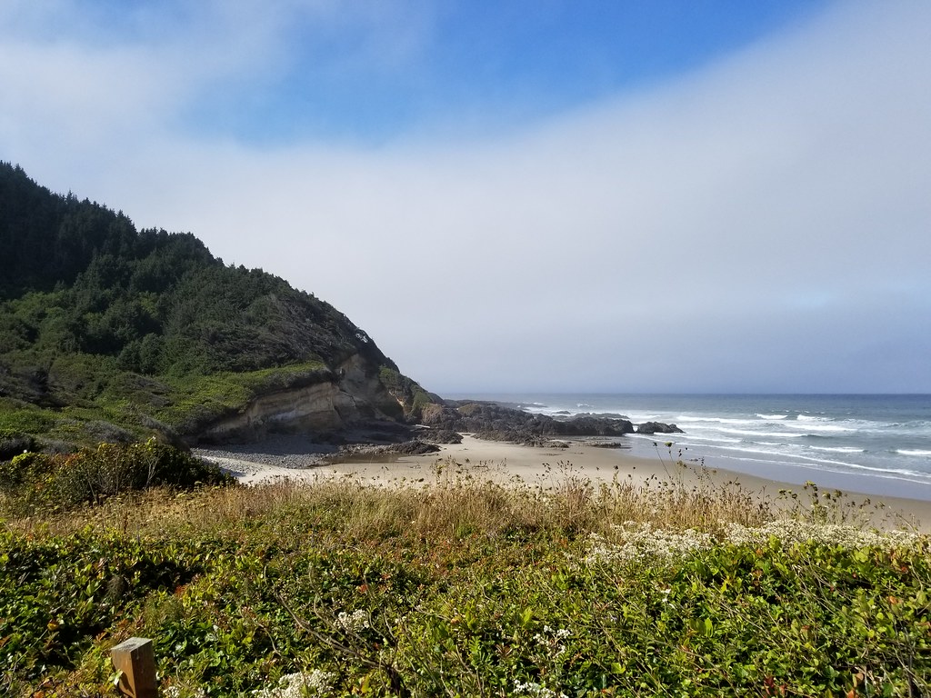 Photo: douaireg, CC BY-SA 2.0 (via Flickr)
Cummins Ridge
~23 min drive
12.20-mile out-and-back trail in Oregon with 2,682 ft elevation gain.
 Photo: Kris Arnold from New York, USA, CC BY-SA 2.0 (via Wikimedia Commons)
Sutton Campground Tie Trail
~1 min drive
0.8-mile out-and-back trail with 188 ft elevation gain in Oregon.
 Photo: REM ~ Photo Off - On, CC BY 2.0 (via Flickr)
Siltcoos Lake Trail
~23 min drive
5.89-mile out-and-back hike to Siltcoos Lake in Oregon with 717 ft gain.
HIKE
Nelson Ridge (Cape Mtn Trail)
~4 min drive
6.89-mile out-and-back trail on a ridge in Oregon with 1,542 ft of elevation gain.
Photo: Kris Arnold from New York, USA, CC BY-SA 2.0 (via Wikimedia Commons)Alder Dune Trail
~1 min drive
1.3-mile out-and-back hike on Oregon dunes with 27 ft gain.
Photo: Kris Arnold from New York, USA, CC BY-SA 2.0 (via Wikimedia Commons)Sutton Creek North
~2 min drive
3.02-mile out-and-back trail in Oregon with 199 ft gain.
Photo: Kris Arnold from New York, USA, CC BY-SA 2.0 (via Wikimedia Commons)Alder Lake Trail
~2 min drive
1.26-mile loop trail in Oregon with 151 ft gain.
HIKE
Lookout Loop Trail
~5 min drive
2.9-mile out-and-back trail in Oregon with 1,572 ft elevation gain

