Harris Ranch
- 5.3 mi
- round trip
- 3,360 ft
- climb
- 1,454 ft
- high point
- Out and back
- route
- Jun–Sep
- best months
Is Harris Ranch open right now?
Closure in the area
There's a closure order in Siuslaw National Forest. It doesn't name Harris Ranch, so check the source for the area it covers.
Homestead Trailhead Closure
Agency closure covering Siuslaw National Forest · Order 06-12-10-26-11 · USFS · Siuslaw National Forest
Sutton Lake Boat Ramp Closure
Agency alert covering Siuslaw National Forest · Order 06-12-10-26-07 · USFS · Siuslaw National Forest
As of · Source: USFS · Siuslaw National Forest. Agencies don't list every closure — check before you go.
Harris Ranch is a hard hike in Oregon's Siuslaw National Forest, within the Central Coast Ranger District-ODNRA. The trail is about 5 miles long, and the round trip climbs about 3,360 feet, with the high point at 1,454 feet. The trailhead is Harris Ranch Trailhead, and the route is an out-and-back. The trail is natural-surface and not accessible. Bikes are not allowed. The trip takes about 3.5 hours, and the trail is open year-round. Summer is the most comfortable time to go. Typical averages from a nearby weather station show July and August highs in the mid-70s with only four or five wet days a month, while winter months bring highs in the mid-40s and rain on 20 or more days. Horse Creek Trail South is about 2 miles away, and Canal Creek campground is about 2.5 miles away. Horse Creek Trail North is about 4 miles away, and Drift Creek, a canoeing spot, is about 5 miles away.
Local outfitters
- Handy Haven RV Park7 mi away
- All Depth Charters15 mi away
Not on Roamze yet. Their page has how to reach them.
Best time to go · Jun–Sep
Best time to visit Harris Ranch
Best months: June–September. Best months have typical highs of 55–85 °F, lows of 30 °F or warmer (32 °F where the station doesn't record snow), at most one snowy day and no more than 12 wet days.
Jan
45° / 36°
21 wet
Feb
49° / 36°
18 wet
Mar
53° / 37°
20 wet
Apr
58° / 39°
17 wet
May
64° / 44°
14 wet
Jun
69° / 47°
10 wet
Jul
75° / 49°
5 wet
Aug
76° / 50°
4 wet
Sep
69° / 46°
9 wet
Oct
59° / 42°
15 wet
Nov
50° / 39°
20 wet
Dec
44° / 35°
21 wet
Typical high / low (°F) and days with rain or snow, 1991–2020. Measured at Alsea Fh (Fall Creek), OR, 9 mi away at 230 ft. The station sits about 1,200 ft lower than this place, so expect it a little cooler here. Source: NOAA NCEI U.S. Climate Normals 1991–2020.
Keep exploring — more trails worth the drive
 Photo: docoverachiever, CC BY 2.0 (via Flickr)
Corvallis-To-The-Sea Trail
~16 min drive
59.18-mile point-to-point trail in Oregon with 5,840 ft elevation gain.
 Photo: U.S. Forest Service- Pacific Northwest Region, Public domain (via Wikimedia Commons)
Amanda's
~22 min drive
3.28-mile loop trail in Oregon with 474 ft elevation gain.
 Photo: Roger Sylvia, CC BY-SA 3.0 (via Wikimedia Commons)
Cummins Creek Loop Trail
~23 min drive
3-mile out-and-back out-and-back hike in Oregon with 1,002 ft gain.
 Photo: Aleksandr Zykov, CC BY-SA 2.0 (via Flickr)
Captain Cook
~23 min drive
1.20-mile out-and-back trail in Oregon with 359 ft gain.
Photo: Aleksandr Zykov, CC BY-SA 2.0 (via Flickr)Discovery Loop
~23 min drive
2.04-mile out-and-back trail in Oregon with 1,125 ft elevation gain.
 Photo: Sheila Sund from Salem, United States, CC BY 2.0 (via Wikimedia Commons)
Cooks Ridge
~23 min drive
4.96-mile out-and-back trail on a ridge in Oregon with 1,511 ft gain
Photo: Roger Sylvia, CC BY-SA 3.0 (via Wikimedia Commons)Oregon Coast
~23 min drive
2.41-mile out-and-back trail on Oregon Coast with 1,330 ft gain/loss
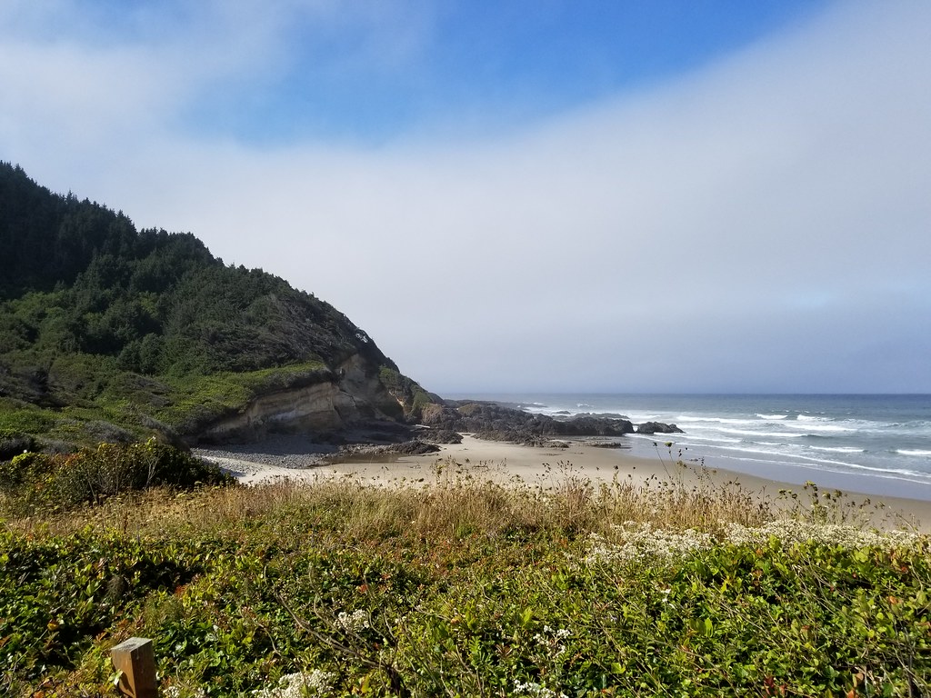 Photo: douaireg, CC BY-SA 2.0 (via Flickr)
Cummins Creek
~24 min drive
6.63-mile out-and-back trail in Oregon with 2,937 ft elevation gain.
 Photo: John Fowler from Placitas, NM, USA, CC BY 2.0 (via Wikimedia Commons)
Gwynn Creek
~24 min drive
4.65-mile out-and-back trail in Oregon with 1,448 ft gain
Photo: Roger Sylvia, CC BY-SA 3.0 (via Wikimedia Commons)Giant Spruce
~23 min drive
2.19-mile out-and-back trail in Oregon with 569 ft elevation gain.
Also worth it near here
SEE
Happy Landing RV Park & Marina boat launch
~3 min drive
SEE
Mike Bauer (Alsea River)
~10 min drive
 Photo: Sandy Horvath-Dori from Grand Junction, CO, USA, CC BY 2.0 (via Wikimedia Commons)
North Fork Yachats River
~13 min drive
 Photo: Finetooth, CC BY-SA 3.0 (via Wikimedia Commons)
Beachside State Recreation Site
~14 min drive
