Winsor Trail (254)
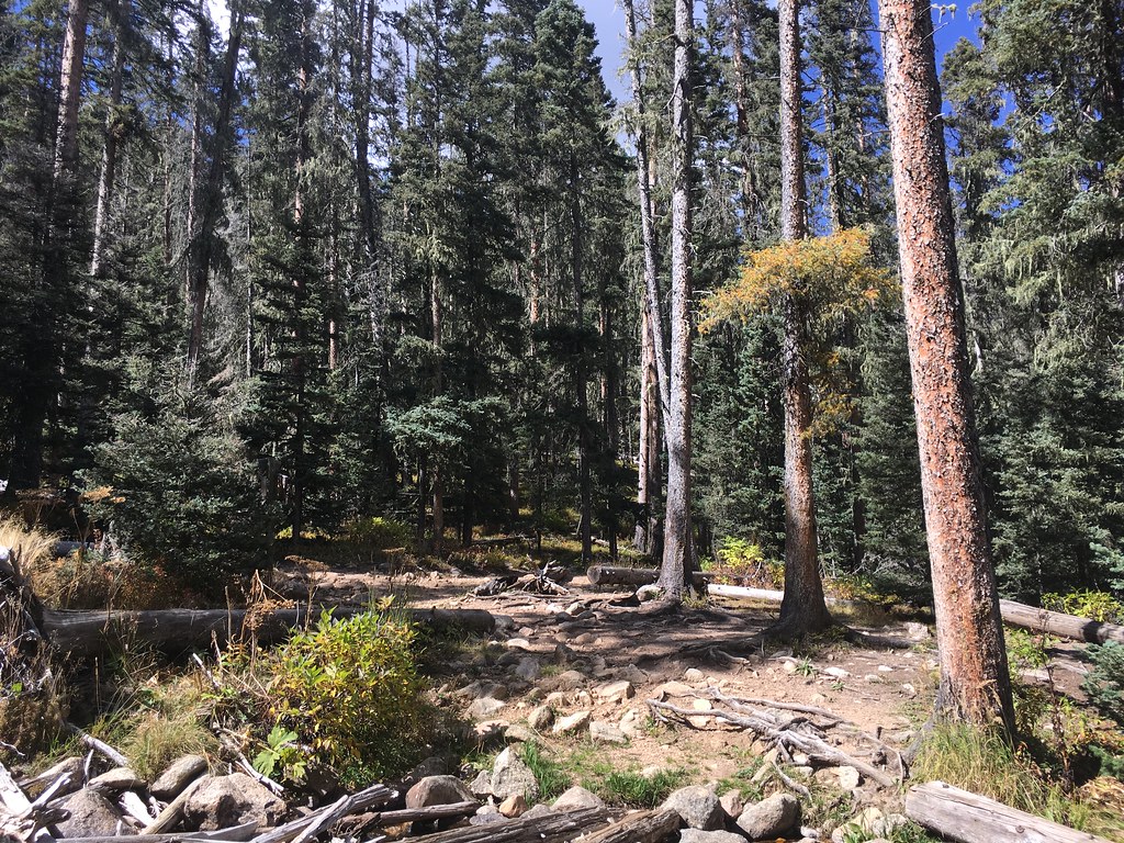 Photo: feverblue, CC BY-SA 2.0 (via Flickr)
- 0.7 mi
- round trip
- 407 ft
- climb
- 10,583 ft
- high point
- Out and back
- route
Is Winsor Trail (254) open right now?
Alert in the area
The Forest Service lists 3 alerts for Santa Fe National Forest.
Road Conditions
Agency alert covering Santa Fe National Forest · USFS · Santa Fe National Forest
Campground and Equestrian Area Closure for Field Tract and Jacks Creek
Agency alert covering Pecos-Las Vegas Ranger District · Order 03-10-05-26-12 · USFS · Pecos-Las Vegas Ranger District
Temporary area, road, and trail closures for Hermits Peak and Calf Canyon post-fire impacts
Agency alert covering Pecos-Las Vegas Ranger District · Order 03-10-05-26-05 · USFS · Pecos-Las Vegas Ranger District
As of · Source: USFS · Santa Fe National Forest. Agencies don't list every closure — check before you go.
Winsor Trail (254) is a short, easy out-and-back hike in the Pecos Wilderness, part of the Pecos-Las Vegas Ranger District of the Santa Fe National Forest in northern New Mexico. The trail is about 1.3 miles long, with a one-way elevation gain of 407 feet, and it starts and ends at roughly 10,163 feet, rising to about 10,583 feet at the high point. The Forest Service manages the land, and the route lies entirely within designated wilderness. It makes a quick addition to a day spent exploring the surrounding area, with two other hikes, Lake Katherine and Stewart Lake, each about half a mile away. For an overnight stay, Holy Ghost Gcg and Panchuela campgrounds sit about 3.5 miles off. Anglers can head to the Pecos River, roughly 5 miles away, or to Jacks Creek Group Area, about 4 miles out.
Local outfitters
- Taos Mountain Outfitters41 mi away
Not on Roamze yet. Their page has how to reach them.
- Lake KatherineHikingPhoto: feverblue, CC BY-SA 2.0 (via Flickr)0.5 mi
 Stewart LakeHikingPhoto: feverblue, CC BY-SA 2.0 (via Flickr)0.5 mi
- Holy Ghost GcgCamping3.5 mi
- PanchuelaCamping3.6 mi
 Jacks Creek Group AreaRiver fishing4.2 mi
- Pecos RiverRiver fishing5.1 mi
- The BleachersRock climbing8.7 mi
- Cathedral RockRock climbing8.7 mi
Source: Roamze catalog (indexable pages within 10 miles, PostGIS distance)
- Lake KatherineHiking · Next doorPhoto: feverblue, CC BY-SA 2.0 (via Flickr)
- Stewart LakeHiking · Next doorPhoto: feverblue, CC BY-SA 2.0 (via Flickr)
 Winsor Trail (254)Hiking · ~2 min drivePhoto: feverblue, CC BY-SA 2.0 (via Flickr)
 Skyline Trail (251)Hiking · ~3 min drivePhoto: feverblue, CC BY-SA 2.0 (via Flickr)
- Lake JohnsonHiking · ~3 min drivePhoto: feverblue, CC BY-SA 2.0 (via Flickr)
- Winsor Trail (254)Hiking · ~3 min drivePhoto: feverblue, CC BY-SA 2.0 (via Flickr)
 Winsor Trail (254)Hiking · ~6 min drivePhoto: Bryan Ungard from Santa Fe, New Mexico, USA, CC BY-SA 2.0 (via Wikimedia Commons)
- Ravens RidgeHiking · ~6 min drivePhoto: Bryan Ungard from Santa Fe, New Mexico, USA, CC BY-SA 2.0 (via Wikimedia Commons)
 Redondo Peak RouteHiking · ~3 min drivePhoto: otaghiking, CC BY-SA 2.0 (via Flickr)
 Upper NambeHiking · ~5 min drivePhoto: Bryan Ungard from Santa Fe, New Mexico, USA, CC BY-SA 2.0 (via Wikimedia Commons)


Map and trail data © OpenStreetMap contributors
