South Wagon Trail
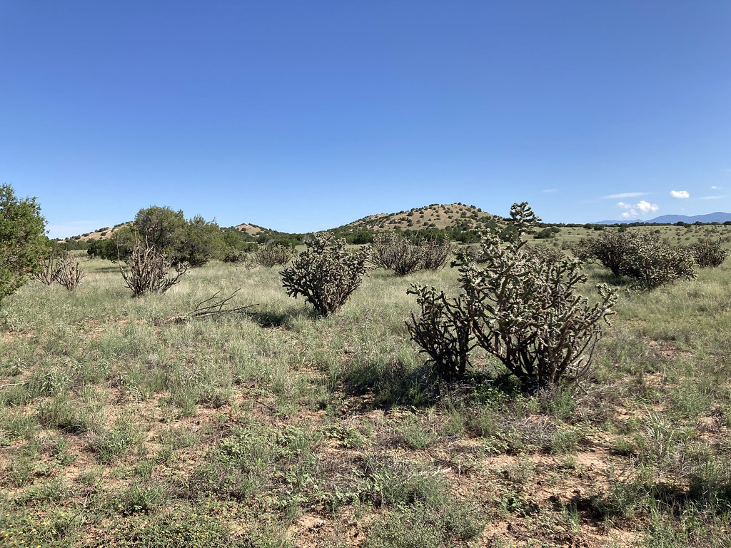
 Photo: Paul and Jill, CC BY 2.0 (via Flickr)
- 1.2 mi
- round trip
- 158 ft
- climb
- 6,349 ft
- high point
- Out and back
- route
- Apr–May, Sep–Oct
- best months
South Wagon Trail is a 2.4-mile out-and-back hike in New Mexico, about 1.3 miles from the town of Spiess. The trail rises from a low point of about 6,259 feet to a high of about 6,349 feet, with a total elevation gain of 158 feet. The climb is front-loaded, and the steepest stretch comes at about 0.7 miles in, with a grade of about 3 percent. The most comfortable months for a visit are typically May and September. Typical averages from a nearby weather station show May highs around 76°F and September highs around 80°F, while July and August bring highs in the upper 80s and the most wet days of the year. The hike takes about an hour to complete. Nathan's Trace is about 0.7 miles away, and the Arroyo de los Angeles Trail and Eliza's Ridge Trail are both within about a mile and a half. For climbing, Apache Canyon (a.k.a. Grasshopper Canyon) Bouldering is about 10 miles off.
Local outfitters
- Turquoise Trail Campground33 mi away
Not on Roamze yet. Their page has how to reach them.
 Nathan's TraceHikingPhoto: Paul and Jill, CC BY 2.0 (via Flickr)0.7 mi
 Arroyo de los Angeles TrailHikingPhoto: Paul and Jill, CC BY 2.0 (via Flickr)1.1 mi
- Eliza's Ridge TrailHiking1.3 mi
- Shepherd's TrailHiking1.4 mi
- South TrailHikingPhoto: Paul and Jill, CC BY 2.0 (via Flickr)1.8 mi
- Canada de la Cueva TrailHiking5.2 mi
- Pueblo Cañyon Greenbelt TrailHiking5.7 mi
- Apache Canyon (a.k.a. Grasshopper Canyon) BoulderingRock climbing9.9 mi
Source: Roamze catalog (indexable pages within 10 miles, PostGIS distance)
- Nathan's TraceHiking · ~1 min drivePhoto: Paul and Jill, CC BY 2.0 (via Flickr)
 Apache Canyon TrailHiking · ~16 min drivePhoto: jimcintosh, CC BY 2.0 (via Flickr)
 Ghost TownHiking · ~23 min drivePhoto: jimcintosh, CC BY 2.0 (via Flickr)
- Arroyo de los Angeles TrailHiking · ~2 min drivePhoto: Paul and Jill, CC BY 2.0 (via Flickr)
- Grasshopper Canyon TrailHiking · ~17 min drivePhoto: jimcintosh, CC BY 2.0 (via Flickr)
- BaldyHiking · ~21 min drive
- Arroyo de los Angeles TrailHiking · ~3 min drivePhoto: Paul and Jill, CC BY 2.0 (via Flickr)
 Spur Trail ConnectorHiking · ~18 min drivePhoto: BFS Man from Webster, TX, USA, CC BY 2.0 (via Wikimedia Commons)
- Glorieta BaldyHiking · ~23 min drive
 Sphinx Loop WestHiking · ~3 min drivePhoto: Paul and Jill, CC BY 2.0 (via Flickr)
Best time to visit South Wagon Trail
Best months: April–May and September–October. Best months have typical highs of 55–85 °F, lows of 30 °F or warmer (32 °F where the station doesn't record snow), at most one snowy day and no more than 12 wet days.
Jan
44° / 20°
4 wet
Feb
50° / 23°
4 wet
Mar
59° / 28°
5 wet
Apr
66° / 34°
4 wet
May
76° / 43°
4 wet
Jun
87° / 52°
5 wet
Jul
88° / 58°
10 wet
Aug
86° / 56°
10 wet
Sep
80° / 49°
7 wet
Oct
68° / 38°
5 wet
Nov
54° / 27°
4 wet
Dec
44° / 20°
4 wet
Typical high / low (°F) and days with rain or snow, 1991–2020. Measured at Santa Fe Co Muni Ap, NM, 14.2 mi away at 6,344 ft. This station doesn't record snowfall. Source: NOAA NCEI U.S. Climate Normals 1991–2020.

Map and trail data © OpenStreetMap contributors
