KOA Kampground
Campground
Campground · 7.3 mi from the trail
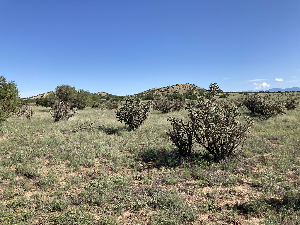
Shepherd's Trail is a short, moderate hike in northern New Mexico, about 2 miles from the town of Spiess. The route is an out-and-back of roughly 1.2 miles, with a total elevation gain of 189 feet. The trail starts at 6,527 feet and reaches a high point of 6,527 feet, so the climb is back-loaded, with the steepest stretch at about 0.16 miles from the start, where the grade reaches 7 percent. Spring and fall are the most comfortable times to go. Typical averages from a nearby weather station in Santa Fe show May highs around 74°F and October highs around 66°F, while July and August bring the most wet days, about 9 to 10 a month. The trail is close to several other routes. Eliza's Ridge Trail is just 0.1 mile away, and Arroyo de los Angeles Trail is about half a mile off. South Wagon Trail and Nathan's Trace are both within about 2 miles.
KOA Kampground
Campground
 If it rainsNewMexicophotographer1, CC BY-SA 4.0 · Wikimedia Commons
Places © OpenStreetMap contributors, Places © Overture Maps Foundation · Photos: NewMexicophotographer1, CC BY-SA 4.0 (commons)
More in Santo Domingo PuebloNot on Roamze yet. Their page has how to reach them.
 Arroyo de los Angeles TrailHikingPhoto: Paul and Jill, CC BY 2.0 (via Flickr)0.5 mi
 South Wagon TrailHikingPhoto: Paul and Jill, CC BY 2.0 (via Flickr)1.4 mi
 Nathan's TraceHikingPhoto: Paul and Jill, CC BY 2.0 (via Flickr)2 miSouth TrailHikingPhoto: Paul and Jill, CC BY 2.0 (via Flickr)2.9 mi
Source: Roamze catalog (indexable pages within 10 miles, PostGIS distance)
Arroyo de los Angeles TrailHiking · Next doorPhoto: Paul and Jill, CC BY 2.0 (via Flickr) Apache Canyon TrailHiking · ~15 min drivePhoto: jimcintosh, CC BY 2.0 (via Flickr)
 Sphinx Loop WestHiking · ~2 min drivePhoto: Paul and Jill, CC BY 2.0 (via Flickr)Grasshopper Canyon TrailHiking · ~16 min drivePhoto: jimcintosh, CC BY 2.0 (via Flickr)South Wagon TrailHiking · ~2 min drivePhoto: Paul and Jill, CC BY 2.0 (via Flickr)
 Spur Trail ConnectorHiking · ~16 min drivePhoto: BFS Man from Webster, TX, USA, CC BY 2.0 (via Wikimedia Commons)Nathan's TraceHiking · ~3 min drivePhoto: Paul and Jill, CC BY 2.0 (via Flickr)
 Pueblos del Sol pathHiking · ~19 min drivePhoto: Mike Fisher from Webster, TX, USA, CC BY 2.0 (via Wikimedia Commons)
Best months: April–June and August–October. Best months have typical highs of 55–85 °F, lows of 30 °F or warmer (32 °F where the station doesn't record snow), at most one snowy day and no more than 12 wet days.
Jan
43° / 18°
4 wet
Feb
48° / 21°
4 wet
Mar
57° / 26°
4 wet
Apr
64° / 32°
4 wet
May
74° / 41°
5 wet
Jun
84° / 50°
5 wet
Jul
86° / 55°
9 wet
Aug
83° / 54°
10 wet
Sep
78° / 47°
6 wet
Oct
66° / 35°
5 wet
Nov
53° / 24°
4 wet
Dec
43° / 18°
4 wet
Typical high / low (°F) and days with rain or snow, 1991–2020. Measured at Santa Fe 2, NM, 10.1 mi away at 6,756 ft. This station doesn't record snowfall. Source: NOAA NCEI U.S. Climate Normals 1991–2020.
Map and trail data © OpenStreetMap contributors

