Palomino Trail
- 0.6 mi
- round trip
- 37 ft
- climb
- 5,885 ft
- high point
- Out and back
- route
- Jan–May, Sep–Nov
- best months
Palomino Trail is a short, easy out-and-back hike in New Mexico, about 1.6 miles from the community of Casas Adobes. The route is roughly 1.3 miles long, with a total elevation gain of about 37 feet, so it's a gentle walk that can be done in about half an hour. The trail is nearly flat, with the high point at about 5,885 feet and the low point at about 5,851 feet. Spring and fall are the most comfortable times to go. Typical averages from the nearby Ft Bayard weather station show October highs around 74°F with lows near 47°F, and April highs around 73°F with lows near 43°F. Summer is hotter and wetter, with July and August highs in the upper 80s and about 13 wet days a month. Nearby, the Mimbres River offers canoeing about 2 miles away. Twin Calf Tank Trail, Lower Gallinas and Rabb Park are all within about 6.5 miles for more hiking.
Local outfitters
- Silver City RV Park19 mi away
- Burro Mountain Homestead RV Park32 mi away
Not on Roamze yet. Their page has how to reach them.
 Mimbres RiverCanoeingPhoto: Rafael Moreno (Flikr user moreno415), CC BY 2.0 (via Wikimedia Commons)2.2 mi
- Twin Calf Tank TrailHiking5.5 mi
- Lower GallinasHiking6.5 mi
- Rabb ParkHiking6.5 mi
- Allie Canyon Trail #100Hiking7.8 mi
- Old Allie CanyonHiking7.8 mi
- Allie CanyonHiking8.4 mi
Source: Roamze catalog (indexable pages within 10 miles, PostGIS distance)
 CdtHiking · ~18 min drivePhoto: Patrick Alexander from Las Cruces, NM, CC0 (via Wikimedia Commons)
 Royal John Mine RoadHiking · ~19 min drivePhoto: Patrick Alexander from Las Cruces, NM, CC0 (via Wikimedia Commons)
- Black Range Crest Trail #79Hiking · ~20 min drivePhoto: Patrick Alexander from Las Cruces, NM, CC0 (via Wikimedia Commons)
- Allie Canyon Trail #100Hiking · ~13 min drive
 Silver Creek RoadHiking · ~19 min drivePhoto: Patrick Alexander from Las Cruces, NM, CC0 (via Wikimedia Commons)
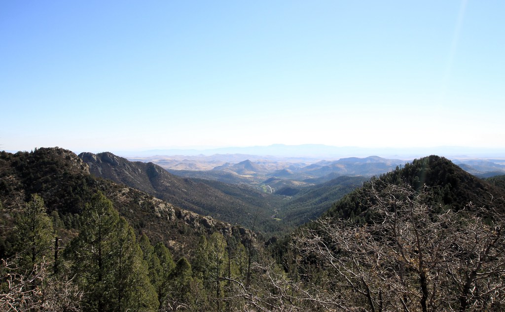 Cdt JovHiking · ~21 min drivePhoto: uıɐɾ ʞ ʇɐɯɐs, CC BY-SA 2.0 (via Flickr)
- Scenic TrailHiking · ~21 min drivePhoto: uıɐɾ ʞ ʇɐɯɐs, CC BY-SA 2.0 (via Flickr)
- Gallinas CanyonHiking · ~17 min drive
- Twin Calf Tank TrailHiking · ~9 min drive
 Black Range CrestHiking · ~21 min drivePhoto: uıɐɾ ʞ ʇɐɯɐs, CC BY-SA 2.0 (via Flickr)
Best time to visit Palomino Trail
Best months: January–May and September–November. Best months have typical highs of 55–85 °F, lows of 30 °F or warmer (32 °F where the station doesn't record snow), at most one snowy day and no more than 12 wet days.
Jan
56° / 32°
6 wet
Feb
59° / 34°
6 wet
Mar
66° / 37°
5 wet
Apr
73° / 43°
3 wet
May
80° / 50°
3 wet
Jun
90° / 60°
5 wet
Jul
88° / 64°
13 wet
Aug
87° / 63°
13 wet
Sep
83° / 58°
8 wet
Oct
74° / 47°
5 wet
Nov
63° / 37°
4 wet
Dec
55° / 30°
6 wet
Typical high / low (°F) and days with rain or snow, 1991–2020. Measured at Ft Bayard, NM, 12 mi away at 6,099 ft. This station doesn't record snowfall. Source: NOAA NCEI U.S. Climate Normals 1991–2020.
Map and trail data © OpenStreetMap contributors
