East Fork
 Photo: RuggyBearLA, CC BY 2.0 (via Flickr)
- 18.6 mi
- round trip
- 2,114 ft
- climb
- 8,558 ft
- high point
- Out and back
- route
- May–Jun, Sep
- best months
Is East Fork open right now?
Closure in the area
There's a closure order in Jemez Ranger District. It doesn't name East Fork, so check the source for the area it covers.
NFSR 313 Closed Due to Washout Near NM Highway 12
Agency closure covering Jemez Ranger District · USFS · Jemez Ranger District
Road Conditions
Agency alert covering Santa Fe National Forest · USFS · Santa Fe National Forest
Gilman Tunnels closed due to rockslide
Agency alert covering Jemez Ranger District · USFS · Jemez Ranger District
As of · Source: USFS · Jemez Ranger District. Agencies don't list every closure — check before you go.
East Fork is a hard hike of about 18.6 miles on the Jemez Ranger District of the Santa Fe National Forest, managed by the Forest Service. The trail starts near Sierra de los Pinos, about 3 miles away, and rises from roughly 6,780 feet to about 8,560 feet, a climb of about 2,114 feet one way. Bikes are allowed on this natural-surface route. For timing, July is the warmest month, with typical highs around 74°F and lows near 45°F at the Los Alamos weather station 7 miles away. September is cooler, with highs around 66°F. Spence Hot Springs lies about 1.6 miles off, and the Jemez Falls Overlook Trail and Jemez Falls Campground are both about 2 miles away. Redondo campground is about 2.5 miles out.
Best time to go · May–Jun, Sep
Best time to visit East Fork
Best months: May–June and September. Best months have typical highs of 55–85 °F, lows of 30 °F or warmer (32 °F where the station doesn't record snow), at most one snowy day and no more than 12 wet days.
Jan
36° / 9°
9 wet
Feb
38° / 12°
9 wet
Mar
44° / 20°
9 wet
Apr
52° / 25°
8 wet
May
62° / 32°
8 wet
Jun
72° / 39°
8 wet
Jul
74° / 45°
15 wet
Aug
71° / 43°
15 wet
Sep
66° / 35°
11 wet
Oct
57° / 26°
7 wet
Nov
45° / 17°
6 wet
Dec
36° / 9°
9 wet
Typical high / low (°F) and days with rain or snow, 1991–2020. Measured at Los Alamos 13 W, NM, 7.2 mi away at 8,716 ft. This station doesn't record snowfall. Source: NOAA NCEI U.S. Climate Normals 1991–2020.
Keep exploring — more trails worth the drive
 Photo: Mary P Madigan, CC BY 2.0 (via Flickr)
Jemez Falls Overlook Trail
~4 min drive
0.6-mile out-and-back hike to Jemez Falls Overlook in New Mexico
 Photo: RuggyBearLA, CC BY-SA 2.0 (via Flickr)
Monastery Trail
~7 min drive
3.64-mile out-and-back hike in New Mexico with 1,166 ft elevation gain
HIKE
Saddle Shed
~13 min drive
The saddle shed, also known as the tack shed, was built in 1963 to serve ranch operations. Ranch hands started their days here, grooming their horses and saddling up before sunrise. They would ride up to 20 miles a day, checking on livestock, inspecting fences, and tending to…
HIKE
Redondito Trail
~11 min drive
13.44-mile out-and-back hike in New Mexico with 959 ft elevation gain.
HIKE
Backcountry Driving Route
~17 min drive
45.36-mile out-and-back trail in New Mexico with 1,024 ft elevation gain.
 Photo: cogdogblog, CC0 (via Wikimedia Commons)
LAKE FORK MESA LOOP
~6 min drive
1.89-mile loop trail in New Mexico with 621 ft elevation gain
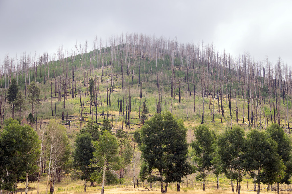 Photo: Paul and Jill, CC BY 2.0 (via Flickr)
Coyote Call Trail
~17 min drive
2.86-mile loop trail in New Mexico with 1,009 ft gain and 9,237 ft max elevation.
HIKE
Cerro La Jara Stop 6
~14 min drive
So far, you have learned that about 1.2 million years ago, a giant volcanic eruption occurred and created Valles Caldera when the roof of the empty magma chamber collapsed. The material that was erupted (called the Bandelier Tuff) was deposited inside the new hole in the groun…
HIKE
Rio Cebolla
~13 min drive
9.71-mile out-and-back trail in New Mexico with 1,391 ft of elevation gain.
Photo: cogdogblog, CC0 (via Wikimedia Commons)Horseshoe Springs Trail
~6 min drive
2.58-mile out-and-back hike in New Mexico with 607 ft elevation gain/loss.

