
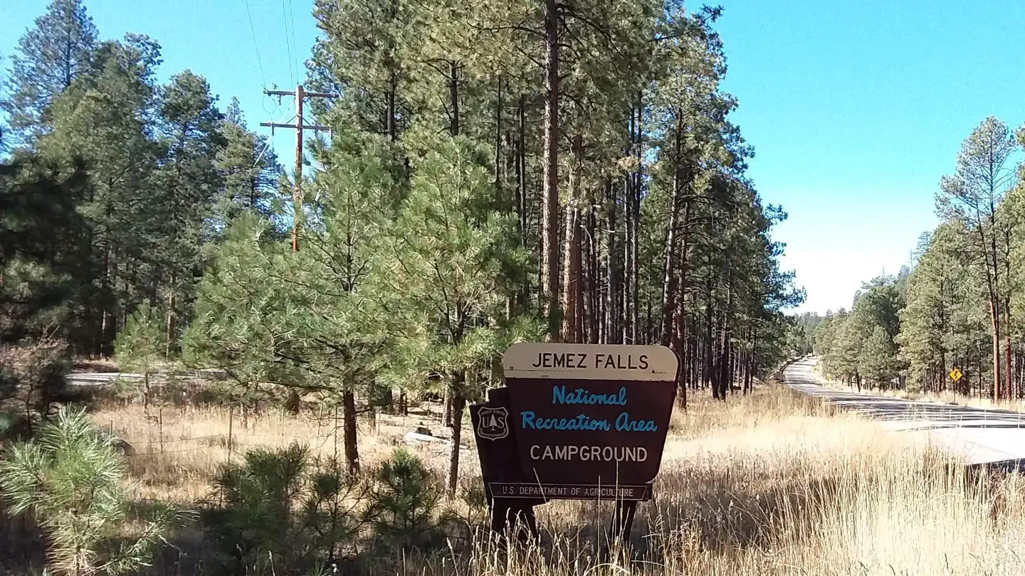
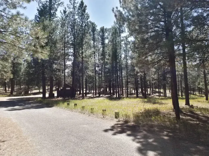
Turquoise Trail Campground
Hiking business nearby (~49 mi away) — hasn't claimed their Roamze page yet
Cerro La Jara Stop 6
Free — you'll pick up right here.
Watch this trail
Sign up to watch it — saving subscribes you to gate, closure and report changes.
New Mexico
We won't guess. Here is exactly what we do and don't know.
What we do know
Inside Valles Caldera National Preserve
National Park unit boundary is mapped — agency alerts for it feed this page automatically.
Boundary data
What's missing
No access route mapped
We don't yet know which road reaches this trailhead, so we can't tell you if it's gated.
Nobody's filed a report here yet — be the first.
Cerro La Jara Stop 6
AI-suggested draft · review before you go
No elevation data on file for this trail.
No permit or access details on file for this trail — check with the local land manager before you go.
So far, you have learned that about 1.2 million years ago, a giant volcanic eruption occurred and created Valles Caldera when the roof of the empty magma chamber collapsed. The material that was erupted (called the Bandelier Tuff) was deposited inside the new hole in the ground and on the surrounding landscape. Shortly after that, molten rock that was still under the caldera floor pushed the ground up to create the resurgent dome, Redondo Peak, that is now ahead of you. The volcanic domes Cerro La Jara – to your right, and South Mountain – to your left, were formed when thick, rhyolitic lava was extruded at the surface through vents and fissures that were located above the ring fracture system.<br /> <br /> The volcanic dome, Cerro La Jara, is still to your right. This is a good place to see flow banding in the rocks. The banding looks like layers in the rock and indicates that either different lava textures or different lava composition, or both, made the rocks break down and weather differently.<br /> <br /> Imagine a lake, right here where you are standing. Over the hundreds of thousands of years since it was formed, the caldera was sometimes home to a lake, or several lakes. Sediment deposits show that one of the lakes was about 75 feet deep here. The gently sloped mound ahead of you is made of a frothy rock called pumice that was floating on a lake and was left behind when the water broke through a lava dam and drained, leaving the pumice raft behind.<br /> <br /> Lake deposits of mud, silt, and sand contain climate indicators such as pollen. Scientists use these to learn about past climates. The climate has changed many times since the creation of Valles Caldera and is changing today. Climate records from the last 100 years show the average yearly temperature in the area is increasing quickly and the average yearly precipitation is decreasing.<br /> <br /> Continue on the trail to Stop 7, which is on a high point around the corner where you can see the road and mountains in the distance.<br /> <br /> <br /> <br /> <meta charset="utf-8" /> <p dir="ltr"><em><b id="docs-internal-guid-abb6378c-7fff-36af-44eb-06b902f15393">Hasta ahora, has aprendido que hace aproximadamente 1.2 millones de años se sucedió una erupción volcánica gigantesca que creó la caldera de Valles cuando se derrumbó el techo de la cámara magmática vacía. El material que entró en erupción (denominado toba de Bandelier) se depositó dentro del nuevo agujero en el suelo y en el paisaje circundante. Poco después, la roca fundida que aún se encontraba bajo el suelo de la caldera empujó el terreno hacia arriba y creó el domo resurgente, Redondo Peak, que ahora se encuentra frente a ti. Los domos volcánicos Cerro La Jara, a tu derecha, y South Mountain, a tu izquierda, se formaron cuando la lava riolítica espesa se extruyó en la superficie a través de conductos y fisuras que se encontraban sobre el sistema de fracturas anulares.</b></em></p> <p dir="ltr"><em><b id="docs-internal-guid-abb6378c-7fff-36af-44eb-06b902f15393">El domo volcánico, Cerro La Jara, sigue estando a su derecha. Este es un buen lugar para ver las bandas de flujo en las rocas. Las bandas parecen capas en la roca e indican que o bien diferentes texturas de lava o diferentes composiciones de lava, o ambas cosas, hicieron que las rocas se descompusieran y se erosionaran de manera diferente.</b></em></p> <p dir="ltr"><em><b id="docs-internal-guid-abb6378c-7fff-36af-44eb-06b902f15393">Imagina un lago justo aquí, donde estás parado. Durante los cientos de miles de años desde su formación, la caldera albergó en ocasiones un lago o varios lagos. Los depósitos de sedimentos muestran que uno de los lagos tenía aquí una profundidad de unos 23 metros. El monte que se encuentra frente a ti está formado por una roca espumosa llamada piedra pómez que flotaba en un lago y quedó atrás cuando el agua rompió una presa de lava y se drenó, dejando atrás la balsa de piedra pómez.</b></em></p> <p dir="ltr"><em><b id="docs-internal-guid-abb6378c-7fff-36af-44eb-06b902f15393">Los depósitos lacustres de lodo, limo y arena contienen indicadores climáticos como el polen. Los científicos los utilizan para obtener información sobre los climas del pasado. El clima ha cambiado muchas veces desde la creación de Valles Caldera y sigue cambiando en la actualidad. Los registros climáticos de los últimos 100 años muestran que la temperatura media anual de la zona está aumentando rápidamente y que la precipitación media anual está disminuyendo.</b></em></p> <p dir="ltr"><em><b id="docs-internal-guid-abb6378c-7fff-36af-44eb-06b902f15393">Continúe por el sendero hasta la parada 7, que se encuentra en un punto elevado a la vuelta de la esquina, desde donde se puede ver la carretera y las montañas en la distancia.</b></em></p>
Cerro La Jara Stop 5
~0 min drive
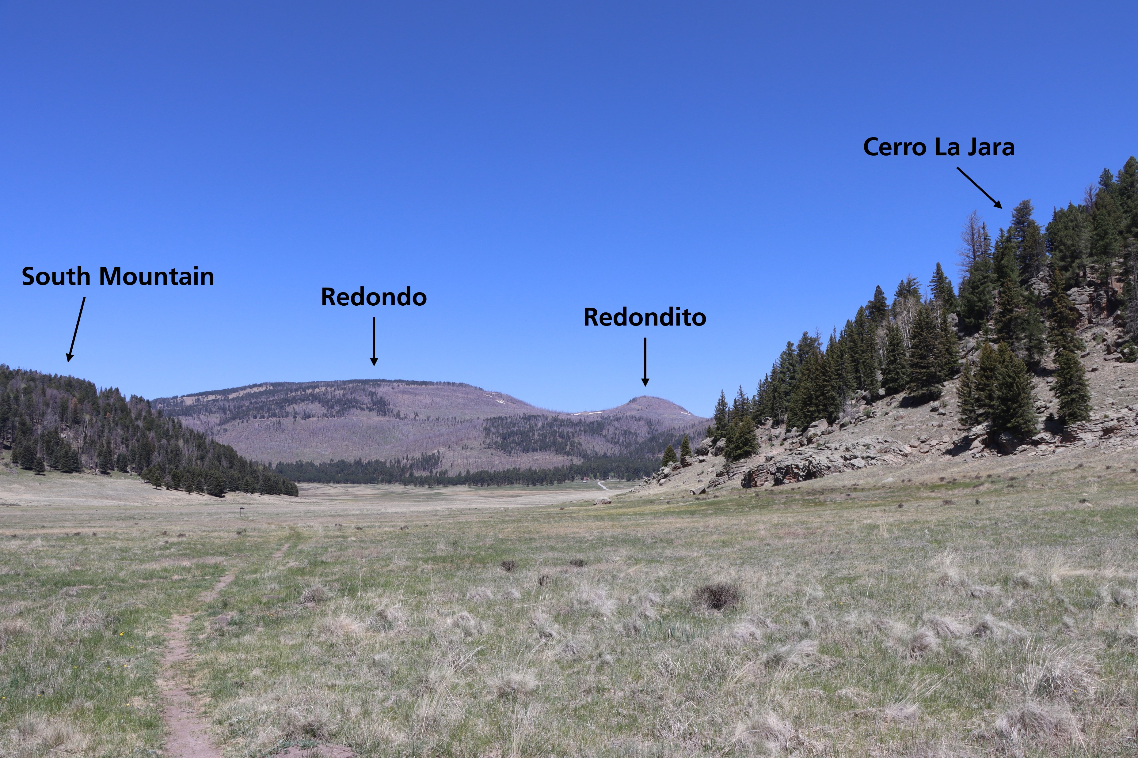
The large mountain in the distance directly ahead of you is Redondo Peak. The smaller peak just to the right is Redondito. These mountains are part of a resurgent dome in the center of Valles Caldera. A resurgent dome is different than a volcanic dome; it wasn’t extruded as la…
North East Fork
~4 min drive
Easy 1.14-mile walk with minimal elevation gain near North East Fork.
Alamo Spring
~7 min drive
Moderate 10.51-mile high desert trail to Alamo Spring with gentle elevation gain.
Cerro Pelado
~10 min drive
Moderate 3.79-mile summit hike with 780 ft gain and scenic ridgeline views.
Cerro La Jara Stop 4
~0 min drive
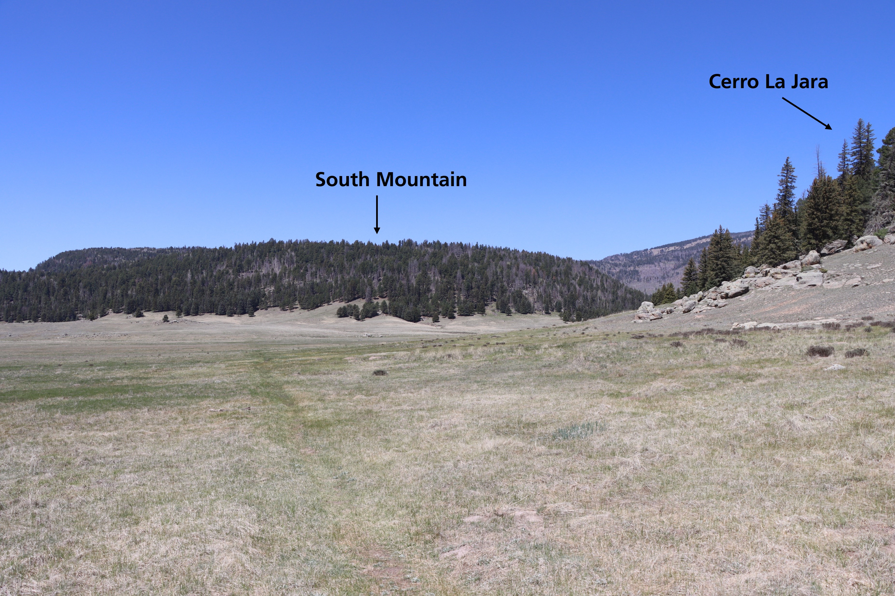
Look straight down the path. Cerro La Jara is to your right and South Mountain is directly in front of you. Both of these formations are volcanic domes. Volcanic domes are formed by the extrusion of lava that piles up in a dome shape. Cerro La Jara and South Mountain were form…
Peralta Canyon
~10 min drive
Moderate 10.5-mile canyon hike with 1,710 ft elevation gain in the Sandias.
Pajarito Nordic
~12 min drive
Accessible high-altitude loop through Pajarito Plateau forests and meadows.
Cerro La Jara Stop 7
~1 min drive
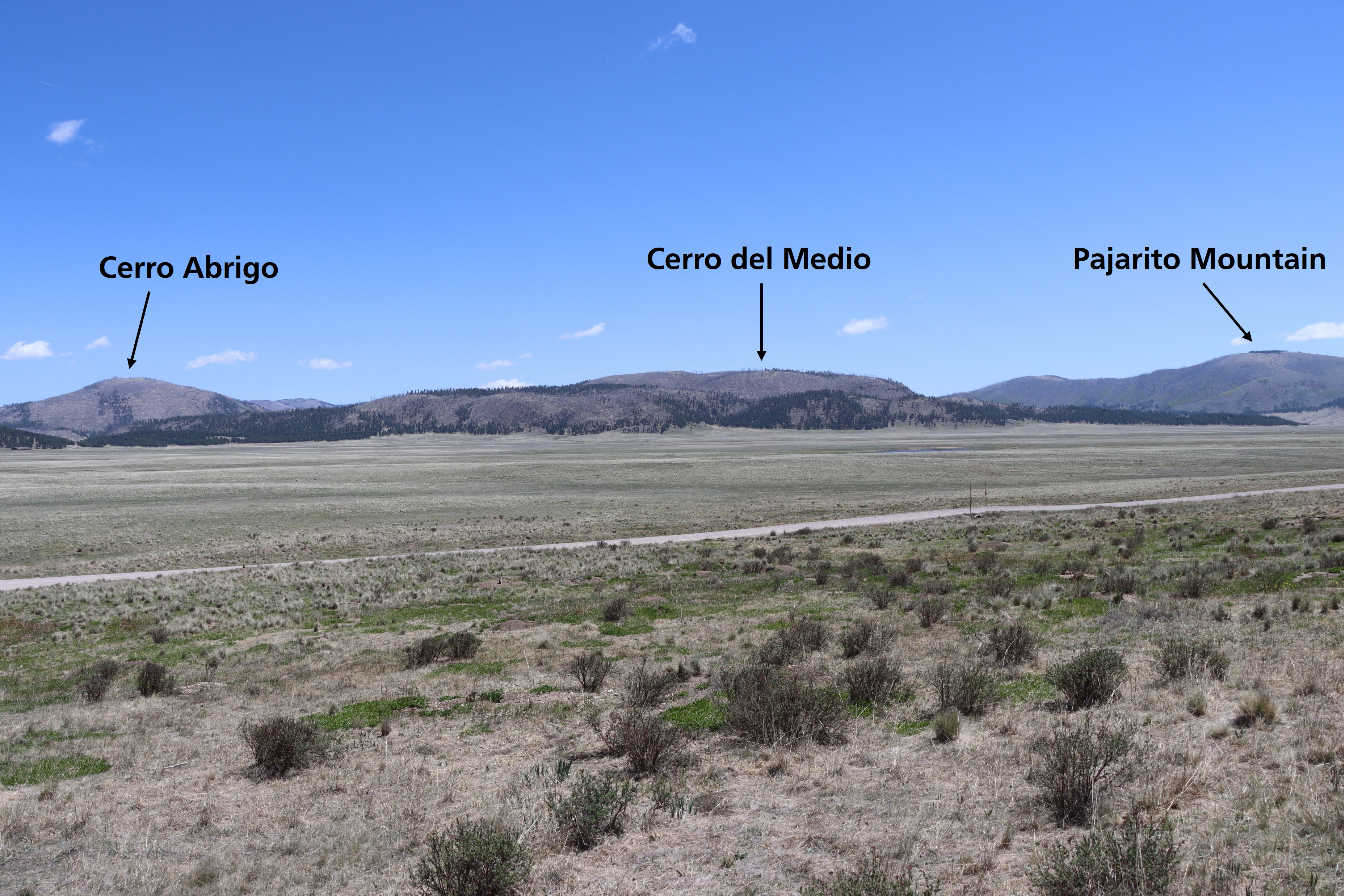
Look northward across the road. The broad valley is Valle Grande. A lake filled this valley several times in the past. If the lighting is right, you will be able to see low, flat lying ridges at the base of the mountains in the distance. These ridges are sediments that were de…
Bearhead Ridge
~10 min drive
Moderate 7-mile ridgeline hike with 1,342 ft elevation gain and panoramic views.
Water Canyon
~13 min drive
Moderate canyon hike with steady elevation gain and scenic desert views.
Local operatorsoffering guided trips. You book directly with them — Roamze doesn’t take a cut.
Turquoise Trail Campground
Hiking business nearby (~49 mi away) — hasn't claimed their Roamze page yet