Horseshoe Springs Trail
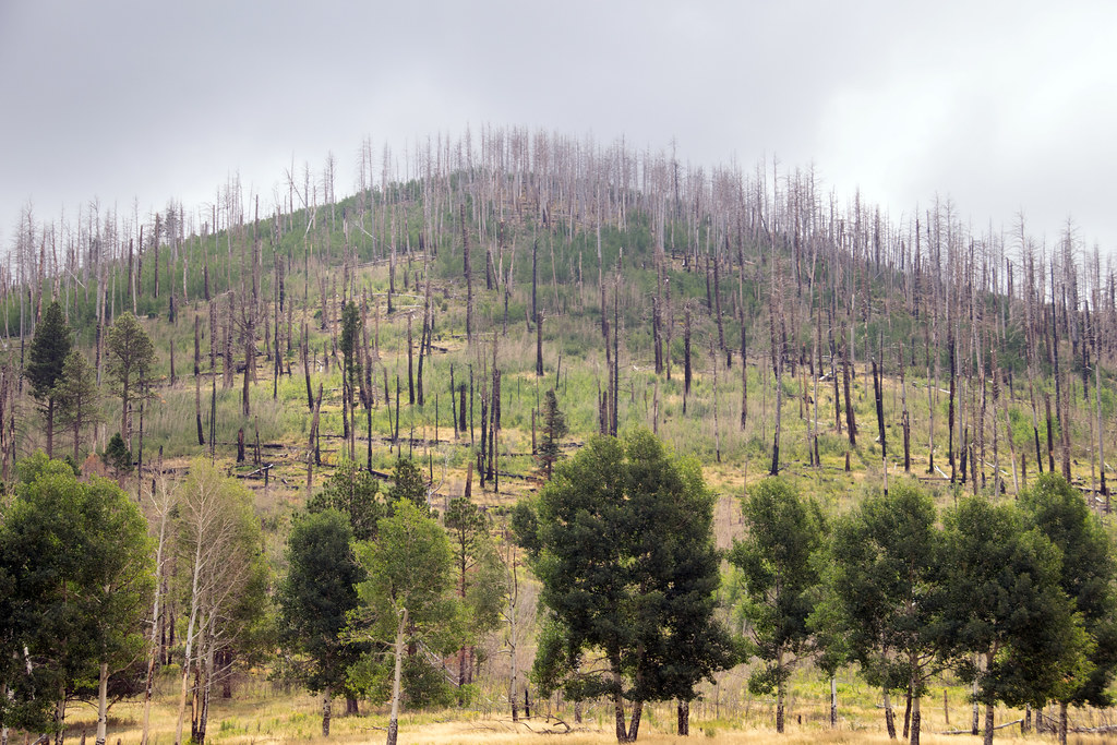
 Photo: cogdogblog, CC0 (via Wikimedia Commons)
- 1.3 mi
- round trip
- 607 ft
- climb
- 7,989 ft
- high point
- Out and back
- route
- May–Jul, Sep
- best months
Is Horseshoe Springs Trail open right now?
Closure in the area
There's a closure order in Jemez Ranger District. It doesn't name Horseshoe Springs Trail, so check the source for the area it covers.
NFSR 313 Closed Due to Washout Near NM Highway 12
Agency closure covering Jemez Ranger District · USFS · Jemez Ranger District
Road Conditions
Agency alert covering Santa Fe National Forest · USFS · Santa Fe National Forest
Gilman Tunnels closed due to rockslide
Agency alert covering Jemez Ranger District · USFS · Jemez Ranger District
As of · Source: USFS · Jemez Ranger District. Agencies don't list every closure — check before you go.
Horseshoe Springs Trail is an easy, out-and-back hike of about 2.6 miles on Forest Service land in the Jemez Ranger District of the Santa Fe National Forest in New Mexico. The route starts and ends at roughly 7,932 feet, with a steady climb that reaches a high point of 7,989 feet and a total elevation gain of about 607 feet over the full round trip. The trail is short enough for a day of walking, and the climb is gentle, with the steepest stretch at about 7% grade near the start. The most comfortable months for a visit tend to be late spring and early fall. Typical averages from the nearby Wolf Canyon weather station run from highs around 65°F in May to about 69°F in September, with July and August bringing more wet days. Winter is cold, with highs near 38°F and about seven snowy days in both January and December. San Antonio campground sits less than a mile away, and Twin Cabins Trail (506) is about a mile off. Lake Fork Mesa Loop is roughly 1.5 miles away, and Redondo campground is about 2.1 miles away.
- San AntonioCamping0.7 mi
- Twin Cabins Trail (506)HikingPhoto: cogdogblog, CC0 (via Wikimedia Commons)1 mi
- LAKE FORK MESA LOOPHikingPhoto: cogdogblog, CC0 (via Wikimedia Commons)1.5 mi
- RedondoCamping2.1 mi
- LAKE FORK MESAHiking2.1 mi
- Jemez Mountains and Jemez ValleyRock climbing5.1 mi
 Jemez Cave (a.k.a. Crystal Cave) - CLOSEDRock climbingPhoto: RuggyBearLA, CC BY 2.0 (via Flickr)6.4 mi
- Rio de las VacasCanoeing9.6 mi
Source: Roamze catalog (indexable pages within 10 miles, PostGIS distance)
- Twin Cabins Trail (506)Hiking · ~2 min drivePhoto: cogdogblog, CC0 (via Wikimedia Commons)
 East ForkHiking · ~6 min drivePhoto: RuggyBearLA, CC BY 2.0 (via Flickr)
 Monastery TrailHiking · ~12 min drivePhoto: RuggyBearLA, CC BY-SA 2.0 (via Flickr)
- Saddle ShedHiking · ~13 min drive
- Backcountry Driving RouteHiking · ~12 min drive
- LAKE FORK MESA LOOPHiking · ~3 min drivePhoto: cogdogblog, CC0 (via Wikimedia Commons)
- Rio CebollaHiking · ~7 min drive
 Coyote Call TrailHiking · ~19 min drivePhoto: Paul and Jill, CC BY 2.0 (via Flickr)
- Cerro La Jara Stop 6Hiking · ~15 min drive
- Abrigo TrailHiking · ~17 min drive
Best time to visit Horseshoe Springs Trail
Best months: May–July and September. Best months have typical highs of 55–85 °F, lows of 30 °F or warmer (32 °F where the station doesn't record snow), at most one snowy day and no more than 12 wet days.
Jan
38° / 9°
7 wet · 7 snow
Feb
40° / 13°
6 wet · 6 snow
Mar
48° / 19°
6 wet · 5 snow
Apr
56° / 24°
5 wet · 3 snow
May
65° / 30°
5 wet · 1 snow
Jun
75° / 37°
5 wet
Jul
77° / 44°
12 wet
Aug
75° / 43°
13 wet
Sep
69° / 36°
8 wet
Oct
59° / 27°
6 wet · 1 snow
Nov
47° / 18°
5 wet · 4 snow
Dec
38° / 10°
7 wet · 7 snow
Typical high / low (°F) and days with rain or snow, 1991–2020. Measured at Wolf Canyon, NM, 6.9 mi away at 8,220 ft. Source: NOAA NCEI U.S. Climate Normals 1991–2020.

Map and trail data © OpenStreetMap contributors
