Ponderosa Reservation Group Campground
Campground
Sites open the weekend of Nov 6 on Recreation.gov
Closure in the area
There's a closure order in Jemez Ranger District. It doesn't name Alamo Spring, so check the source for the area it covers.
NFSR 313 Closed Due to Washout Near NM Highway 12
Agency closure covering Jemez Ranger District · USFS · Jemez Ranger District
Road Conditions
Agency alert covering Santa Fe National Forest · USFS · Santa Fe National Forest
Gilman Tunnels closed due to rockslide
Agency alert covering Jemez Ranger District · USFS · Jemez Ranger District
As of · Source: USFS · Jemez Ranger District. Agencies don't list every closure — check before you go.
Alamo Spring is a hard hike of about 10.5 miles in the Jemez Ranger District of Santa Fe National Forest in New Mexico, managed by the Forest Service. The route is out and back, climbing from a low point of about 7,780 feet to a high of about 8,816 feet, with roughly 1,056 feet of elevation gain one way. Summer is the most comfortable time to go. A nearby weather station at a similar elevation records typical July averages of about 74°F for the high and 45°F for the low, though July and August also bring the most wet days of the year, about 15 each. Winter is cold, with typical January highs around 36°F and lows near 9°F. The trail is natural-surfaced and allows bikes. Several other routes sit close by, including the Alamo Boundary Trail and the Sawyer Mesa Ski Trail, both within about a mile. Jemez Falls Campground is about 10 miles away for anyone planning an overnight trip.
Ponderosa Reservation Group Campground
Campground
Places © OpenStreetMap contributors
More in Santo Domingo PuebloNot on Roamze yet. Their page has how to reach them.
Best months: May–June and September. Best months have typical highs of 55–85 °F, lows of 30 °F or warmer (32 °F where the station doesn't record snow), at most one snowy day and no more than 12 wet days.
Jan
36° / 9°
9 wet
Feb
38° / 12°
9 wet
Mar
44° / 20°
9 wet
Apr
52° / 25°
8 wet
May
62° / 32°
8 wet
Jun
72° / 39°
8 wet
Jul
74° / 45°
15 wet
Aug
71° / 43°
15 wet
Sep
66° / 35°
11 wet
Oct
57° / 26°
7 wet
Nov
45° / 17°
6 wet
Dec
36° / 9°
9 wet
Typical high / low (°F) and days with rain or snow, 1991–2020. Measured at Los Alamos 13 W, NM, 5.3 mi away at 8,716 ft. This station doesn't record snowfall. Source: NOAA NCEI U.S. Climate Normals 1991–2020.
 Photo: Paul and Jill, CC BY 2.0 (via Flickr)
Valle Grande Trail
~3 min drive
1.98-mile out-and-back trail in New Mexico with 570 ft elevation gain.
HIKE
Birding By Car Stop 1
~3 min drive
This site, near the South Valle Grande Trailhead along NM State Route 4, is predominantly mixed conifer forest and woodland (both dry and moist mesic). Prevalent plant species include blue spruce and ponderosa pine, fox tail, wildflowers, and yarrow. Watch for these birds each…
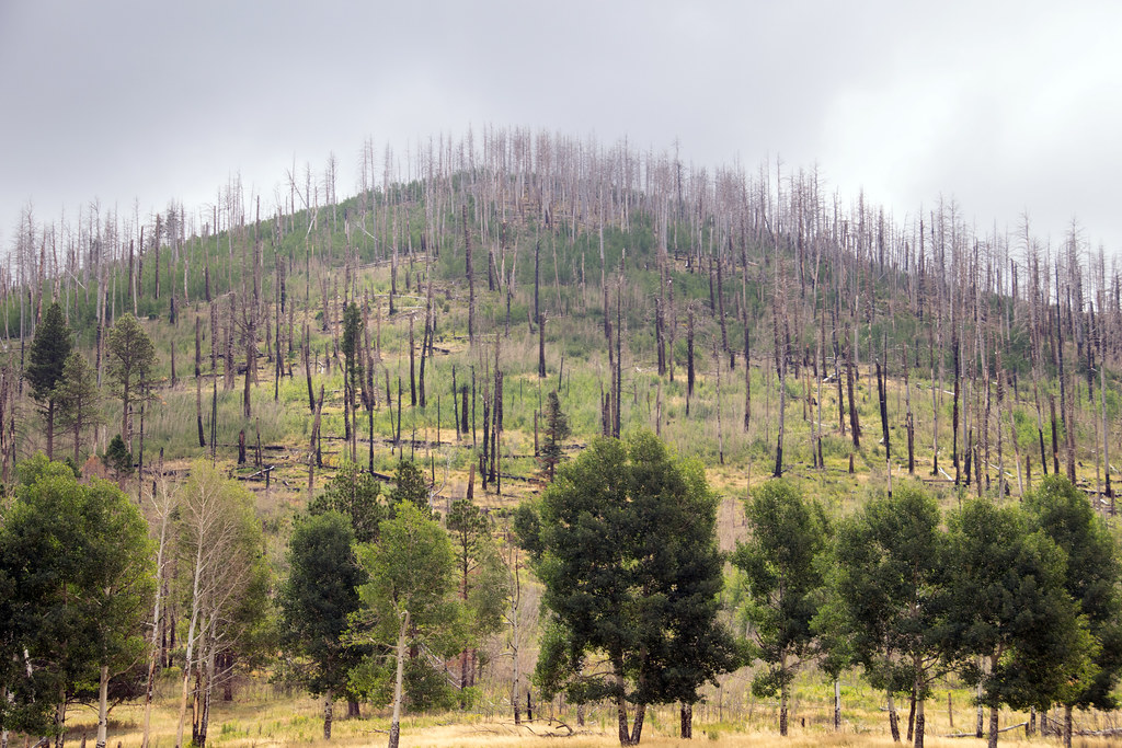 Photo: Paul and Jill, CC BY 2.0 (via Flickr)
Coyote Call Trail
~4 min drive
2.86-mile loop trail in New Mexico with 1,009 ft gain and 9,237 ft max elevation.
HIKE
Apache Spring Trail
~7 min drive
5.97-mile out-and-back hike in New Mexico with 2,201 ft gain.
 Photo: Paul and Jill, CC BY 2.0 (via Flickr)
Rabbit Ridge Trail
~3 min drive
2.12-mile out-and-back trail in New Mexico with 836 ft gain and 9,550 ft max elevation.
HIKE
The Movie Set Cabin
~6 min drive
Located on Valles Caldera's main entrance road, approximately a half mile from NM State Route 4, this cabin is part of the 2003 "The Missing" movie set starring Tommy Lee Jones and Cate Blanchett. Park at the Jemez River Trailhead and walk a quarter mile up the trail beyond th…
HIKE
Sawyer Mesa Ski Trail
~1 min drive
6.52-mile out-and-back ski trail in New Mexico with 749 ft gain/loss
HIKE
Frijoles Rim Trail
~7 min drive
11.36-mile out-and-back trail in New Mexico with 2,063 ft elevation gain and loss.
 Photo: cogdogblog, CC0 (via Wikimedia Commons)
Pond Trail
~6 min drive
0.41-mile lollipop trail in New Mexico with 4 ft elevation gain.
HIKE
Cerro La Jara Stop 2
~6 min drive
As you walked, you probably noticed that you are walking in a large valley and there are rounded hills or mountains in the distance, behind you, and to your right. You are walking in a volcanic caldera – a depression formed during a volcanic eruption. This caldera was formed…
Season: Year-round.
About 10.5 mi round trip.
About 1,056 ft of climbing round trip.
It is rated hard.
Year-round.
Daily highs and lows, wind and the chance of precipitation at the summit and route start for the next 7 days, from the Open-Meteo model.
