Gold Venture Loop
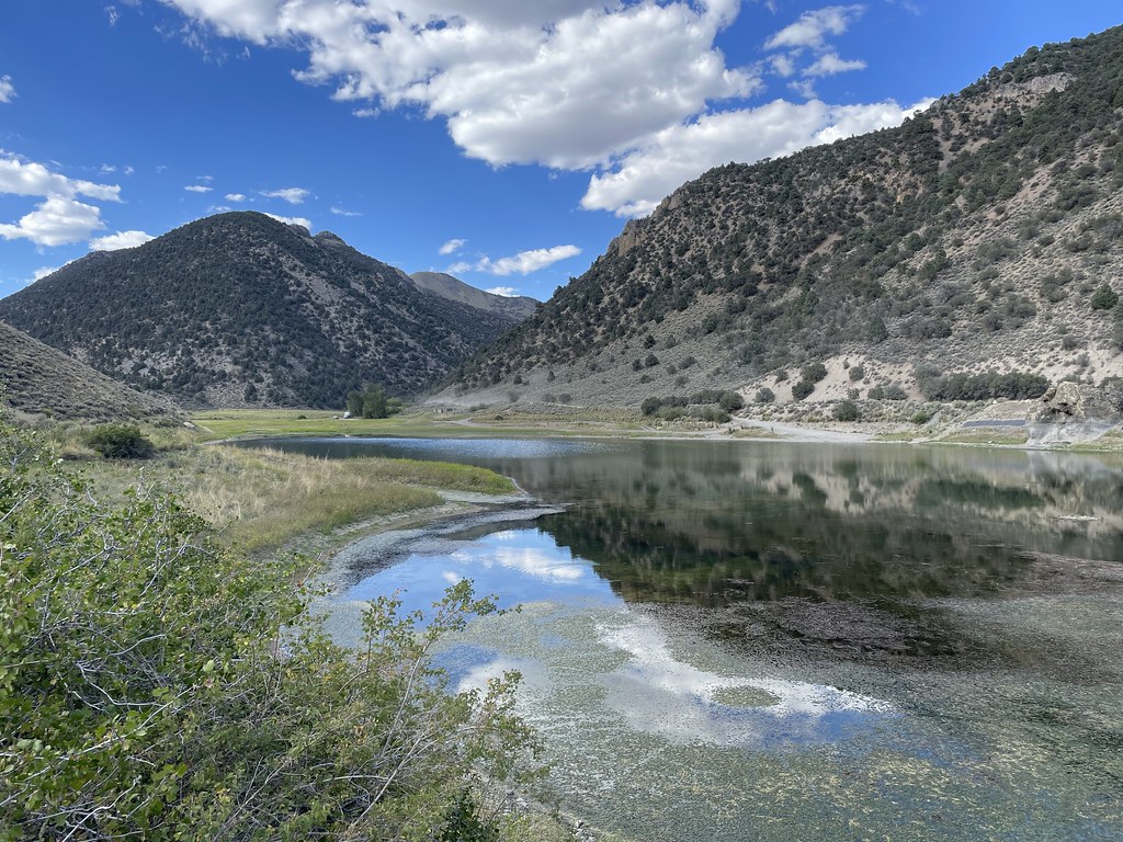
 Photo: Seth Tisue, CC BY-SA 2.0 (via Flickr)
- 44.0 mi
- round trip
- 3,629 ft
- climb
- 8,813 ft
- high point
- Out and back
- route
Is Gold Venture Loop open right now?
Closure in the area
There's a closure order in Humboldt-Toiyabe National Forest. It doesn't name Gold Venture Loop, so check the source for the area it covers.
Elephant Fire Closure
Agency closure covering Humboldt-Toiyabe National Forest · Order 04-17-26-01-04 · USFS · Humboldt-Toiyabe National Forest
Area, Road, and Trail Closures (Spring Mountains National Recreation Area)
Agency alert covering Humboldt-Toiyabe National Forest · Order 04-17-25-04 · USFS · Humboldt-Toiyabe National Forest
Year-Round Fire Restrictions (Spring Mountains National Recreation Area)
Agency alert covering Humboldt-Toiyabe National Forest · Order 04-17-24-01 · USFS · Humboldt-Toiyabe National Forest
Vehicle Snow Chain Requirements during Inclement Weather (Spring Mountains National Recreation Area)
Agency alert covering Humboldt-Toiyabe National Forest · Order 04-17-23-01 · USFS · Humboldt-Toiyabe National Forest
Rainbow Canyon Flood Diversion Structure Closure (Spring Mountains National Recreation Area)
Agency alert covering Humboldt-Toiyabe National Forest · Order 04-17-15-01 · USFS · Humboldt-Toiyabe National Forest
As of · Source: USFS · Humboldt-Toiyabe National Forest. Agencies don't list every closure — check before you go.
Gold Venture Loop is a 44-mile out-and-back hike in Nevada's Humboldt-Toiyabe National Forest, on the Austin-Tonopah Ranger District. It is a hard route, with a total elevation gain of 3,629 feet, and it climbs from a low point of 6,129 feet to a high point of 8,813 feet. The Forest Service manages the land, and the trail has a natural surface. The trail is open year round, and it is open to biking. Because it is a long, steep route, plan for a full day or more and bring supplies for the whole trip. Castle Loop is about a mile away, and Cahill Canyon Run is about 1.3 miles away. Pony Canyon Downhill is about 1.8 miles off, and Bob Scott Campground is about 4.6 miles away.
- Castle LoopHiking1 mi
 Cahill Canyon RunHikingPhoto: Ken Lund, CC BY-SA 2.0 (via Flickr)1.3 mi
 Pony Canyon DownhillHikingPhoto: Ken Lund, CC BY-SA 2.0 (via Flickr)1.8 mi
 Pony Express LoopHikingPhoto: Matt Lavin, CC BY-SA 2.0 (via Flickr)2.5 mi
- Bob Scott SlideHiking3 mi
- Bob Scott Slide AlternateHiking4.3 mi
- Bob Scott CampgroundCamping4.6 mi
- Big Creek CampgroundCamping9.7 mi
Source: Roamze catalog (indexable pages within 10 miles, PostGIS distance)
- Cahill Canyon RunHiking · ~2 min drivePhoto: Ken Lund, CC BY-SA 2.0 (via Flickr)
- Pony Canyon DownhillHiking · ~3 min drivePhoto: Ken Lund, CC BY-SA 2.0 (via Flickr)
- Pony Express LoopHiking · ~4 min drivePhoto: Matt Lavin, CC BY-SA 2.0 (via Flickr)
- South Fork Barrett Canyon TrailHiking · ~1h 1m drive
 Camp Creek National Recreation - CaliforniaHiking · ~28 min drivePhoto: Seth Tisue, CC BY-SA 2.0 (via Flickr)
- Castle LoopHiking · ~2 min drive
 Toiyabe Crest TrailHiking · ~38 min drivePhoto: Seth Tisue, CC BY-SA 2.0 (via Flickr)
 Bob Scott SlideHiking · ~8 min drivePhoto: Ken Lund, CC BY-SA 2.0 (via Flickr)
- Bob Scott SlideHiking · ~5 min drive
- Box SpringsHiking · ~15 min drive
