Bob Scott Slide
 Photo: Ken Lund, CC BY-SA 2.0 (via Flickr)
- 10.0 mi
- round trip
- 1,305 ft
- climb
- 8,493 ft
- high point
- Out and back
- route
Is Bob Scott Slide open right now?
Closure in the area
There's a closure order in Humboldt-Toiyabe National Forest. It doesn't name Bob Scott Slide, so check the source for the area it covers.
Elephant Fire Closure
Agency closure covering Humboldt-Toiyabe National Forest · Order 04-17-26-01-04 · USFS · Humboldt-Toiyabe National Forest
Area, Road, and Trail Closures (Spring Mountains National Recreation Area)
Agency alert covering Humboldt-Toiyabe National Forest · Order 04-17-25-04 · USFS · Humboldt-Toiyabe National Forest
Year-Round Fire Restrictions (Spring Mountains National Recreation Area)
Agency alert covering Humboldt-Toiyabe National Forest · Order 04-17-24-01 · USFS · Humboldt-Toiyabe National Forest
Vehicle Snow Chain Requirements during Inclement Weather (Spring Mountains National Recreation Area)
Agency alert covering Humboldt-Toiyabe National Forest · Order 04-17-23-01 · USFS · Humboldt-Toiyabe National Forest
Rainbow Canyon Flood Diversion Structure Closure (Spring Mountains National Recreation Area)
Agency alert covering Humboldt-Toiyabe National Forest · Order 04-17-15-01 · USFS · Humboldt-Toiyabe National Forest
As of · Source: USFS · Humboldt-Toiyabe National Forest. Agencies don't list every closure — check before you go.
Bob Scott Slide is a 10-mile out-and-back hike in the Austin-Tonopah Ranger District of Humboldt-Toiyabe National Forest in Nevada, managed by the Forest Service. The trail rises from about 7,184 feet to about 8,493 feet, with a total elevation gain of 1,305 feet. The route is rated hard, and the trail surface is natural. Bikes are allowed. Bob Scott Campground sits just 0.3 miles away, making it the natural base for an overnight stay. The Bob Scott Slide Alternate lies about 1.4 miles off. Within a few miles you'll also find the Pony Express Loop and Pony Canyon Downhill.
Keep exploring — more trails worth the drive
 Photo: Matt Lavin, CC BY-SA 2.0 (via Flickr)
Pony Express Loop
~5 min drive
13.60-mile out-and-back trail in Nevada with 22 ft elevation gain.
 Photo: Ken Lund, CC BY-SA 2.0 (via Flickr)
Pony Canyon Downhill
~5 min drive
2.40-mile downhill trail in Nevada with 19 ft gain and 978 ft loss.
 Photo: Ken Lund, CC BY-SA 2.0 (via Flickr)
Cahill Canyon Run
~7 min drive
18-mile out-and-back trail in Nevada with 1,436 ft elevation gain.
 Photo: Seth Tisue, CC BY-SA 2.0 (via Flickr)
Toiyabe Crest Trail
~38 min drive
0.33-mile out-and-back hike on Toiyabe Crest Trail in Nevada.
HIKE
Bob Scott Slide
~5 min drive
A demanding 4-mile out-and-back singletrack in Nevada connecting to Bob Scott campground, ideal for experienced hikers seeking a hard-difficulty challenge.
 Photo: Seth Tisue, CC BY-SA 2.0 (via Flickr)
Gold Venture Loop
~8 min drive
44.00-mile out-and-back trail in Nevada with 3,629 ft elevation gain.
HIKE
Bob Scott Slide Alternate
~2 min drive
2.80-mile out-and-back trail in Nevada with 7,316 ft elevation gain.
HIKE
Castle Loop
~8 min drive
5.20-mile loop trail in Nevada with 613 ft elevation gain.
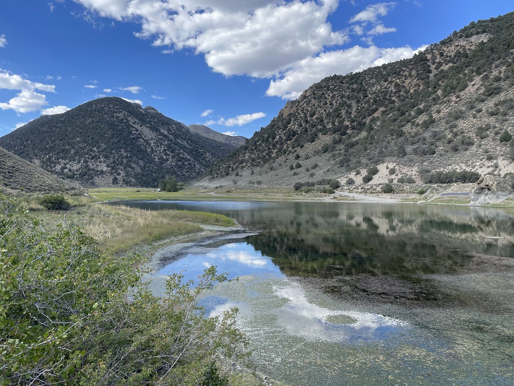 Photo: Seth Tisue, CC BY-SA 2.0 (via Flickr)
Camp Creek National Recreation - California
~29 min drive
222-mile point-to-point Nevada backcountry trek for experienced long-distance hikers.
HIKE
Box Springs
~10 min drive
3.30-mile out-and-back trail in Nevada with 356 ft gain.
