San Juan Cua
- May
- season
- Jun–Aug
- best months
Is San Juan Cua open right now?
Closure in the area
There's a closure order in Humboldt-Toiyabe National Forest. It doesn't name San Juan Cua, so check the source for the area it covers.
Elephant Fire Closure
Agency closure covering Humboldt-Toiyabe National Forest · Order 04-17-26-01-04 · USFS · Humboldt-Toiyabe National Forest
Area, Road, and Trail Closures (Spring Mountains National Recreation Area)
Agency alert covering Humboldt-Toiyabe National Forest · Order 04-17-25-04 · USFS · Humboldt-Toiyabe National Forest
Year-Round Fire Restrictions (Spring Mountains National Recreation Area)
Agency alert covering Humboldt-Toiyabe National Forest · Order 04-17-24-01 · USFS · Humboldt-Toiyabe National Forest
Vehicle Snow Chain Requirements during Inclement Weather (Spring Mountains National Recreation Area)
Agency alert covering Humboldt-Toiyabe National Forest · Order 04-17-23-01 · USFS · Humboldt-Toiyabe National Forest
Rainbow Canyon Flood Diversion Structure Closure (Spring Mountains National Recreation Area)
Agency alert covering Humboldt-Toiyabe National Forest · Order 04-17-15-01 · USFS · Humboldt-Toiyabe National Forest
As of · Source: USFS · Humboldt-Toiyabe National Forest. Agencies don't list every closure — check before you go.
- At 7,479 ft
- Austin-Tonopah Ranger DistrictHumboldt-Toiyabe National Forest
San Juan Cua is a dispersed campground in Nevada's Humboldt-Toiyabe National Forest, within the Austin-Tonopah Ranger District. It sits in an open setting with canyon views, and the Toiyabe Crest National Recreation Trail passes through here via the San Juan Trailhead. The site typically stays open from May to October, depending on weather and conditions, and no fees are required. County Road 21 runs through the area and in places follows the Austin-Grantville Stage Route, which was used from 1861 to 1866. Summer is the warmest stretch. Typical averages from a nearby weather station show July highs around 85°F and lows near 41°F, while September cools to about 76°F by day and 31°F at night. That station sits roughly 1,100 feet lower, so temperatures at the campground run cooler. Several trails start close by, including North San Juan and Main San Juan, both about 0.2 miles away, and South San Juan Creek at 0.6 miles. For climbing, Main Dome is about 4.6 miles off, and Kingston Campground is roughly 10 miles away.
- North San JuanHiking0.2 mi
- Main San JuanHiking0.2 mi
- South San Juan CreekHiking0.6 mi
- Cottonwood Creek 1Hiking1.8 mi
- Washington CreekHiking3.1 mi
- Main DomeRock climbing4.6 mi
- The Wild GranitesRock climbing4.7 mi
- Kingston CampgroundCamping9.9 mi
Source: Roamze catalog (indexable pages within 10 miles, PostGIS distance)
- Big Creek CampgroundCamping · ~29 min drive
- Kingston Guard Station RentalHut camping · ~19 min drive
- Bob Scott CampgroundCamping · ~47 min drive
- Flowers CampCamping · ~53 min drive
- Pine Creek CampgroundCamping · ~56 min drive
- Hicksons Petroglyphs Recreation AreaCamping · ~1h 2m drive
- Belmot CamgroundCamping · ~1h 12m drive
- Middlegate Station RV ParkCamping · ~1h 12m drive
- Kingston CampgroundCamping · ~17 min drive
- Columbine CampgroundCamping · ~28 min drive
Also worth it near here
- The Wild GranitesRock climbing · ~8 min drive
 Toiyabe Crest TrailHiking · ~10 min drivePhoto: Seth Tisue, CC BY-SA 2.0 (via Flickr)
- McLeod Ranch Hot SpringHot spring · ~17 min drive
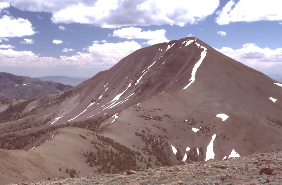 Arc DomeSummit · ~35 min drivePhoto: User:G. Thomas, Public domain (via Wikimedia Commons)
- Crest Cut-OffMountain biking · ~36 min drive
Best time to visit San Juan Cua
Best months: June–August. Best months have typical highs of 55–85 °F, lows of 30 °F or warmer (32 °F where the station doesn't record snow), at most one snowy day and no more than 12 wet days.
Jan
42° / 11°
5 wet
Feb
45° / 14°
5 wet
Mar
51° / 20°
6 wet
Apr
57° / 23°
6 wet
May
65° / 30°
6 wet
Jun
76° / 35°
4 wet
Jul
85° / 41°
3 wet
Aug
83° / 39°
3 wet
Sep
76° / 31°
3 wet
Oct
64° / 22°
3 wet
Nov
51° / 15°
4 wet
Dec
42° / 10°
5 wet
Typical high / low (°F) and days with rain or snow, 1991–2020. Measured at Reese River Ione 13ne, NV, 8.5 mi away at 6,413 ft. The station sits about 1,100 ft lower than this place, so expect it a little cooler here. This station doesn't record snowfall. Source: NOAA NCEI U.S. Climate Normals 1991–2020.
